Drumbeg, Sutherland

Drumbeg, Sutherland

Coordinates: 58°14′31″N 5°11′56″W / 58.242°N 5.199°W / 58.242; -5.199

Drumbeg
Scottish Gaelic: An Druim Beag
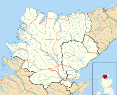
Drumbeg is located in Sutherland
Drumbeg

 Drumbeg shown within the Sutherland area
Population 60 (estimate)
OS grid reference NC122327
Council area Highland
Country Scotland
Sovereign state United Kingdom
Post town Lairg
Postcode district IV27 4
Dialling code (01571) 833
Police Northern
Fire Highlands and Islands
Ambulance Scottish
EU Parliament Scotland
UK Parliament Caithness, Sutherland and Easter Ross
Scottish Parliament Caithness, Sutherland and Easter Ross
List of places: UK • Scotland •

Drumbeg (Scottish Gaelic: An Druim Beag) is a remote crofting village on the north west coast of Scotland in Assynt, Sutherland, Scottish Highlands and is in the Scottish council area of Highland.

Parts of the short film, Zip 'n Zoo were filmed in Drumbeg. Several of the villagers appeared in the film as extras.

External links


Wikimedia Foundation. 2010.

Игры ⚽ Поможем написать реферат

Look at other dictionaries:

  • Culkein Drumbeg — Not to be confused with Culkein. Coordinates: 58°15′03″N 5°13′02″W / 58.2509°N 5.2172°W / 58.2509; 5.2172 …   Wikipedia

  • Zip 'n zoo — Infobox Film name = Zip n Zoo caption = Promotional Poster director = Bruce Robertson starring = John Hannah Simone Lahbib Remy Bennett music = Charlie McKerron cinematography = Kenneth Simpson released = 1st September 2008 runtime = 29 minutes… …   Wikipedia

  • Lochinver — infobox UK place country = Scotland official name= Lochinver gaelic name= Loch an Inbhir population = os grid reference= latitude=58.15 longitude= 5.25 unitary scotland= Highland lieutenancy scotland= Sutherland constituency westminster=… …   Wikipedia

  • Nedd — Coordinates: 58°14′11″N 5°10′31″W / 58.23638°N 5.17541°W / 58.23638; 5.17541 …   Wikipedia

  • Provincial Parks in British Columbia — Karte der Provincial Parks in British Columbia Die kanadische Provinz British Columbia unterhält 620 Provincial Parks (Stand: November 2010). Damit besitzt die Provinz nach den kanadischen Nationalparks das größte Parksystem des Landes. Über 13,5 …   Deutsch Wikipedia

  • Oldany Island — Not to be confused with Alderney. Oldany Island Location …   Wikipedia

  • Lochinver — Koordinaten 58° 9′ N, 5° 15′ W …   Deutsch Wikipedia

  • Assynt — ( gd. Asainte ) is a parish in west Sutherland, Highland, Scotland ndash; north of Ullapool.It is famous for its landscape (Inverpolly Nature Reserve) and its remarkable mountains (Quinag, Canisp, Suilven, Cul Mòr, Stac Pollaidh, Ben More Assynt) …   Wikipedia

  • List of British Columbia Provincial Parks — The following is a list of all British Columbia land currently managed by [http://www.env.gov.bc.ca/bcparks BC Parks] . Any parks that are closed are not currently listed.There were a number of provincial parks, protected areas and ecological… …   Wikipedia

  • Liste des parcs provinciaux de Colombie-Britannique — Parcs provinciaux de la Colombie Britannique Les parcs provinciaux de la Colombie Britannique sont gérés par l agence BC Parks du ministère de l Environnement de cette province.[1] L agence gère aussi les aires protégées, les aires de… …   Wikipédia en Français

Share the article and excerpts

Direct link
Do a right-click on the link above
and select “Copy Link”