- Druimindarroch
-
Coordinates: 56°53′33″N 5°48′01″W / 56.89241°N 5.80027°W
Druimindarroch Scottish Gaelic: Druim nan Darach 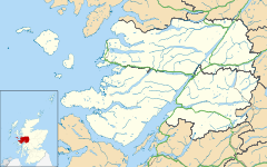
 Druimindarroch
Druimindarroch shown within the Lochaber areaOS grid reference NM686843 Council area Highland Country Scotland Sovereign state United Kingdom Post town Arisaig Postcode district PH39 4 Police Northern Fire Highlands and Islands Ambulance Scottish EU Parliament Scotland List of places: UK • Scotland • Druimindarroch (Scottish Gaelic: Druim nan Darach) is a small settlement which lies on the north coast of Loch nan Uamh in Lochaber, Scottish Highlands and is in the council area of Highland.
Prince Charlies Cave where Charles Edward Stuart is said to have sheltered in the cave for 5 days in 1746, when on the run after defeat at the Battle of Culloden, is nearby.
Categories:- Populated places in Lochaber
- Sites of Special Scientific Interest in North Lochaber
- Scottish Site of Special Scientific Interest stubs
- Highland geography stubs

Wikimedia Foundation. 2010.