Dresden Basin

Dresden Basin

The Dresden Basin (German: Elbtalkessel) is a roughly 45 km long and 10 km wide area of the Elbe Valley between the towns of Pirna and Meißen.[1] The city of Dresden lies in the Dresden Basin.

Geography

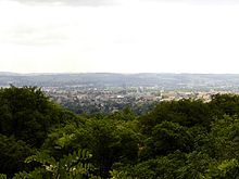
View from Mordgrund of the Dresden Heath over eastern parts of the city near the Altstadt
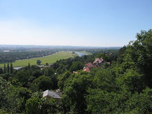
View of Dresden from Luisenhof on the northern slopes of the Elbe
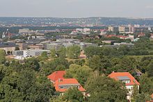
View from Fichteturm on the slopes of the city district of Plauen
View of the Bosel near Meißen looking towards Dresden and Saxon Switzerland

The Dresden Basin is formed by the foothills and flanks of the Eastern Ore Mountains and western Lausitzer Bergland and the northwestern slopes of Saxon Switzerland. Geologically it is a rift valley and its most important river, the Elbe flows through it in wide meanders. The region is climatically milder than the surrounding area, so that on the northern slopes of the hills vineyards may be cultivated is (Saxon Wine Route). In addition, there is intensive fruit farming. The valley climate is significantly drier (average annual precipitation below 700 mm) and warmer (average air temperature 8.5 °C, in Dresden city centre 9.9 °C) than the surrounding hills. The region was settled early due to the fertile soils (loess) and the easy river crossings and achieved worldwide importance from a cultural and historical perspective. Today the Dresden conurbation almost entirely fills the basin.

Parts of the Dresden Basin near the Elbe (the Dresden Elbe Valley) were given World Heritage Site status between 2004 and 2009 by UNESCO due to their cultural and natural significance.

During the East German era, the Basin was jokingly referred to by its inhabitants as the Valley of the Clueless, because they were not able to receive West German television until the late 1980s, and then only patchily.

The most important towns and cities are (in downstream order):

References

  1. ^ Elkins, T H (1972). Germany (3rd ed.). London: Chatto & Windus, pp. 293-4. ASIN B0011Z9KJA.

See also


Wikimedia Foundation. 2010.

Игры ⚽ Поможем решить контрольную работу

Look at other dictionaries:

  • Dresden Elbe Valley — (delisted in 2009) * UNESCO World Heritage Site View over the river meadows and Dresden …   Wikipedia

  • Dresden — This article is about the city in Germany. For other places named Dresden, and other uses of the word, see Dresden (disambiguation). Dresden …   Wikipedia

  • Dresden–Werdau railway — Dresden Hbf–Werdau Bogendreieck junction Route number: 510, 510.3 Line number: 6258; 6257 Line length: 136.304 Gauge: 1435 Voltage …   Wikipedia

  • Dresden — /drez deuhn/; Ger. /drddays deuhn/, n. the capital of Saxony in E Germany, on the Elbe River. 518,057. * * * City (pop., 2002: 478,600), situated on the Elbe River, eastern Germany. Originally a Slavonic settlement, it was the residence of the… …   Universalium

  • Dresden, Washington County, New York — Not to be confused with the village of Dresden, Yates County, New York. Dresden   Town   …   Wikipedia

  • Geography and urban development of Dresden — Dresden is a large city in the eastern German Free State of Saxony nearby the border to the Czech Republic at the river Elbe. The geography and urban development of Dresden is embossed by the valley location and by the Elbe stream.Geography… …   Wikipedia

  • Culture in Dresden — The Dresden Elbe Valley cultural landscape Dresden is a cultural centre in Germany having influenced the development of European culture. It enhanced international styles and examples to an own identity and cityscape.[1] The Culture in Dresden is …   Wikipedia

  • Upper Silesian Coal Basin — The Upper Silesian Coal Region around Kattowitz (Katowice) in 1905 Upper Silesian Coal Basin (Polish: Górnośląskie Zagłębie Węglowe, GZW, Czech: Hornoslezské uhelné pánve) is a coal basin in Silesia in Poland and …   Wikipedia

  • Ore Mountains — For other similarly named ranges, see Ore Mountains (disambiguation). Ore Mountains Erzgebirge Krušné hory Range …   Wikipedia

  • Ore Mountain Foreland — The Ore Mountain Foreland (German: Erzgebirgsvorland) is a strip of countryside of about 200 m to 500 m above sea level high, in the German state of Saxony, that lies immediately north of the German Ore Mountains and runs mainly… …   Wikipedia

Share the article and excerpts

Direct link
Do a right-click on the link above
and select “Copy Link”