Dome Creek, British Columbia
- Dome Creek, British Columbia
-
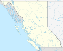
Dome Creek is a community located between Prince George and McBride in central British Columbia. A post office was opened here 1 May 1916, with J.O. Kendall as postmaster. The post office closed 31 January 1936, then re-opened 6 September 1937. Dome Creek may have reached a population of 2000 during the construction of the Grand Trunk Pacific Railway.
Via Rail's Jasper – Prince Rupert train calls at the Dome Creek railway station.
References
Categories:
- Populated places in the Regional District of Fraser-Fort George
- British Columbia Interior geography stubs
Wikimedia Foundation.
2010.
Look at other dictionaries:
Dome Creek railway station — Via Rail (inter city rail) Station statistics Address Dome Creek, BC Canada Coordinates … Wikipedia
Mount Josephine (British Columbia) — Mount Josephine Elevation 1,767 m (5,797 ft) Prominence 517 m (1,696 ft) … Wikipedia
Geography of British Columbia — Continent North America Region Western Canada Coordinates … Wikipedia
Ring Mountain (British Columbia) — Ring Mountain Elevation 2,192 m (7,192 ft) [1 … Wikipedia
Mount Hosmer (British Columbia) — Mount Hosmer Elevation 2,500 m (8,202 ft) … Wikipedia
Victoria, British Columbia — For other uses, see Victoria (geographical disambiguation). This article is about the city of Victoria. For electoral districts with the name Victoria, or in the area of Greater Victoria, see Victoria (electoral districts). City of Victoria… … Wikipedia
Fountain, British Columbia — Fountain is an unincorporated rural area and Indian Reserve in the Fraser Canyon region of British Columbia, Canada, located at the ten mile mark from the town of Lillooet on BC Highway 99, which in that area is also on the route of the Old… … Wikipedia
Dome Mountain — Elevation 2,031 m (6,663 ft) Prominence 136 m (446 ft) … Wikipedia
Bralorne, British Columbia — Bralorne is an historic underground gold mining community in the Bridge River District, some sixty dirt road miles west of the town of Lillooet.BackgroundGold has been the central element in the area s history going back to the 1858 1860 Fraser… … Wikipedia
Columbia River — Coordinates: 46°14′39″N 124°3′29″W / 46.24417°N 124.05806°W / 46.24417; 124.05806 … Wikipedia