- Dimnøya
-
Dimnøya 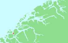
Location in Møre og RomsdalGeography Location Ulstein, Norway Coordinates 62°18′42″N 5°48′27″E / 62.3117°N 5.8076°ECoordinates: 62°18′42″N 5°48′27″E / 62.3117°N 5.8076°E Area 9 km2 (3.5 sq mi) Length 5 km (3.1 mi) Width 4 km (2.5 mi) Highest elevation 240 m (790 ft) Highest point Høgåsen Norway County Møre og Romsdal Municipality Ulstein Dimnøya (or Dimna) is an island in the municipality of Ulstein in Møre og Romsdal county, Norway. It is connected to the island of Hareidlandet to the east by a bridge. The town of Ulsteinvik lies 2 kilometres (1.2 mi) northeast of the island.
The 9-square-kilometre (3.5 sq mi) island is about 5 kilometres (3.1 mi) long and about 4 kilometres (2.5 mi) wide. It is located about 1 kilometre (0.62 mi) north of the island of Gurskøy and about 1.5 kilometres (0.93 mi) north of the island of Leinøy, both in neighboring Herøy.[1]
References
- ^ Store norske leksikon. "Dimnøy" (in Norwegian). http://www.snl.no/Dimn%C3%B8y. Retrieved 2010-09-24.
Categories:- Ulstein
- Islands of Møre og Romsdal

Wikimedia Foundation. 2010.