Dharyala Jalap

Dharyala Jalap
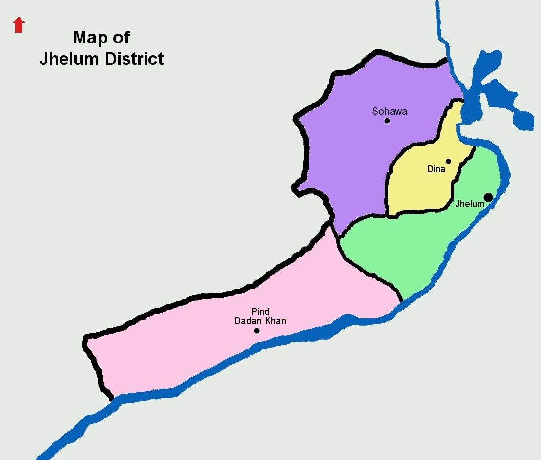
Dharyala Jalap
—  Village and union council  —
Country Pakistan
Region Punjab Province
District Jhelum District
Tehsil
Time zone PST (UTC+5)

Dharyala Jalap is a village and union council of Jhelum District in the Punjab Province of Pakistan. It is part of Pind Dadan Khan Tehsil,.[1] The village gets its name from the Jalap tribe, who make up the bulk of the population.

References


Wikimedia Foundation. 2010.

Игры ⚽ Нужно сделать НИР?

Look at other dictionaries:

  • Chak Ali Shah — is a village approximately 20 kilometres (12 mi) east of tehsil Pind Dadan Khan, Jhelum District, in the province of Punjab, Pakistan. It is bounded in the south by the River Jhelum and on the north by the Salt Range. The Khewra Salt Mine is …   Wikipedia

  • Jhelum District — For other uses, see Jhelum (disambiguation). Jhelum   District   Nickname(s) …   Wikipedia

  • Jhelum — For other uses, see Jhelum (disambiguation). Coordinates: 32°55′43″N 73°43′53″E / 32.92861°N 73.73139°E / 32.92861; 73.73139 …   Wikipedia

  • Dina, Pakistan — For the tehsil, see Dina Tehsil. Dina   Immigirant city   Dina City …   Wikipedia

  • Monan, Punjab —   Village and union council   Country Pakistan Region Punjab Province District Jhelum District Tehsil …   Wikipedia

  • Chak Khasa — Tahlianwala   Village and union council   Country Pakistan Region Punjab Province District Jhelum District …   Wikipedia

  • Chotala — MKB   Village and union council   Country Pakistan Region Punjab Province District Jhelum District …   Wikipedia

  • Darapur —   Village and union council   Country Pakistan Region Punjab Province District Jhelum District Tehsil …   Wikipedia

  • Dhanyala — Coordinates: 32°59′40″N 73°24′10″E / 32.99444°N 73.40278°E / 32.99444; 73.40278 …   Wikipedia

  • Mughalabad — مغل آباد   Village and union council   Country Pakistan Region Punjab Province District Jhelum District Tehsil …   Wikipedia

Share the article and excerpts

Direct link
Do a right-click on the link above
and select “Copy Link”