- Descartes Highlands
-
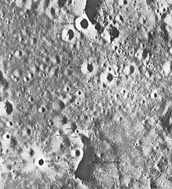
The Descartes Highlands is an area of lunar highlands located on the near side that served as the landing site of the American Apollo 16 mission in early 1972. The Descartes Highlands is located in the area surrounding Descartes crater, after which the feature received its name.[1]
Contents
Geology
Two major formations dominate the Descartes Highlands area: the Cayley plains and the Descartes formation. The latter is composed primarily of highland plateau material, perhaps debris from large impact events. North and South Ray craters, the former sampled directly by the Apollo 16 crew, revealed a layering sequence, possibly an overlap of the Cayley and Descartes formations.[1]
The area of the Descartes Highlands is characterized by an undulating landscape covered with old and some new, sharp rimmed craters. Based upon findings during the Apollo 16 mission, some of the floors of these craters were covered with glass similar to that found at the Taurus-Littrow landing site on Apollo 17. According to Apollo 16 commander John Young, the arrangement of the glass gave it the appearance of dried mud.[2]
Before Apollo 16 sampled the Descartes Highlands, it was believed that volcanic material would be abundant in the area after visual analysis of the features there. It was thought that the formations in the area were formed by lavas more viscous than the lavas that formed the Lunar mare. This was later disproved after the analysis of samples from the area. It was revealed that many of the rocks in the area are not volcanic in origin, but breccias composed of fragments from several lunar impacts.[3]
Landing site selection
All of the preceding Apollo landing missions sampled Lunar mare material, either directly or indirectly. A landing site in the Lunar highlands was to be selected with the goal of investigating the material located there. Two landing sites were given consideration to achieve this goal: the Descartes site and the crater Alphonsus.[2]
The Descartes Highlands was selected for the Apollo 16 mission in order to enable astronauts John Young and Charles Duke to sample the prominent Descartes and Cayley formations concentrated in the area. Sampling these formations was a priority, as the two cover much of the near side of the Moon. Priority was also given to locating and obtaining samples of old highland material that was older than the Imbrium impact in order to give insight to the geologic timeline and composition of the Moon. North and South Ray craters, both prominent features in the immediate landing area, were also prioritized because material from the prominent formations in the area had been naturally excavated there by the impacts that formed them.[2]
See also
References
- ^ a b "Apollo 16 Landing Site". The Apollo Program. National Air and Space Museum. http://www.nasm.si.edu/collections/imagery/apollo/as16/a16landsite.htm. Retrieved 12 September 2010.
- ^ a b c "Apollo 16 Mission Landing Site Overview". Apollo 16 Mission. Lunar and Planetary Institute. http://www.lpi.usra.edu/lunar/missions/apollo/apollo_16/landing_site/. Retrieved 12 September 2010.
- ^ Taylor; Gorton, Muir, Nance, Rudowski, Ware (December 1973). "Compostion of the Descartes region, lunar highlands". Geochimica et Cosmochimica Acta 37 (12): 2665–2683. Bibcode 1973GeCoA..37.2665T. doi:10.1016/0016-7037(73)90271-8. http://www.sciencedirect.com/science?_ob=ArticleURL&_udi=B6V66-488Y338-PT&_user=10&_coverDate=12/31/1973&_rdoc=1&_fmt=high&_orig=search&_origin=search&_sort=d&_docanchor=&view=c&_searchStrId=1458455843&_rerunOrigin=google&_acct=C000050221&_version=1&_urlVersion=0&_userid=10&md5=5157477e8659ea5c27a6b429e412f273&searchtype=a. Retrieved 12 September 2010.
Categories:- Moon
- LQ20 quadrangle
- 1972 in spaceflight
Wikimedia Foundation. 2010.

