- Wakefield River
-
Wakefield River
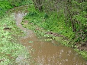
Wakefield River flowing through AuburnOrigin Clare Valley Mouth Port Wakefield Basin countries Australia Basin area 1,913 km² The Wakefield River, is part of an estuary located in South Australia. It is an ephemeral river that usually flows only when there are significant rains. The town of Balaklava is located along the lower reaches of the river.
The river's catchment covers 1,913 km².[1] Three quarters of the catchment is used for agricultural purposes.[1]
Contents
Dennis Creek
Dennis Creek is a very short ephemeral stream which is located in the Clare Valley town of Auburn and only flows during periods of rain. Its headwaters are located in the hills on the western side of the town and it runs along a small gully, passing under Main North Road, and into the Wakefield River. The creek was named after the father of C.J. Dennis, who ran a hotel in the town for a time.
See also
References
- ^ a b "Soils - Wakefield River". Australian Natural Resources Atlas. Department of Sustainabililty, Environment, Water, Population and Communities. 6 May 2009. http://www.anra.gov.au/topics/soils/erosion/sa/basin-wakefield-river-se.html. Retrieved 25 October 2011.
External links
- Archived water quality assessments Environmental Protection Authority (South Australia)
Coordinates: 34°11′24″S 138°08′38″E / 34.19°S 138.14389°ECategories:- Rivers of South Australia
- Adelaide Plains
- South Australia geography stubs
Wikimedia Foundation. 2010.

