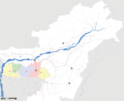
- Dawki
-
Dawki
Duki
— town — Coordinates 25°11′0″N 92°1′0″E / 25.183333°N 92.016667°ECoordinates: 25°11′0″N 92°1′0″E / 25.183333°N 92.016667°E Country India State Meghalaya District(s) Jaintia Hills Nearest city Shillong, Syllhet Time zone IST (UTC+05:30) Codes-
• Pincode • 793109
Dawki is a town in Jaintia Hills district, Meghalaya, India.
Contents
Geography
It is located at 25°11′0″N 92°1′0″E / 25.183333°N 92.016667°E.[1]
It is on the border of India Bangladesh.
Location
National Highway 40 passes through Dawki. It is situated in the border of Bangladesh, Tamabil border crossing.
Places of interest
Dawki Bridge, is a suspension bridge over the Amngot river. It was constructed in 1932 by the Britishers.[2]
References
- ^ http://wikimapia.org/559420/Dawki Wikimapia
- ^ http://en.structurae.de/structures/data/index.cfm?id=s0010632 Dawki Suspension Bridge
External links
Categories:- Tourism in Meghalaya
- Cities and towns in Jaintia district
- India geography stubs
- Meghalaya stubs
-
Wikimedia Foundation. 2010.


