- Dart River (Otago)
-
For the river in Tasman Region, see Dart River, Tasman.
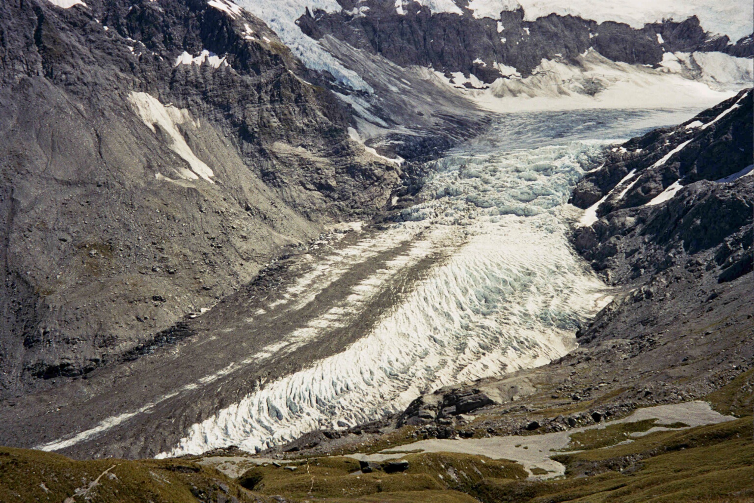
Dart River Origin Southern Alps Mouth Lake Wakatipu Basin countries New Zealand Length 60 km (37 mi) Source elevation 1,025 m (3,363 ft) Mouth elevation 330 m (1,080 ft) The Dart River, Te Awa Wakatipu in Māori language, flows through rugged forested country in the southwestern South Island of New Zealand. Partly in Mount Aspiring National Park, it flows south-west and then south for 60 kilometres (37 mi) from its headwaters in the Southern Alps and the Dart Glacier, eventually flowing into the northern end of Lake Wakatipu near Glenorchy.[1] It was named in the 1860s by a runholder, William G Rees, who chose the name for the river's swift flow.[2]
Several popular tramping tracks are found nearby, notably the Rees-Dart Track, which follows the valley of the Dart and the nearby Rees River.[3] Jet boats operate on the river.[4]
 Dart Glacier (source of the Dart River)
The Dart River, as many other areas in and around the Glenorchy and Queenstown area, has also been the location for many scenes filmed for The Lord of the Rings film trilogy. Examples of these locations are Isengard, filmed at Dan's Paddock and Lothlórien in the forests slightly further north.[5]
The upper valley was the site of one of one of New Zealand's worst light aircraft accidents in 1989, when an Aspiring Air Britten-Norman Islander crashed, killing all ten people on board.[6]
References
- ^ Peter Dowling (editor) (2004). Reed New Zealand Atlas. Reed Books. Maps 89,90. ISBN 0-7900-0952-8.
- ^ Discover New Zealand:A Wises Guide (9th ed.). 1994. p. 443.
- ^ "Rees-Dart Track". New Zealand Department of Conservation. http://www.doc.govt.nz/parks-and-recreation/tracks-and-walks/otago/wakatipu-area/rees-dart-track/. Retrieved 28 August 2009.
- ^ "Jet boat on the Dart River". Te Ara Encyclopedia of New Zealand. 3 March 2009. http://www.teara.govt.nz/en/economy/1/4. Retrieved 28 August 2009.
- ^ "Ring things". Rough Guides. http://www.roughguides.com/website/travel/destination/content/default.aspx?titleid=83&xid=idbox_head92675976_0862. Retrieved 28 August 2009.
- ^ [1]
Coordinates: 44°50′27″S 168°21′28″E / 44.84083°S 168.35778°E
Categories:- Rivers of the Otago Region
- Mount Aspiring National Park
- Otago Region geography stubs
Wikimedia Foundation. 2010.