- D416 road (Croatia)
-
D416 state road
Route information Length: 0.9 km (0.6 mi) Major junctions From:  D414 in Donja Banda
To:  Prapratno ferry port
Location Counties: Dubrovnik-Neretva Highway system State roads in Croatia
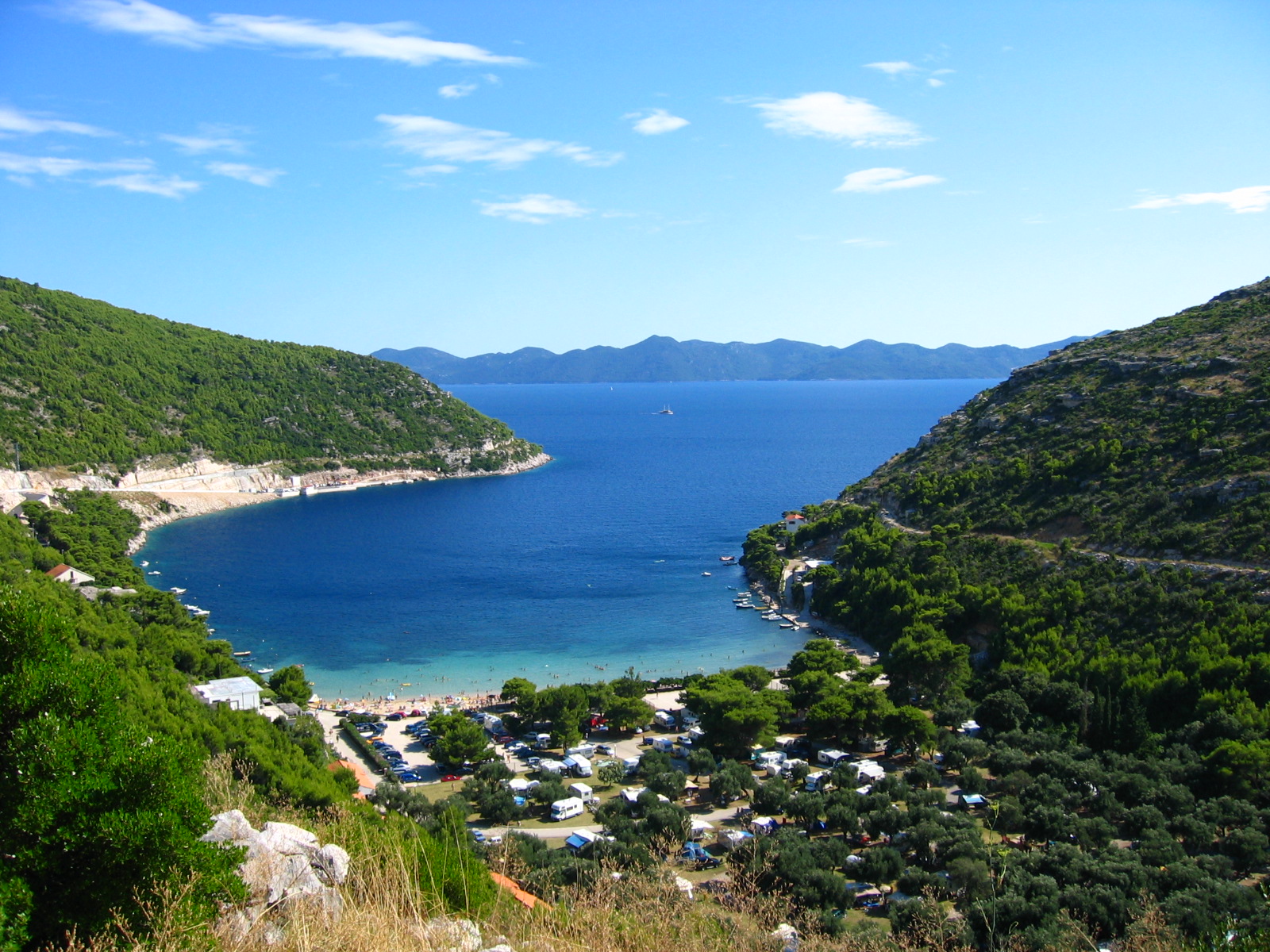
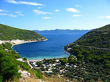 Prapratno, at the southern terminus of the D415 road
D416 branches off to the south from the D414 near Ston towards Prapratno ferry port - providing ferry access to Sobra on island of Mljet and the D123 state road. The road is 0.9 km (0.56 mi) long.[1]
The road, as well as all other state roads in Croatia, is managed and maintained by Hrvatske ceste, state owned company.[2]
Contents
Traffic volume
Traffic is not regularly counted on the road, however, Hrvatske ceste report number of vehicles using Prapratno-Sobra ferry line, connecting D416 to the D123 state road.[3] Furthermore the D416 road carries some local traffic on Pelješac peninsula itself, which does use the ferry at all, substantially exceeding the ferried traffic. Substantial variations between annual (AADT) and summer (ASDT) traffic volumes are attributed to the fact that the road connects to a number of summer resorts.
D416 traffic volume Road Counting site AADT ASDT Notes  D416
D4168311 Prapratno-Sobra 96 237 Vehicles using Prapratno-Sobra ferry line. Road junctions and populated areas
D416 junctions/populated areas Type Slip roads/Notes  D414 to Orebić and Trpanj (to the west) and to Ston and Dubrovnik (to the east). The northern terminus of the road.
Prapratno 
Prapratno ferry port - ferry access[4] to Sobra, Mljet (D123). The southern terminus of the road. Sources
- ^ "Decision on categorization of public roads as state roads, county roads and local roads" (in Croatian). Narodne novine. February 17, 2010. http://narodne-novine.nn.hr/clanci/sluzbeni/2010_02_17_410.html.
- ^ "Public Roads Act" (in Croatian). Narodne novine. December 14, 2004. http://narodne-novine.nn.hr/clanci/sluzbeni/2004_12_180_3130.html.
- ^ "Traffic counting on the roadways of Croatia in 2009 - digest" (in English). Hrvatske ceste. May 1, 2010. http://www.hrvatske-ceste.hr/WEB%20-%20Legislativa/brojenje-prometa/CroDig2009.pdf.
- ^ "Jadolinija ferry service" (in English). May 11, 2010. http://www.jadrolinija.hr/default.aspx?lang=2.
See also
- State roads in Croatia
- Hrvatske ceste
- Jadrolinija
Categories:- State roads in Croatia
- Dubrovnik-Neretva County

Wikimedia Foundation. 2010.