- D2 motorway (Slovakia)
-
D2 Motorway
Diaľnica D2 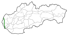
Route information Part of 

Length: 80 km (50 mi)
Planned: 80 km (50 mi)Major junctions From:  D2 border with Czech Republic at Kúty
 D1 in Bratislava
 D4 in Bratislava
To:  M15 border with Hungary at Čunovo
Location Regions: Trnava Region, Bratislava Region Major cities: Bratislava Highway system D2 is a motorway (Slovak: diaľnica) in Slovakia. It connects the Czech border at Kúty with the Hungarian border at Čunovo, passing through (ordered north to south) Malacky, Bratislava and Jarovce. It is part of the European routes E65 and E75 and of the Pan-European corridor IV. The length of the motorway is 80 km.
Contents
History
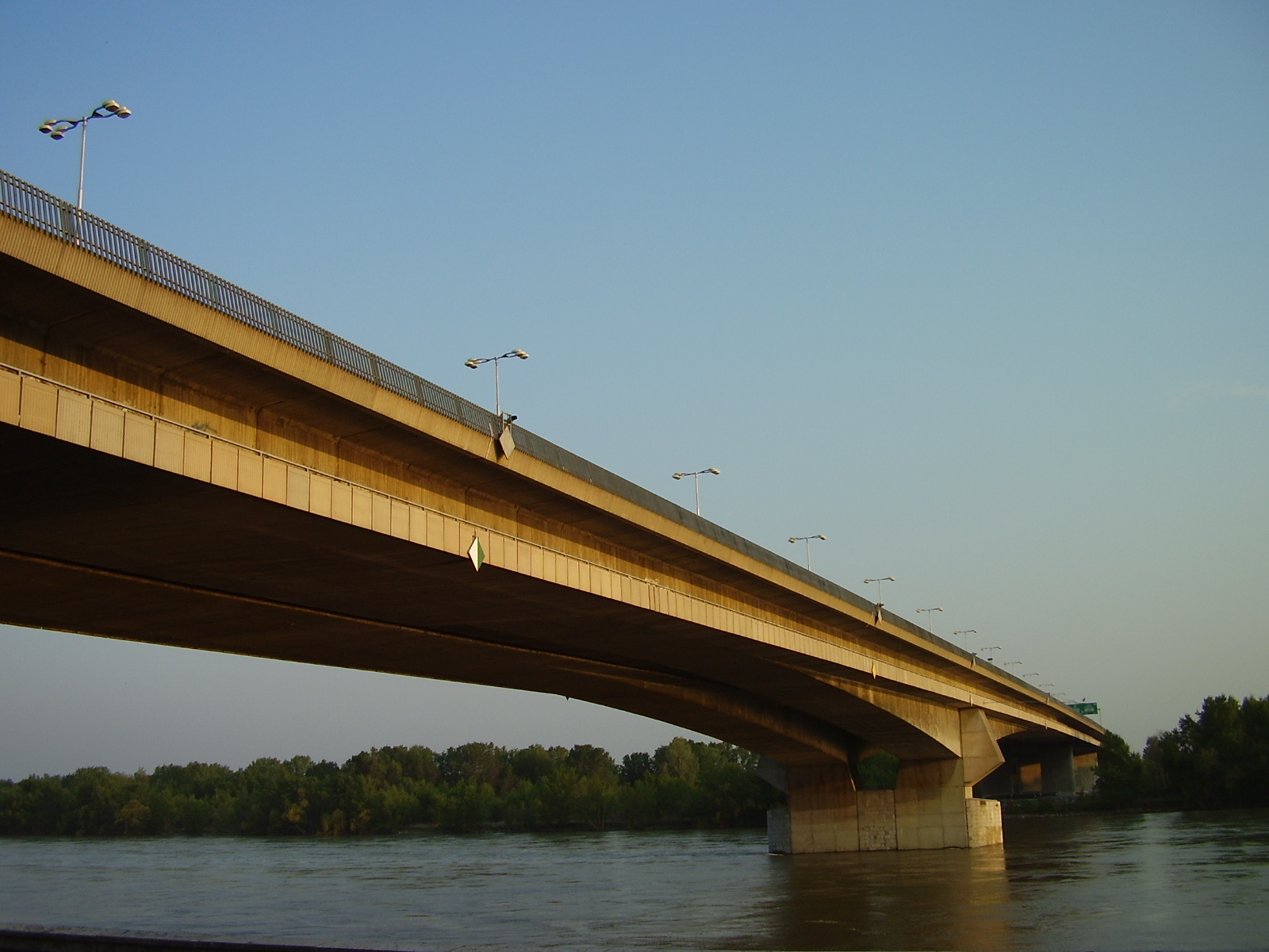
The first plans on D2 motorway/freeway appeared in the 1960s, from the Czechoslovak government act in 1963 to build 117 km long motorway from Brno to Bratislava, with 58.4 km in today's Slovakia. The construction started on April 1969, with the first section from Bratislava to Malacky, which was open on November 1973. In 1974, construction also started on the Czech side from Brno, with the two ends of the motorways joining on 8 November 1980, a day, when also the D1 motorway in the Czech part of Czechoslovakia was completed, joining the three most important cities in the country (Prague, Brno and Bratislava). A new planned segment from Bratislava to the Hungarian border was added in 1987. Construction continued with the building of the Lafranconi Bridge in Bratislava and the junction with D1 motorway junction and temporary end in Petržalka in the years 1985 - 1991 and after its opening, construction stopped for five years. It continues further since 1996, with the sections from temporary end to Hungary and Austria, with all being opened in 1998 and with the 8.5 km segment from D4 junction to the Hungarian border being widened in 2002. Today, the motorway is complete, with the last 3 km in Bratislava with the only tunnel in its entire length, the Sitina Tunnel opened on 24 June 2007.
Sections of the motorway
 Lafranconi Bridge
Section Length Opening Slovakia/Czechia border - Kúty 4,5 km November 1980 Kúty - Malacky 27,2 km July 1977 Malacky - Bratislava, Lamač 29,3 km November 1973 Bratislava, Lamač - Bratislava, Staré grunty 3,1 km 24 June 2007 Bratislava, Staré grunty - Bratislava, Viedenská cesta 2,6 km 1990/widened 1992 Bratislava, Viedenská cesta - Bratislava, Jarovce 4,9 km 2002 Bratislava, Jarovce - Čunovo on the Slovakia/Hungary border 8,5 km 1998/widened 2002 See also
External links
Highways in Slovakia Motorways 
Expressways Categories:- Roads in Slovakia


Wikimedia Foundation. 2010.