- Jarovce
Geobox | settlement
name = Jarovce
native_name =
other_name =
category = Borough
etymology =
official_name =
motto =
nickname =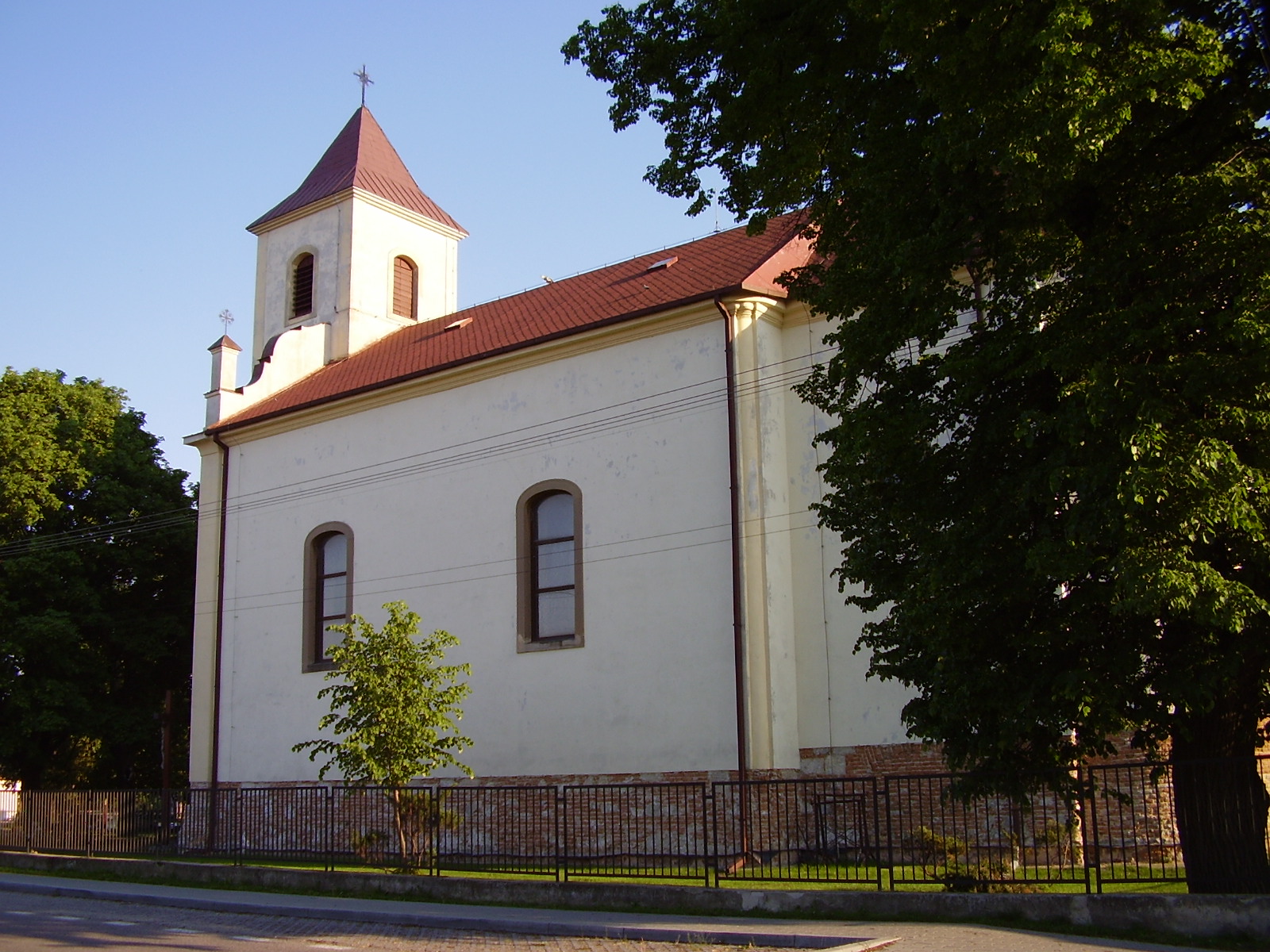
image_caption = A church in Jarovce
symbol = Jarovce CoA.svg
country = Slovakia
country_
state =
region = Bratislava
district = Bratislava V
municipality =
part =
river =
location =
elevation = 126
lat_d = 48
lat_m = 03
lat_s = 55
lat_NS = N
long_d = 17
long_m = 06
long_s = 48
long_EW = E
coordinates_type = region:SK_type:city
highest =
highest_lat_d =
highest_long_d =
lowest =
lowest_lat_d =
lowest_long_d =
area = 21.342
area_round = 3
population = 1127
population_density = auto
established =
date =
mayor =
timezone =
timezone_DST =
postal_code = 851 01
area_code = 421-02
code = BA
code_type = Car plate
free =
map_background = Slovakia - background map.png
map_locator = Slovakia
website =
commons =
footnotes = Source: [ [http://www.statistics.sk/mosmis/eng/run.html Mestská a obecná štatistika SR ] ]__NOTOC__Jarovce ( _de. Kroatisch-Jahrndorf, _hr. Hrvatski Jandrof, _hu. Horvátjárfalu) is a small borough of
Bratislava ,Slovakia .History
The village was first mentioned in
1208 under the name "Ban". During the Ottoman wars, manyCroats settled here in the16th century (therefore "Croatian" in the German name to borderingDeutsch-Jahrndorf / "German"-Jahrndorf inAustria ). They are still a strong minority. The area belonged toHungary until1947 along with the neighbouring villagesRusovce ("Karlburg" in German, Oroszvár in Hungarian) andČunovo ("Sarndorf" in German, Dunacsún in Hungarian). In the years1947 -1950 , Jarovce administratively belonged to Rusovce. It has been an official borough ofBratislava since1 January 1972 .Transport
Jarovce is located near the only
motorway border crossing between Slovakia and Austria.The St. Nicholas church in Jarovce
The oldest church in locality of
Bratislava V is the late baroque St. Nicholas church which is located in Jarovce, which comes from the years 1763-1765. There are two versions of its establishment. [http://www.jarovce.sk/index.php?option=com_content&task=view&id=18&Itemid=62 Kultúrne pamiatky - Jarovce | Web stránka ] ] The first version holds it that the church was built by local inhabitants in 1765. The second version says that this church was built by an owner of this location - by the count Mikuláš Eszterházy. Before the end of theWorld War II on 3 April 1945, the church tower was destroyed by the recessive German armies. Building-up the new church tower lasted two years. People put into this tower two carillons which are there up to this day. The last repairs were made in the end of the 1990s.References
External links
* [http://www.jarovcemu.sk/ jarovcemu.sk] sk icon


Wikimedia Foundation. 2010.