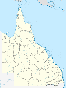
- Wallaville, Queensland
-
Wallaville
QueenslandPopulation: 182[1] Postcode: 4671 Coordinates: 25°04′17.41″S 151°59′59.19″E / 25.0715028°S 151.999775°ECoordinates: 25°04′17.41″S 151°59′59.19″E / 25.0715028°S 151.999775°E Location: - 372 km (231 mi) N of Brisbane
- 43 km (27 mi) SW of Bundaberg
LGA: Bundaberg Region State District: Burnett Federal Division: Hinkler Wallaville is a town in Queensland, Australia. The town is located in the Bundaberg Region local government area, 372 kilometres (231 mi) north of the state capital, Brisbane and 43 kilometres (27 mi) south west of the regional centre of Bundaberg. At the 2006 census, Wallaville had a population of 182.[1]
Currajong Creek runs through the town, flowing into the Burnett River. The creek is also known for the Ceratodus lung fish found in quite large numbers.[citation needed]
History
The town was home to a sugar mill that closed in 1975. During the cane crushing season from July to December the population of the town doubled with as influx of mill workers and cane cutters. The town had two general stores, a bakery, a butcher shop, post office, garage as well as the Bellevue Hotel, which is still trading.[citation needed]
Wallaville State School celebrated its 100th anniversary in November 2009.[citation needed]
References
- ^ a b Australian Bureau of Statistics (25 October 2007). "Wallaville (Kolan Shire) (State Suburb)". 2006 Census QuickStats. http://www.censusdata.abs.gov.au/ABSNavigation/prenav/LocationSearch?collection=Census&period=2006&areacode=SSC37837&producttype=QuickStats&breadcrumb=PL&action=401. Retrieved 19 January 2011.
Suburbs and towns in the Bundaberg Region | Wide Bay-Burnett | Queensland Bundaberg Ashfield · Avenell Heights · Avoca · Bargara · Branyan · Bundaberg Central · Bundaberg East · Bundaberg North · Bundaberg South · Bundaberg West · Coral Cove · Elliott Heads · Gooburrum · Kalkie · Kensington · Kepnock · Millbank · Mon Repos · Norville · Oakwood · Qunaba · Rubyanna · Sharon · Svensson Heights · Thabeban · Walkervale · Woongarra ·
Other areas Alloway · Apple Tree Creek · Avondale · Booyal · Bullyard · Burnett Heads · Buxton · Calavos · Childers · Coonarr · Cordalba · Elliott · Fairymead · Gin Gin · Gooburrum · Goodwood · Innes Park · Kalkie · Kalpowar · Meadowvale · Miara · Monduran · Moore Park · Moorland · Port Bundaberg · Rosedale · South Kolan · Tirroan · Wallaville · Watalgan · Windermere · Woodgate · Yandaran ·
Main Article: Local Government Areas of QueenslandCategories:- Towns in Queensland
- Queensland geography stubs
Wikimedia Foundation. 2010.

