- Cruser Brook
-
Cruser Brook 
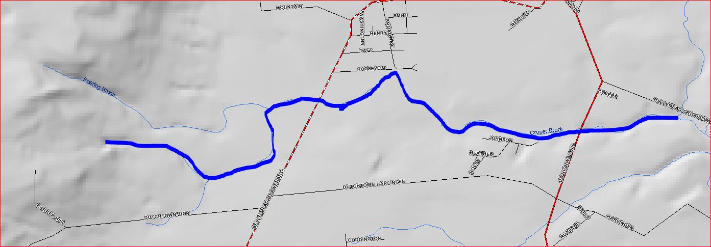
Map of Cruser BrookOrigin 40°26′47″N 74°42′17″W / 40.44639°N 74.70472°W Mouth 40°27′20″N 74°39′4″W / 40.45556°N 74.65111°W Progression Pike Run, Beden Brook, Millstone River, Raritan River, Atlantic Ocean Basin countries United States Mouth elevation 52 ft (16 m) Left tributaries Roaring Brook The Cruser Brook, also known as the Crusers Brook[1], is a tributary of the Pike Run in Somerset county, New Jersey, United States.[2]
Contents
Course
The Cruser Brook starts at 40°26′47″N 74°42′17″W / 40.44639°N 74.70472°W[1] in Sourland Mountain. It flows northeast and picks up Roaring Brook. It crosses CR-601 (Belle Mead-Blawenburg Road) and continues flowing east. It crosses Route 206 and drains into the Pike Run at 40°27′20″N 74°39′4″W / 40.45556°N 74.65111°W[1].
Tributaries
The Cruser Brook has one tributary; the Roaring Brook.
Sister Tributaries
- Back Brook
- Pine Tree Run
See also
References
- ^ a b c "GNIS Detail - Cruser Brook". USGS. http://gnis.usgs.gov/pls/gnispublic/f?p=139:3:4270984338033599::NO:3:P3_FID,P3_TITLE:875757%2CCruser%20Brook. Retrieved 21 July 2010.
- ^ "Cruser Brook in Somerset County, New Jersey". AnyPlaceAmerica. http://www.anyplaceamerica.com/topographic_maps/new_jersey/somerset_county/cruser_brook/1573/. Retrieved 21 July 2010.
External links
Categories:- Rivers of New Jersey
- Tributaries of the Raritan River
- Geography of Somerset County, New Jersey
Wikimedia Foundation. 2010.