Cropp River

Cropp River
Cropp River

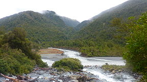
Cropp River meets the Whitcombe River in the Foreground
Origin Galena Ridge
Mouth Whitcombe River
Basin countries New Zealand
Length 9 km (5.6 mi)
Source elevation 1,200 m (3,900 ft)
Mouth elevation 755 m (2,477 ft)

The Cropp River is a river of New Zealand. It flows east for nine kilometres before joining the Whitcombe River, a tributary of the Hokitika River.[1]

1049 mm of rain fell over the Cropp River on 12-13 December 1995, a record rainfall for a 48 hour period for New Zealand.[2]

See also

References

  1. ^ Peter Dowling (editor) (2004). Reed New Zealand Atlas. Reed Books. Map 75. ISBN 0-7900-0952-8. 
  2. ^ "Summary of New Zealand Climate Extremes". NIWA. January 2004. http://www.niwa.co.nz/education-and-training/schools/resources/climate/extreme. Retrieved 4 September 2009. 


Coordinates: 43°04′S 171°01′E / 43.067°S 171.017°E / -43.067; 171.017


Wikimedia Foundation. 2010.

Игры ⚽ Поможем решить контрольную работу

Look at other dictionaries:

  • List of rivers of New Zealand — This is a list of all waterways named as rivers in New Zealand. In a small number of cases, which have not been fully indexed here, there are multiple rivers bearing the same name; in these cases the notation (#) indicates the number of rivers… …   Wikipedia

  • Liste der Flüsse in Neuseeland — Die Liste der Flüsse in Neuseeland gibt eine Übersicht über alle permanent wasserführenden Flüsse im Staat Neuseeland: Inhaltsverzeichnis A B C D E F G H I J K L M N O P Q R S T U V W X Y Z …   Deutsch Wikipedia

  • Liste des cours d'eau de Nouvelle-Zélande — Liste des cours d eau de Nouvelle Zélande. Pour un petit nombre de cas, qui n a pas été pris intégralement en compte ici, il existe de multiples rivières portant un nom identique. Dans ce cas, la notation (#) indique le nombre de rivières… …   Wikipédia en Français

  • Liste des rivières de Nouvelle-Zélande — Liste des cours d eau de Nouvelle Zélande Liste des cours d eau de Nouvelle Zélande. Pour un petit nombre de cas, qui n a pas été pris intégralement en compte ici, il existe de multiples rivières portant un nom identique. Dans ce cas, la notation …   Wikipédia en Français

  • Mount Adams (New Zealand) — Mount Adams Mount Adams from the south east, Escape Glacier at left, Seige Glacier (partially covered in rock debris) at centre. Late summer conditions. Elevation …   Wikipedia

  • Organic Valley — Type Agricultural cooperative Founded 1988 (1988) Headquarters …   Wikipedia

  • Cook Island Aquatic Reserve — This article is about the aquatic reserve in New South Wales, Australia. For other uses, see Cook Island (disambiguation). Cook Island Aquatic Reserve Protected Area Country Australia …   Wikipedia

  • Cook Island Aquatic Reserve — ist ein 73 ha großes Meeresschutzgebiet in der Tasmansee, einem Randmeer des südlichen Pazifik, etwa 600 m von Fingal Head auf dem Festland von New South Wales in Australien entfernt. Entdeckt wurde Cook Island von James Cook im Jahr… …   Deutsch Wikipedia

  • Outline of sharks — A great white shark at Isla Guadalupe, Mexico Sharks (superorder Selachimorpha) are a type of fish with a full cartilaginous skeleton and a highly streamlined body. The earliest known sharks date from more than 420 million years ago, before the… …   Wikipedia

  • Cropredy — Coordinates: 52°06′58″N 1°19′12″W / 52.116°N 1.320°W / 52.116; 1.320 …   Wikipedia

Share the article and excerpts

Direct link
Do a right-click on the link above
and select “Copy Link”