- Crick Road
-

Crick Road is a road in North Oxford, England.[2]
Location
At the western end is the Bradmore Road and at the eastern end is Fyfield Road. To the north is Norham Road and to the south are Norham Gardens and the University Parks.
History and residents
Houses in the road were first leased between 1876 and 1880.[2] Architects include Willson Beasley, Frederick Codd, Galpin & Shirley, and Frederick R. Pike. The houses are mostly in pairs, with Jacobean as well as more traditional North Oxford Gothic detailing.[3]
In 1879, the school that was to become known as the Dragon School (previous known as the Oxford Preparatory School) moved from rooms at Balliol Hall in St Giles' to 17 Crick Road, which became known as "School House".[4] The headmaster was initially A. E. Clarke and from 1886 Charles Cotterill Lynam (known as the "Skipper").[5] The school expanded and moved in 1895 to its current location at Bardwell Road, further north in North Oxford.
In 1879, the historian and later Master of Balliol College, Oxford, Arthur Lionel Smith married Mary Smith.[6] They first lived at 7 Crick Road until 1893. They had had nine children together, six of whom were born at the house in Crick Road.
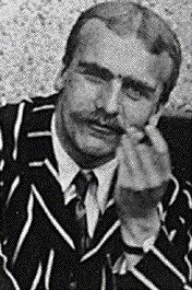
The Haldane family[7] lived at 11 Crick Road and the house is marked with a blue plaque.[1] The family included the physiologist and father John Scott Haldane (1860–1936), together with his children, the geneticist and evolutionary biologist J. B. S. Haldane (Fellow of New College, Oxford), and the novelist Naomi Mitchison. The family later moved to 'Cherwell' at the end of Linton Road to the north, now the location of Wolfson College on the banks of the River Cherwell.
The botanist and Mayor of Oxford, George Claridge Druce (1850–1932), moved to 9 Crick Road in 1909.[8] He named the house "Yardley Lodge", after the village of Yardley Gobion where he lived in his youth. He died at his home and was buried in Holywell Cemetery, Oxford.
References
- ^ a b "J. S. Haldane (1860–1936)". Oxfordshire Blue Plaques Scheme, UK. 14 March 2011. http://www.oxfordshireblueplaques.org.uk/plaques/haldane.html. Retrieved May 6, 2011.
- ^ a b Hinchcliffe, Tanis (1992). North Oxford. New Haven & London: Yale University Press. pp. 55, 85, 109, 223. ISBN 0 14 071045 0.
- ^ Sherwood, Jennifer and Pevsner, Nikolaus (1974). The Buildings of England: Oxfordshire. Penguin Books. p. 318. ISBN 0 14 071045 0.
- ^ Jaques, C. H. (1977). "I: Beginnings". A Dragon Century: 1877–1977. Blackwell's. pp. 1–7.
- ^ Jaques, C. H. (1977). "II: The Crick Road Era". A Dragon Century: 1877–1977. Blackwell's. pp. 7–21.
- ^ Symonds, Ann Spokes. "Families: The A.L. Smiths". The Changing Faces of North Oxford: Book One. Robert Boyd Publications. pp. 117–118. ISBN 1 899536 25 6.
- ^ Symonds, Ann Spokes. "Families: The Haldanes". The Changing Faces of North Oxford: Book One. Robert Boyd Publications. pp. 99–101. ISBN 1 899536 25 6.
- ^ Jenkins, Stephanie (6 March 2011). "George Claridge Druce: Mayor of Oxford 1900/1". Headington, Oxford, UK. http://www.headington.org.uk/oxon/mayors/1836_1962/druce_george_1900.htm. Retrieved May 6, 2011.
Coordinates: 51°45′53″N 1°15′25″W / 51.76475°N 1.25705°W

This England road or road transport-related article is a stub. You can help Wikipedia by expanding it.