- Crendell
-
Coordinates: 50°55′13″N 1°53′01″W / 50.920324°N 1.8835739°W
Crendell 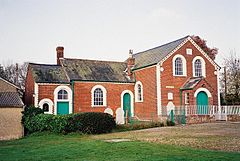
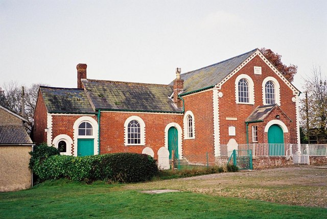
Methodist Chapel, Crendell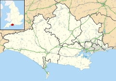
 Crendell
Crendell shown within DorsetOS grid reference SU082134 District East Dorset Shire county Dorset Region South West Country England Sovereign state United Kingdom Post town FORDINGBRIDGE Postcode district SP6 Dialling code 01425 Police Dorset Fire Dorset Ambulance South Western EU Parliament South West England UK Parliament North Dorset List of places: UK • England • Dorset Crendell is a hamlet in the civil parish of Alderholt[1] in the East Dorset district of Dorset, England. The hamlet is close to the Dorset-Hampshire border. Its nearest town is Verwood, which lies approximately 2.5 miles (4 km) south from the hamlet.
Crendell has about ten houses.[2] Clay was once mined here for the local pottery industry in Alderholt.[3] Crendell also has a Methodist chapel, which remained on the Hampshire side of the border when the county borders were redrawn in 1974. The chapel, which was built in 1870, closed in 2011.[2]
Notes
- ^ History, St James Church, Alderholt
- ^ a b Crendell Church closes as Alderholt Chapel opens, BBC News, 27 May 2011
- ^ A History of Alderholt
Categories:- Hampshire geography stubs
- Villages in Dorset

Wikimedia Foundation. 2010.