- Creek Street, Brisbane
-
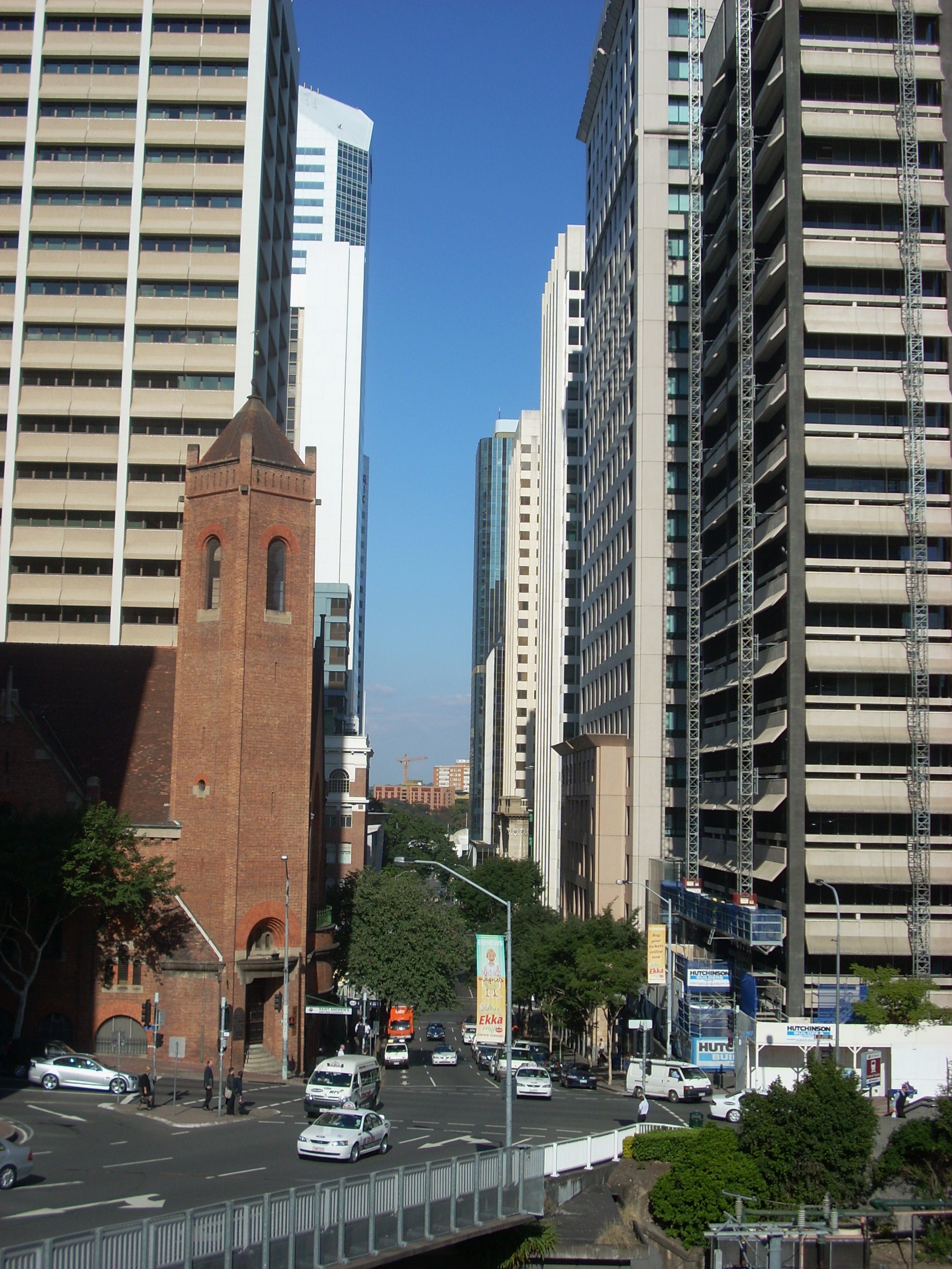
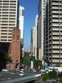 The view south, down Creek Street
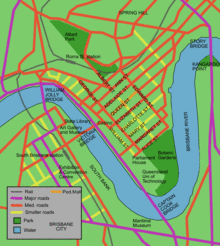 Map of Brisbane City streets
Creek Street is a major street in the central business district of Brisbane. Although the street is immediately within the Brisbane CBD, it has not been named accordingly, similar to that of other streets in the CBD. It follows a one-way south-north direction, starting at the beginning of Charlotte Street, cutting through Elizabeth Street, Queen Street, Adelaide Street, Ann Street, before coming to an end at Turbot Street in the northern end of the CBD.
Contents
Financial district
The street is part of the emerging financial district known as the "Golden Triangle". The street is lined with a wall of skyscrapers of 100m or more in height including Comalco Place, Central Plaza 1(corner), NAB House.
Street upgrade
In 2008 it was announced that the Brisbane City Council was going to convert the street into a two-way road to improve traffic flow in the CBD as part of its Town Reach project. Doubts emerged later in the year due to cost blowouts and traffic planners who questioned the new design's effectiveness.[1] After traffic tests proved the new design was not feasible, the plan was put on hold indefinitely.[2]
See also
References
- ^ Tony Moore (28 October 2008). "CBD road project faces blowout". Brisbane Times. Fairfax Digital. http://www.brisbanetimes.com.au/news/queensland/cbd-road-project-faces-blowout/2008/10/27/1224955949498.html. Retrieved 2009-10-25.
- ^ Tony Moore (19 February 2009). "$6.8m Brisbane traffic plan up the Creek". Brisbane Times. Fairfax Digital. http://www.brisbanetimes.com.au/news/queensland/68m-brisbane-traffic-plan-up-the-creek/2009/02/18/1234632868416.html. Retrieved 2009-10-25.
Coordinates: 27°27′59.24″S 153°01′41.11″E / 27.4664556°S 153.0280861°E
Categories:- Streets in Brisbane
- Australia road stubs

Wikimedia Foundation. 2010.