- Cranzahl Dam
-
Cranzahl Dam 
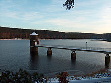
Cranzahl Dam, December 2006Location Erzgebirgskreis, Saxony,  Germany
Coordinates 50°30′14″N 13°00′13″E / 50.50389°N 13.00361°E Construction began 1949–1952 Dam and spillways Type of dam earth-fill dam Height (thalweg) 32 Height (foundation) 36 Length 428 Crest width 6 Volume 335000 Impounds Lampertsbach, Moritzbach Reservoir Capacity 3,2 Mio. m³ Active capacity 3,1 Mio. m³ Catchment area 9.25 Surface area 0.35 Normal elevation 715.05 Cranzahl Dam (German: Talsperre Cranzahl) is a dam in the Free State of Saxony in East Germany. It was built from 1949 to 1952 near Sehmatal-Cranzahl and the Bärenstein mountain in the Ore Mountains to supply drinking water to Annaberg-Buchholz and the surrounding area. Together with the Sosa Dam it was one of the two biggest dam construction projects of the newly-created GDR. In keeping with the time it was called the Dam of Friendschip (Talsperre der Freundschaft).
The actual dam itself is a crooked earth-fill dam with a sloping inner seal of loam. It is a large dam based on ICOLD criteria. The streams impounded by it are the Lampertsbach and the Moritzbach.
A trafficable track runs along the dam crest (500 metres). Bathing and water sports in the reservoir are not permitted. However there is a circular path of 3.5 kilometres for walkers, mountain-bikers and skiers.
See also
- List of dams in Germany
External links
Categories:- Reservoirs in Germany
- Dams in Saxony
- Mulde basin
- 1950s architecture
Wikimedia Foundation. 2010.
