Coyote Hills (Plumas County)
- Coyote Hills (Plumas County)
-
This article is about the hills in Plumas County,
California.
For other uses,
see Coyote Hills.
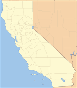
. The Coyote Hills are a low mountain-hills range in Plumas County, California.[1]
References
Categories: - Mountain ranges of Northern California
- Mountain ranges of Plumas County, California
- Shasta Cascade geography stubs
Wikimedia Foundation.
2010.
Look at other dictionaries:
Coyote Hills — may refer to: Coyote Hills (Alameda County), California, USA Coyote Hills Regional Park Coyote Hills (Plumas County), California, USA Coyote Hills, Baker County, Oregon, USA Related names include Coyote Mountains, San Diego County, California,… … Wikipedia
Santa Clara County, California — County of Santa Clara County Images, from top, left to right: Downtown San Jose, San Jose Museum of Art … Wikipedia
San Mateo County, California — County of San Mateo County Seal … Wikipedia
San Bernardino County, California — County of San Bernardino County Seal … Wikipedia
Riverside County, California — County of Riverside County Flag … Wikipedia
Ventura County, California — County of Ventura County Seal … Wikipedia
Nevada County, California — County of Nevada County Seal … Wikipedia
Orange County, California — For other uses, see Orange County (disambiguation). Coordinates: 33°40′N 117°47′W / 33.67°N 117.78°W / 33.67; 117.78 … Wikipedia
Los Angeles County, California — For the city in California, see Los Angeles. County of Los Angeles County … Wikipedia
Chino Hills State Park — Coordinates: 33°57′16″N 117°42′07″W / 33.954325°N 117.701855°W / 33.954325; 117.701855 … Wikipedia