- Coxs Creek, Kentucky
-
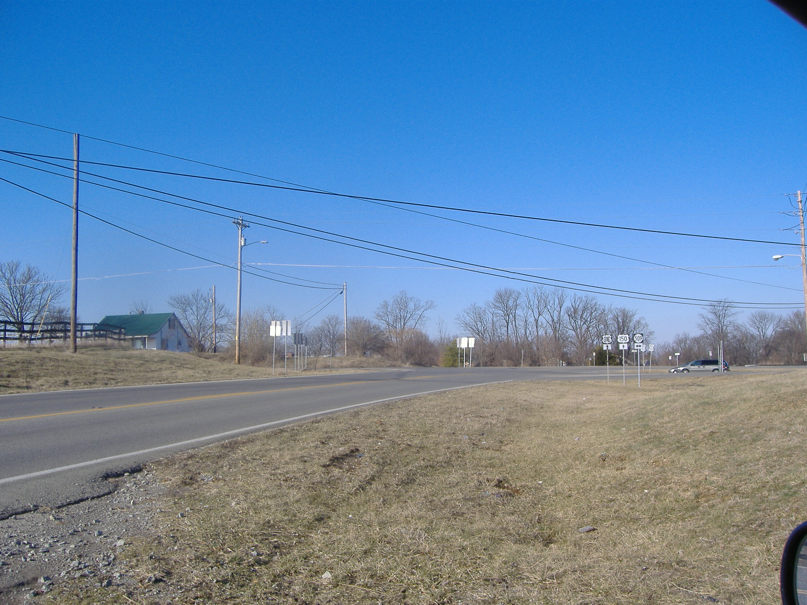
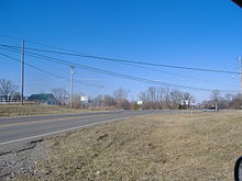 Crossroads of U.S. Route 31E and Kentucky State Route 509 in Coxs Creek, Kentucky
Coxs Creek is an unincorporated community along U.S. Routes 31E/150 (known locally as Louisville Road[1]) in Nelson County, Kentucky, United States, 4½ miles north of the county seat of Bardstown. It is named for Colonel Isaac Cox of Pennsylvania, who built a "fort" (actually an "old time block house") at the site in April 1775 before he fought in the American Revolutionary War, with the help of his brother James Cox. The land had actually been his father's (David Cox), but David moved back to Virginia before he developed it. More of a station, Cox's 1,000 acres (4.0 km2) was said to be the first pioneer station in Nelson County.[2][3] Isaac Cox would later have the unenviable position as the last white men to be killed by Indians during the time of the great Indian wars in what later became Kentucky.[4]
Kentucky's second Baptist association was formed at Coxs Creek on October 29, 1785.[5] The first post office in the community was established on November 28, 1856, with a descendant of Isaac Cox, John C. Cox, the first postmaster. By the time of the automobiles the post office and adjacent store blocked the view of upcoming traffic on US-31, forcing the Kentucky Highway Department to order the post office moved from Coxs Creek's crossroads of US-31E/US-150 and Kentucky State Route 509 in the 1960s; the new post office is 1/2 mile south of the crossroads.[6]
The nearby creek is called Coxs Creek, and is a tributary of Kentucky's Salt River.[7] Elevations in Coxs Creek range from 650 to 736 feet (224 m) above sea level.[8] It has one school: Cox's Creek Elementary School.[9] Its latitude/longitude is 37.899N and 85.474W.[10]
References
- ^ "Cox's Creek Elementary School". Nelson County Public Schools. http://cces.nelson.kyschools.us/cox%27s%20creek%20home%20page%2007.htm. Retrieved 2009-01-11.
- ^ Simon p.290
- ^ Rennick p.70
- ^ Kerr p.408
- ^ Taylor p.333
- ^ Rennick p.70
- ^ Rennick p.70
- ^ Hoeing p.312
- ^ "Cox's Creek Elementary School". Nelson County Public Schools. http://cces.nelson.kyschools.us/cox%27s%20creek%20home%20page%2007.htm. Retrieved 2009-01-11.
- ^ "Community and City Profiles: HomeTownLocator.com Coxs Creek, KY Community Profile". Community and City Profiles: HomeTownLocator.com Kentucky Gazetteer Cities, Features, Maps & Data. http://kentucky.hometownlocator.com/ky/nelson/coxs-creek.cfm. Retrieved 2009-01-11.
Bibliography
- Hoeing, J.B. (1914). Reports By Kentucky State Geologist. Frankfort, Kentucky: Kentucky State Government. http://books.google.com/books?id=wl65YXf_LVMC. Retrieved January 10, 2009.
- Kerr, Charles; William Elsey Connelley, Ellis Merton Coulter (1922). History of Kentucky. The American Historical Society.
- Rennick, Robert M. (1988). Kentucky Place Names. University Press of Kentucky. ISBN 0813101794.
- Simon, F. Kevin (1996). The WPA Guide to Kentucky: A Guide to the Bluegrass State. University Press of Kentucky. ISBN 0813108659.
- Taylor, John; Chester Raymond Young (1995). [0865544794 Baptists on the American Frontier]. Mercer University Press. 0865544794.
Municipalities and communities of Nelson County, Kentucky Cities 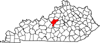
Unincorporated
communityBoston | Coxs Creek
Coordinates: 37°53′55″N 85°28′25″W / 37.89861°N 85.47361°W
Categories:- Populated places in Nelson County, Kentucky
- Unincorporated communities in Kentucky
- Louisville metropolitan area

Wikimedia Foundation. 2010.