- Cow Creek (South Umpqua River)
-
Cow Creek River 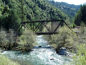 Westfolk Bridge over Cow Creek
Country United States State Oregon Part of South Umpqua River Primary source South Fork Cow Creek - location A mile north of Round Top, Jackson County, Umpqua National Forest - elevation 4,000 ft (1,219 m) - coordinates 42°43′34″N 122°59′44″W / 42.72611°N 122.99556°W [1] Secondary source East Fork Cow Creek - location Richter Mountain, Umpqua National Forest - elevation 4,500 ft (1,372 m) - coordinates 42°46′02″N 122°55′53″W / 42.76722°N 122.93139°W [2] Source confluence About 3 miles (4.8 km) east-southeast of Devils Flat [3] - location Umpqua National Forest, Douglas County - elevation 2,402 ft (732 m) - coordinates 42°48′06″N 122°59′26″W / 42.80167°N 122.99056°W [3] Mouth South Umpqua River - location Canyonville, Douglas County - elevation 636 ft (194 m) [3] - coordinates 42°56′49″N 123°20′16″W / 42.94694°N 123.33778°W [3] Length 44 mi (71 km), East-west Basin 456 sq mi (1,181 km2) [4] Discharge - average 856 cu ft/s (24 m3/s) - max 38,400 cu ft/s (1,087 m3/s) - min 7.4 cu ft/s (0 m3/s) 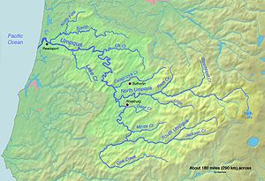 Map of the Umpqua River watershed including Cow Creek (the C-shaped watercourse near the bottom)
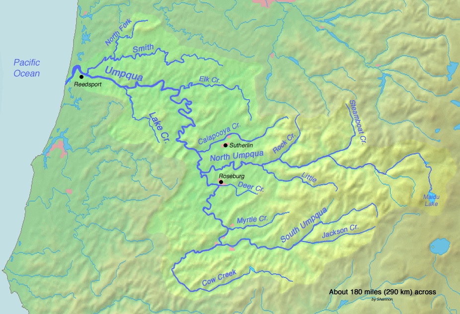
Cow Creek is a medium-sized river in southwestern Oregon, a tributary of the South Umpqua River. It drains an area of over 400 square miles (1,000 km2) on the western foothills of the Cascade Range and within the Oregon Coast Range. Although the vast majority of the basin is within Douglas County, a tiny portion in the southeast extends into northern Jackson County.
Course
The stream rises in the Umpqua National Forest at the confluence of South Fork Cow Creek and East Fork Cow Creek. The south fork, which is much larger, is sometimes considered the main stem. In its first few miles the creek flows west through an agricultural valley and through Galesville Reservoir. Cow Creek runs alongside Interstate 5 for several miles and receives Windy Creek from the right at Glendale, Oregon. The stream then bends northwest into a canyon, receiving West Fork Cow Creek on the left and Middle Creek from the right. It then continues northwards, bending steadily eastwards and doubling back on its former course. The river emerges from the mountains near Riddle, and bends sharply south around a ridge, joining the South Umpqua about 2 miles (3.2 km) west of Canyonville.[5]
See also
- List of longest streams of Oregon
- Cow Creek Band of Umpqua Tribe of Indians
References
- ^ "South Fork Cow Creek". Geographic Names Information System, U.S. Geological Survey. 1986-05-22. http://geonames.usgs.gov/pls/gnispublic/f?p=gnispq:3:::NO::P3_FID:1155363. Retrieved 2010-08-23.
- ^ "East Fork Cow Creek". Geographic Names Information System, U.S. Geological Survey. 1980-11-28. http://geonames.usgs.gov/pls/gnispublic/f?p=gnispq:3:::NO::P3_FID:1141550. Retrieved 2010-08-23.
- ^ a b c d "Cow Creek". Geographic Names Information System, U.S. Geological Survey. 1980-11-28. http://geonames.usgs.gov/pls/gnispublic/f?p=gnispq:3:::NO::P3_FID:1140278. Retrieved 2010-08-23.
- ^ "USGS Gage #14310000 on Cow Creek near Riddle, Oregon –– Water-Data Report 2009". National Water Information System. United States Geological Survey. 2009. http://wdr.water.usgs.gov/wy2009/pdfs/14310000.2009.pdf. Retrieved 2010-08-23.
- ^ ACME Mapper. USGS Topo Maps for United States (Map). Cartography by United States Geological Survey. http://mapper.acme.com/. Retrieved 2010-08-23.
Categories:- Streams of Oregon
- Landforms of Jackson County, Oregon
- Landforms of Douglas County, Oregon

Wikimedia Foundation. 2010.