Taila County

Taila County
Taila
New South Wales
Taila NSW.PNG
Location in New South Wales
Lands administrative divisions around Taila
Wentworth Perry Kilfera
Wentworth Taila Caira
Karkarooc (Vic) Tatchera (Vic) Caira

Taila County is one of the 141 Cadastral divisions of New South Wales. It contains the town of Euston.

The name Taila is believed to be derived from a local Aboriginal word.[1]

Parishes within this county

A full list of parishes found within this county; their current LGA and mapping coordinates to the approximate centre of each location is as follows:

Parish LGA Coordinates
Benanee Balranald Shire 34°30′43″S 142°54′10″E / 34.51194°S 142.90278°E / -34.51194; 142.90278 (Benanee)
Bengallow Wentworth Shire 34°29′18″S 142°28′41″E / 34.48833°S 142.47806°E / -34.48833; 142.47806 (Bengallow)
Bertram Balranald Shire 34°34′27″S 142°36′40″E / 34.57417°S 142.61111°E / -34.57417; 142.61111 (Bertram)
Bidura West Balranald Shire 34°08′51″S 143°10′03″E / 34.1475°S 143.1675°E / -34.1475; 143.1675 (Bidura West)
Boorong Wentworth Shire 34°20′01″S 142°34′31″E / 34.33361°S 142.57528°E / -34.33361; 142.57528 (Boorong)
Brooke Balranald Shire 33°59′34″S 143°14′56″E / 33.99278°S 143.24889°E / -33.99278; 143.24889 (Brooke)
Bunchie Wentworth Shire 33°54′18″S 142°53′46″E / 33.905°S 142.89611°E / -33.905; 142.89611 (Bunchie)
Burkett Balranald Shire 33°37′40″S 143°06′36″E / 33.62778°S 143.11°E / -33.62778; 143.11 (Burkett)
Caringy Balranald Shire 34°23′14″S 142°55′50″E / 34.38722°S 142.93056°E / -34.38722; 142.93056 (Caringy)
Coolena Balranald Shire 34°25′38″S 142°51′17″E / 34.42722°S 142.85472°E / -34.42722; 142.85472 (Coolena)
Euston Balranald Shire 34°31′57″S 142°44′59″E / 34.5325°S 142.74972°E / -34.5325; 142.74972 (Euston)
Garnet Wentworth Shire 34°09′48″S 142°44′34″E / 34.16333°S 142.74278°E / -34.16333; 142.74278 (Garnet)
Grant Balranald Shire 34°13′18″S 142°53′37″E / 34.22167°S 142.89361°E / -34.22167; 142.89361 (Grant)
Gulthul Balranald Shire 34°20′17″S 142°47′37″E / 34.33806°S 142.79361°E / -34.33806; 142.79361 (Gulthul)
Ki Balranald Shire 34°38′43″S 142°33′38″E / 34.64528°S 142.56056°E / -34.64528; 142.56056 (Ki)
Koorakee Balranald Shire 34°29′40″S 143°01′25″E / 34.49444°S 143.02361°E / -34.49444; 143.02361 (Koorakee)
Laurie Wentworth Shire 34°15′53″S 142°43′38″E / 34.26472°S 142.72722°E / -34.26472; 142.72722 (Laurie)
Lette Balranald Shire 34°19′52″S 143°08′48″E / 34.33111°S 143.14667°E / -34.33111; 143.14667 (Lette)
Lowan Balranald Shire 34°02′36″S 143°14′10″E / 34.04333°S 143.23611°E / -34.04333; 143.23611 (Lowan)
Mallee Cliffs Wentworth Shire 34°23′58″S 142°28′46″E / 34.39944°S 142.47944°E / -34.39944; 142.47944 (Mallee Cliffs)
Manie Balranald Shire 34°38′54″S 143°11′17″E / 34.64833°S 143.18806°E / -34.64833; 143.18806 (Manie)
Maniette Balranald Shire 34°37′22″S 143°04′00″E / 34.62278°S 143.0666667°E / -34.62278; 143.0666667 (Maniette)
Marma Balranald Shire 34°03′01″S 142°48′10″E / 34.05028°S 142.80278°E / -34.05028; 142.80278 (Marma)
Matalong Wentworth Shire 34°32′39″S 142°29′47″E / 34.54417°S 142.49639°E / -34.54417; 142.49639 (Matalong)
Meilman Balranald Shire 34°36′35″S 142°57′29″E / 34.60972°S 142.95806°E / -34.60972; 142.95806 (Meilman)
Mendook Balranald Shire 34°27′32″S 142°46′01″E / 34.45889°S 142.76694°E / -34.45889; 142.76694 (Mendook)
Merowa Balranald Shire 34°37′08″S 143°11′54″E / 34.61889°S 143.19833°E / -34.61889; 143.19833 (Merowa)
Mundonah Balranald Shire 34°07′11″S 142°54′31″E / 34.11972°S 142.90861°E / -34.11972; 142.90861 (Mundonah)
Mungo Balranald Shire 33°51′08″S 143°05′56″E / 33.85222°S 143.09889°E / -33.85222; 143.09889 (Mungo)
Mylatchie Balranald Shire 34°23′11″S 143°09′15″E / 34.38639°S 143.15417°E / -34.38639; 143.15417 (Mylatchie)
North Mundonah Balranald Shire 34°01′06″S 142°55′57″E / 34.01833°S 142.9325°E / -34.01833; 142.9325 (North Mundonah)
Nowong Balranald Shire 34°42′57″S 142°37′22″E / 34.71583°S 142.62278°E / -34.71583; 142.62278 (Nowong)
Ormond Balranald Shire 34°06′47″S 143°03′16″E / 34.11306°S 143.05444°E / -34.11306; 143.05444 (Ormond)
Park Balranald Shire 34°19′50″S 143°00′37″E / 34.33056°S 143.01028°E / -34.33056; 143.01028 (Park)
Prungle Balranald Shire 34°10′54″S 143°03′37″E / 34.18167°S 143.06028°E / -34.18167; 143.06028 (Prungle)
Rainding Balranald Shire 34°28′17″S 142°39′12″E / 34.47139°S 142.65333°E / -34.47139; 142.65333 (Rainding)
Spencer Balranald Shire 33°58′35″S 143°03′39″E / 33.97639°S 143.06083°E / -33.97639; 143.06083 (Spencer)
Taila Balranald Shire 34°33′20″S 142°51′43″E / 34.55556°S 142.86194°E / -34.55556; 142.86194 (Taila)
Tittara Balranald Shire 34°30′56″S 143°08′38″E / 34.51556°S 143.14389°E / -34.51556; 143.14389 (Tittara)
Werimble Balranald Shire 34°24′45″S 143°03′53″E / 34.4125°S 143.06472°E / -34.4125; 143.06472 (Werimble)
Youngera Balranald Shire 34°23′32″S 142°41′57″E / 34.39222°S 142.69917°E / -34.39222; 142.69917 (Youngera)
Zanci Balranald Shire 33°45′41″S 143°06′47″E / 33.76139°S 143.11306°E / -33.76139; 143.11306 (Zanci)

References

  1. ^ Geographical Names Board of NSW

Wikimedia Foundation. 2010.

Игры ⚽ Нужно сделать НИР?

Look at other dictionaries:

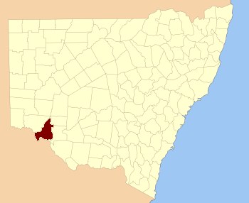
  • Taila County, New South Wales — Infobox Australian cadastral name = Taila state = New South Wales caption = Location in New South Wales near nw = Wentworth near n = Perry near ne = Kilfera near e = Caira near se = Caira near s = Tatchera (Vic) near sw = Karkarooc (Vic) near w …   Wikipedia

  • County of Karkarooc — Karkarooc Victoria Location in Victoria Established: 24 February 1871 Area: 15,372 km² …   Wikipedia

  • Caira County — Map of all coordinates from Google Map of all coordinates from Bing Export all coordinates as KML …   Wikipedia

  • Wentworth County — For the former county in Canada, see Wentworth County, Ontario. Map of all coordinates from Google Map of all coordinates from Bing Export all coordinates as KML …   Wikipedia

  • Wentworth County, New South Wales — Infobox Australian cadastral name = Wentworth state = New South Wales caption = Location in New South Wales near nw = Windeyer near n = Perry near ne = Manara near e = Taila near se = Taila near s = Karkarooc (Vic) near sw = Millewa (Vic) near w …   Wikipedia

  • Caira County, New South Wales — Infobox Australian cadastral name = Caira state = New South Wales caption = Location in New South Wales near nw = Taila near n = Kilfera near ne = Waljeers near e = Waradgery near se = Wakool near s = Wakool near sw = Tatchera (Vic) near w =… …   Wikipedia

  • Kilfera County, New South Wales — Infobox Australian cadastral name = Kilfera state = New South Wales caption = Location in New South Wales near nw = Perry near n = Manara near ne = Waljeers near e = Waljeers near se = Waljeers near s = Caira near sw = Taila near w =… …   Wikipedia

  • Kilfera County — Map of all coordinates from Google Map of all coordinates from Bing Export all coordinates as KML …   Wikipedia

  • Lands administrative divisions of New South Wales — The 141 counties of New South Wales, with the original Nineteen shown in pink …   Wikipedia

  • Cadastral divisions of New South Wales — refers to the 141 counties within the Australian state of New South Wales, which are further subdivided into 7,459 parishes. There are also three Land Divisions, around 100 Land Districts, and several other types of districts as well as land… …   Wikipedia

Share the article and excerpts

Direct link
Do a right-click on the link above
and select “Copy Link”