Hunter County

Hunter County
Hunter
New South Wales
Hunter NSW.PNG
Location in New South Wales
Lands administrative divisions around Hunter
Phillip Brisbane Durham
Phillip Hunter Northumberland
Roxburgh Cook Cumberland

Hunter County was one of the original Nineteen Counties in New South Wales and is now one of the 141 Cadastral divisions of New South Wales. It lies between the Hunter River in the north, and the Colo River in the south, including much of Wollemi National Park. Macdonald River lies to the east.

Hunter County was named in honour of Governor John Hunter (1737-1821).[1]

Parishes within this county

A full list of parishes found within this county; their current LGA and mapping coordinates to the approximate centre of each location is as follows:

Parish LGA Coordinates
Angorawa City of Hawkesbury 33°1854S 150°4404E / 33.315°S 150.73444°E / -33.315; 150.73444 (Angorawa Parish)
Arndell Muswellbrook Shire 32°2154S 150°3404E / 32.365°S 150.56778°E / -32.365; 150.56778 (Arndell Parish)
Baerami Muswellbrook Shire 32°2454S 150°2704E / 32.415°S 150.45111°E / -32.415; 150.45111 (Baerami Parish)
Blackwater Muswellbrook Shire 32°4054S 150°2404E / 32.68167°S 150.40111°E / -32.68167; 150.40111 (Blackwater Parish)
Bulga Singleton Shire 32°4954S 150°4904E / 32.83167°S 150.81778°E / -32.83167; 150.81778 (Bulga Parish)
Bureen Muswellbrook Shire 32°2854S 150°3904E / 32.48167°S 150.65111°E / -32.48167; 150.65111 (Bureen Parish)
Capertee City of Lithgow 33°0554S 150°2304E / 33.09833°S 150.38444°E / -33.09833; 150.38444 (Capertee Parish)
Caroora Muswellbrook Shire 32°3354S 150°2504E / 32.565°S 150.41778°E / -32.565; 150.41778 (Caroora Parish)
Colo City of Hawkesbury 33°2324S 150°4704E / 33.39°S 150.78444°E / -33.39; 150.78444 (Colo Parish)
Cook City of Hawkesbury 33°1554S 150°3504E / 33.265°S 150.58444°E / -33.265; 150.58444 (Cook Parish)
Coonbaralba Singleton Shire 32°3654S 150°5304E / 32.615°S 150.88444°E / -32.615; 150.88444 (Coonbaralba Parish)
Coorongooba City of Lithgow 32°5754S 150°1804E / 32.965°S 150.30111°E / -32.965; 150.30111 (Coorongooba Parish)
Coricudgy Muswellbrook Shire 32°5254S 150°2504E / 32.88167°S 150.41778°E / -32.88167; 150.41778 (Coricudgy Parish)
Doyle Singleton Shire 32°3554S 150°4804E / 32.59833°S 150.80111°E / -32.59833; 150.80111 (Doyle Parish)
Glen Alice City of Lithgow 33°0354S 150°1504E / 33.065°S 150.25111°E / -33.065; 150.25111 (Glen Alice Parish)
Grono City of Hawkesbury 33°1854S 150°4904E / 33.315°S 150.81778°E / -33.315; 150.81778 (Grono Parish)
Gullongulong Singleton Shire 32°5354S 150°4104E / 32.89833°S 150.68444°E / -32.89833; 150.68444 (Gullongulong Parish)
Gungalwa Muswellbrook Shire 32°3254S 150°3904E / 32.54833°S 150.65111°E / -32.54833; 150.65111 (Gungalwa Parish)
Hawkesbury City of Hawkesbury 33°2424S 150°5204E / 33.40667°S 150.86778°E / -33.40667; 150.86778 (Hawkesbury Parish)
Hungerford Muswellbrook Shire 32°3654S 150°3204E / 32.615°S 150.53444°E / -32.615; 150.53444 (Hungerford Parish)
Hunter Muswellbrook Shire 32°2854S 150°4504E / 32.48167°S 150.75111°E / -32.48167; 150.75111 (Hunter Parish)
Innes City of Lithgow 33°0454S 150°2904E / 33.08167°S 150.48444°E / -33.08167; 150.48444 (Innes Parish)
Ivory City of Hawkesbury 33°0954S 150°4504E / 33.165°S 150.75111°E / -33.165; 150.75111 (Ivory Parish)
Jamison City of Lithgow 32°5954S 150°2204E / 32.99833°S 150.36778°E / -32.99833; 150.36778 (Jamison Parish)
Kekeelbon Singleton Shire 32°4854S 150°3204E / 32.815°S 150.53444°E / -32.815; 150.53444 (Kekeelbon Parish)
Kindarun Singleton Shire 32°4954S 150°4204E / 32.83167°S 150.70111°E / -32.83167; 150.70111 (Kindarun Parish)
Lemington Singleton Shire 32°3254S 151°0004E / 32.54833°S 151.00111°E / -32.54833; 151.00111 (Lemington Parish)
Macdonald City of Hawkesbury 33°1754S 150°5604E / 33.29833°S 150.93444°E / -33.29833; 150.93444 (Macdonald Parish)
Martindale Muswellbrook Shire 32°3454S 150°4404E / 32.58167°S 150.73444°E / -32.58167; 150.73444 (Martindale Parish)
McLean Singleton Shire 32°5854S 150°2404E / 32.98167°S 150.40111°E / -32.98167; 150.40111 (Mclean Parish)
Medhurst Singleton Shire 32°4554S 150°3704E / 32.765°S 150.61778°E / -32.765; 150.61778 (Medhurst Parish)
Mediwah Muswellbrook Shire 32°2754S 150°3204E / 32.465°S 150.53444°E / -32.465; 150.53444 (Mediwah Parish)
Mellong City of Hawkesbury 33°1554S 150°4404E / 33.265°S 150.73444°E / -33.265; 150.73444 (Mellong Parish)
Mirrie Muswellbrook Shire 32°3654S 150°2404E / 32.615°S 150.40111°E / -32.615; 150.40111 (Mirrie Parish)
Monundilla Muswellbrook Shire 32°4254S 150°3104E / 32.715°S 150.51778°E / -32.715; 150.51778 (Monundilla Parish)
Myrtle Singleton Shire 32°5054S 150°3604E / 32.84833°S 150.60111°E / -32.84833; 150.60111 (Myrtle Parish)
Nullo Muswellbrook Shire 32°4554S 150°2404E / 32.765°S 150.40111°E / -32.765; 150.40111 (Nullo Parish)
Palomorang Singleton Shire 32°4554S 150°4304E / 32.765°S 150.71778°E / -32.765; 150.71778 (Palomorang Parish)
Parnell Singleton Shire 32°4154S 150°5404E / 32.69833°S 150.90111°E / -32.69833; 150.90111 (Parnell Parish)
Parr City of Hawkesbury 33°2024S 150°3804E / 33.34°S 150.63444°E / -33.34; 150.63444 (Parr Parish)
Parry Singleton Shire 32°5954S 150°3004E / 32.99833°S 150.50111°E / -32.99833; 150.50111 (Parry Parish)
Phillip Singleton Shire 32°4554S 150°2904E / 32.765°S 150.48444°E / -32.765; 150.48444 (Phillip Parish)
Piribil Singleton Shire 32°3154S 150°5004E / 32.53167°S 150.83444°E / -32.53167; 150.83444 (Piribil Parish)
Poppong Singleton Shire 32°4454S 150°5104E / 32.74833°S 150.85111°E / -32.74833; 150.85111 (Poppong Parish)
Putty Singleton Shire 32°5854S 150°4504E / 32.98167°S 150.75111°E / -32.98167; 150.75111 (Putty Parish)
Six Brothers City of Hawkesbury 33°1154S 150°3704E / 33.19833°S 150.61778°E / -33.19833; 150.61778 (Six Brothers Parish)
Sturt Singleton Shire 32°5254S 150°3004E / 32.88167°S 150.50111°E / -32.88167; 150.50111 (Sturt Parish)
Tollagong Singleton Shire 32°5554S 150°3704E / 32.93167°S 150.61778°E / -32.93167; 150.61778 (Tollagong Parish)
Tomalpin Muswellbrook Shire 32°3254S 150°3304E / 32.54833°S 150.55111°E / -32.54833; 150.55111 (Tomalpin Parish)
Tonga Singleton Shire 32°4054S 150°4504E / 32.68167°S 150.75111°E / -32.68167; 150.75111 (Tonga Parish)
Tupa Singleton Shire 33°0054S 150°3704E / 33.015°S 150.61778°E / -33.015; 150.61778 (Tupa Parish)
Wambo Singleton Shire 32°3154S 150°5504E / 32.53167°S 150.91778°E / -32.53167; 150.91778 (Wambo Parish)
Wareng Singleton Shire 32°5054S 150°4704E / 32.84833°S 150.78444°E / -32.84833; 150.78444 (Wareng Parish)
Weeney City of Hawkesbury 33°0354S 150°4604E / 33.065°S 150.76778°E / -33.065; 150.76778 (Weeney Parish)
White Muswellbrook Shire 32°3954S 150°3804E / 32.665°S 150.63444°E / -32.665; 150.63444 (White Parish)
Whybrow Singleton Shire 32°3754S 151°0004E / 32.63167°S 151.00111°E / -32.63167; 151.00111 (Whybrow Parish)
Wilpen Muswellbrook Shire 32°2854S 150°2604E / 32.48167°S 150.43444°E / -32.48167; 150.43444 (Wilpen Parish)
Windsor City of Hawkesbury 33°1054S 150°4904E / 33.18167°S 150.81778°E / -33.18167; 150.81778 (Windsor Parish)
Wirraba City of Hawkesbury 33°0654S 150°3304E / 33.115°S 150.55111°E / -33.115; 150.55111 (Wirraba Parish)
Wolgan City of Lithgow 33°0954S 150°3004E / 33.165°S 150.50111°E / -33.165; 150.50111 (Wolgan Parish)
Wollemi City of Hawkesbury 33°0654S 150°3904E / 33.115°S 150.65111°E / -33.115; 150.65111 (Wollemi Parish)
Womerah City of Hawkesbury 33°1454S 150°5304E / 33.24833°S 150.88444°E / -33.24833; 150.88444 (Womerah Parish)
Wonga City of Hawkesbury 33°2224S 150°5404E / 33.37333°S 150.90111°E / -33.37333; 150.90111 (Wonga Parish)
Yengo City of Hawkesbury 33°0254S 150°4904E / 33.04833°S 150.81778°E / -33.04833; 150.81778 (Yengo Parish)

References

  1. ^ Geographical Names Board of NSW

Wikimedia Foundation. 2010.

Игры ⚽ Нужна курсовая?

Look at other dictionaries:

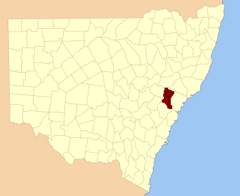
  • Hunter County, New South Wales — Infobox Australian cadastral name = Hunter state = New South Wales caption = Location in New South Wales near nw = Phillip near n = Brisbane near ne = Durham near w = Phillip near e = Northumberland near sw = Roxburgh near s = Cook near se =… …   Wikipedia

  • Hunter S. Thompson — at the Miami Book Fair International of 1988 Born Hunter Stockton Thompson July 18, 1937(1937 07 18) Louisville, Kentucky …   Wikipedia

  • Hunter's Hot Springs (Oregon) — Hunter s Hot Springs Old Perpetual geyser Type private park Location Lake County, Oregon, USA …   Wikipedia

  • Hunter (town), New York — Hunter is a town in Greene County, New York, United States. The population was 2,721 at the 2000 census.The Town of Hunter contains a village named Hunter. The town is on the County s south border. History The town was formed in 1813 from the… …   Wikipedia

  • Hunter Island — heissen: Hunter Island (New York), Insel in den Vereinigten Staaten Hunter Island (Tennessee), Insel in den Vereinigten Staaten Hunter Island (Crawford County, Wisconsin), Insel in den Vereinigten Staaten Hunter Island (Wood County, Wisconsin),… …   Deutsch Wikipedia

  • County-Klasse (1959) — County Klasse Norfolk (D21), weiter hinten die Braunschweig (F225) Übersicht Typ …   Deutsch Wikipedia

  • Hunter House — bezeichnet mehrere gleichnamige, im NRHP gelistete, Objekte: Hunter House (Alabama), ID Nr. 85000446 Hunter House (Grayson County, Kentucky), ID Nr. 85001055 Hunter House (Madison County, Kentucky), ID Nr. 88003342 Hunter House (Michigan), ID Nr …   Deutsch Wikipedia

  • Hunter Township — ist der Name mehrerer Townships in den Vereinigten Staaten: Hunter Township (Illinois) Hunter Township (Minnesota) Hunter Township (North Dakota) Hunter Township (Choctaw County, Oklahoma) Hunter Township (Tillman County, Oklahoma) Diese …   Deutsch Wikipedia

  • Hunter Boot Ltd — Hunter Boot Limited Type Limited Industry Wellington Boots, Rubber and Footwear Goods Founded 1856 [1] …   Wikipedia

  • Hunter Holmes Moss — (* 26. Mai 1874 in Parkersburg, Wood County, West Virginia; † 15. Juli 1916 in Atlantic City, New Jersey) war ein US amerikanischer Politiker. Zwischen 1913 und 1916 vertrat er den vierten …   Deutsch Wikipedia

Share the article and excerpts

Direct link
https://en-academic.com/dic.nsf/enwiki/11583878 Do a right-click on the link above
and select “Copy Link”