Culgoa County

Culgoa County
Culgoa
New South Wales
Culgoa NSW.PNG
Location in New South Wales
Lands administrative divisions around Culgoa
Queensland Queensland Queensland
Irrara Culgoa Narran
Gunderbooka Gunderbooka Narran

Culgoa County is one of the 141 Cadastral divisions of New South Wales. It is bounded by the Warrego River in the west, and the Culgoa River in the east.

The name Culgoa is of unknown origin.[1]

Parishes within this county

A full list of parishes found within this county; their current LGA and mapping coordinates to the approximate centre of each location is as follows:

Parish LGA Coordinates
Anderson Bourke Shire 29°00′38″S 145°54′22″E / 29.01056°S 145.90611°E / -29.01056; 145.90611 (Anderson)
Barringun Bourke Shire 29°01′18″S 145°46′07″E / 29.02167°S 145.76861°E / -29.02167; 145.76861 (Barringun)
Belalie Bourke Shire 29°06′31″S 145°49′52″E / 29.10861°S 145.83111°E / -29.10861; 145.83111 (Belalie)
Beri Brewarrina Shire 29°01′00″S 147°09′38″E / 29.0166667°S 147.16056°E / -29.0166667; 147.16056 (Beri)
Boneda Bourke Shire 29°10′53″S 146°16′03″E / 29.18139°S 146.2675°E / -29.18139; 146.2675 (Boneda)
Booroominia Brewarrina Shire 29°25′21″S 146°35′27″E / 29.4225°S 146.59083°E / -29.4225; 146.59083 (Booroominia)
Bourbah Brewarrina Shire 29°03′43″S 147°02′30″E / 29.06194°S 147.04167°E / -29.06194; 147.04167 (Bourbah)
Brenda Brewarrina Shire 29°01′02″S 147°18′14″E / 29.01722°S 147.30389°E / -29.01722; 147.30389 (Brenda)
Brolga Bourke Shire 29°19′00″S 146°16′51″E / 29.3166667°S 146.28083°E / -29.3166667; 146.28083 (Brolga)
Bundaleear Brewarrina Shire 29°04′05″S 146°24′26″E / 29.06806°S 146.40722°E / -29.06806; 146.40722 (Bundaleear)
Buntawarrara Bourke Shire 29°25′09″S 146°08′23″E / 29.41917°S 146.13972°E / -29.41917; 146.13972 (Buntawarrara)
Cedia Bourke Shire 29°26′13″S 146°14′25″E / 29.43694°S 146.24028°E / -29.43694; 146.24028 (Cedia)
Cockellireena Bourke Shire 29°39′07″S 146°34′18″E / 29.65194°S 146.57167°E / -29.65194; 146.57167 (Cockellireena)
Coolibar Bourke Shire 29°25′04″S 146°27′25″E / 29.41778°S 146.45694°E / -29.41778; 146.45694 (Coolibar)
Corella Bourke Shire 29°28′19″S 146°20′37″E / 29.47194°S 146.34361°E / -29.47194; 146.34361 (Corella)
Coward Bourke Shire 29°30′28″S 146°13′35″E / 29.50778°S 146.22639°E / -29.50778; 146.22639 (Coward)
Currindule Bourke Shire 29°24′56″S 146°02′16″E / 29.41556°S 146.03778°E / -29.41556; 146.03778 (Currindule)
Darling Brewarrina Shire unknown
Diemunga Brewarrina Shire 29°05′43″S 146°55′24″E / 29.09528°S 146.92333°E / -29.09528; 146.92333 (Diemunga)
Dingo Bourke Shire 29°01′18″S 146°07′57″E / 29.02167°S 146.1325°E / -29.02167; 146.1325 (Dingo)
Emu Hill Bourke Shire 29°12′03″S 146°06′07″E / 29.20083°S 146.10194°E / -29.20083; 146.10194 (Emu Hill)
Enngonia Bourke Shire 29°18′22″S 145°52′49″E / 29.30611°S 145.88028°E / -29.30611; 145.88028 (Enngonia)
Grindie Bourke Shire 29°33′44″S 146°20′23″E / 29.56222°S 146.33972°E / -29.56222; 146.33972 (Grindie)
Gurrera Bourke Shire 29°16′13″S 146°19′45″E / 29.27028°S 146.32917°E / -29.27028; 146.32917 (Gurrera)
Hardie Bourke Shire 29°08′45″S 146°16′02″E / 29.14583°S 146.26722°E / -29.14583; 146.26722 (Hardie)
Jamieson Brewarrina Shire 29°12′01″S 146°28′03″E / 29.20028°S 146.4675°E / -29.20028; 146.4675 (Jamieson)
Keats Brewarrina Shire 29°09′10″S 146°48′22″E / 29.15278°S 146.80611°E / -29.15278; 146.80611 (Keats)
Lissington Bourke Shire 29°26′27″S 146°20′21″E / 29.44083°S 146.33917°E / -29.44083; 146.33917 (Lissington)
Loxton Bourke Shire 29°11′22″S 145°55′36″E / 29.18944°S 145.92667°E / -29.18944; 145.92667 (Loxton)
Malgoolie Bourke Shire 29°34′32″S 146°27′44″E / 29.57556°S 146.46222°E / -29.57556; 146.46222 (Malgoolie)
Milroy West Brewarrina Shire 29°30′57″S 146°33′11″E / 29.51583°S 146.55306°E / -29.51583; 146.55306 (Milroy West)
Morton Plains Brewarrina Shire 29°01′19″S 146°33′14″E / 29.02194°S 146.55389°E / -29.02194; 146.55389 (Morton Plains)
Mudelooromun Brewarrina Shire 29°04′04″S 146°40′59″E / 29.06778°S 146.68306°E / -29.06778; 146.68306 (Mudelooromun)
Opal Bourke Shire 29°04′05″S 146°17′22″E / 29.06806°S 146.28944°E / -29.06806; 146.28944 (Opal)
Payera Brewarrina Shire 29°22′43″S 146°37′11″E / 29.37861°S 146.61972°E / -29.37861; 146.61972 (Payera)
Power Bourke Shire 29°16′25″S 146°02′47″E / 29.27361°S 146.04639°E / -29.27361; 146.04639 (Power)
Tatala Brewarrina Shire 29°07′53″S 146°59′02″E / 29.13139°S 146.98389°E / -29.13139; 146.98389 (Tatala)
Tawaggan Brewarrina Shire 29°01′47″S 146°48′44″E / 29.02972°S 146.81222°E / -29.02972; 146.81222 (Tawaggan)
Thurlagoona Bourke Shire 29°03′35″S 145°56′17″E / 29.05972°S 145.93806°E / -29.05972; 145.93806 (Thurlagoona)
Thurmylae Bourke Shire 29°16′52″S 145°54′49″E / 29.28111°S 145.91361°E / -29.28111; 145.91361 (Thurmylae)
Wee Warra Bourke Shire 29°22′30″S 145°57′54″E / 29.375°S 145.965°E / -29.375; 145.965 (Wee Warra)
Weejallah Bourke Shire 29°16′20″S 146°09′48″E / 29.27222°S 146.16333°E / -29.27222; 146.16333 (Weejallah)
Weilmoringle Brewarrina Shire 29°13′14″S 146°54′00″E / 29.22056°S 146.9°E / -29.22056; 146.9 (Weilmoringle)
Yamby Brewarrina Shire 29°16′44″S 146°46′57″E / 29.27889°S 146.7825°E / -29.27889; 146.7825 (Yamby)
Yamby West Brewarrina Shire 29°14′18″S 146°38′21″E / 29.23833°S 146.63917°E / -29.23833; 146.63917 (Yamby West)
Yarran Brewarrina Shire 29°17′46″S 146°29′10″E / 29.29611°S 146.48611°E / -29.29611; 146.48611 (Yarran)

References


Wikimedia Foundation. 2010.

Игры ⚽ Нужна курсовая?

Look at other dictionaries:

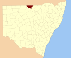
  • Culgoa County, New South Wales — Infobox Australian cadastral name = Culgoa state = New South Wales caption = Location in New South Wales near nw = Queensland near n = Queensland near ne = Queensland near e = Narran near se = Narran near s = Gunderbooka near sw = Gunderbooka… …   Wikipedia

  • Narran County — Map of all coordinates from Google Map of all coordinates from Bing Export all coordinates as KML …   Wikipedia

  • Gunderbooka County, New South Wales — Infobox Australian cadastral name = Gunderbooka state = New South Wales caption = Location in New South Wales near nw = Irrara near n = Culgoa near ne = Culgoa near e = Narran near se = Cowper near s = Yanda near sw = Landsborough near w =… …   Wikipedia

  • Gunderbooka County — Map of all coordinates from Google Map of all coordinates from Bing Export all coordinates as KML …   Wikipedia

  • Narran County, New South Wales — Infobox Australian cadastral name = Narran state = New South Wales caption = Location in New South Wales near nw = Queensland near n = Queensland near ne = Queensland near e = Finch near se = Leichardt near s = Clyde near sw = Gunderbooka near w …   Wikipedia

  • Irrara County, New South Wales — Infobox Australian cadastral name = Irrara state = New South Wales caption = Location in New South Wales near nw = Queensland near n = Queensland near ne = Queensland near e = Culgoa near se = Gunderbooka near s = Barrona near sw = Ularara near w …   Wikipedia

  • Irrara County — Map of all coordinates from Google Map of all coordinates from Bing Export all coordinates as KML …   Wikipedia

  • Liste der längsten Flüsse der Erde — Die Liste der längsten Flüsse der Erde enthält die Flüsse mit mehr als 1.000 Kilometer Länge in absteigender Reihenfolge. Unbedeutend ist dabei, ob sie durch verschiedene Staaten fließen oder in einen anderen Fluss oder Strom, ein Meer, einen See …   Deutsch Wikipedia

  • Lands administrative divisions of New South Wales — The 141 counties of New South Wales, with the original Nineteen shown in pink …   Wikipedia

  • Cadastral divisions of New South Wales — refers to the 141 counties within the Australian state of New South Wales, which are further subdivided into 7,459 parishes. There are also three Land Divisions, around 100 Land Districts, and several other types of districts as well as land… …   Wikipedia

Share the article and excerpts

Direct link
Do a right-click on the link above
and select “Copy Link”