- Coucoucache, Quebec
-
Coucoucache — Native reserve — 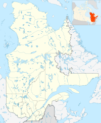
 Coucoucache
Coordinates: 47°45′08″N 73°13′50″W / 47.75222°N 73.23056°WCoordinates: 47°45′08″N 73°13′50″W / 47.75222°N 73.23056°W Country  Canada
Province  Quebec
Region Mauricie Census division La Tuque Settled 1823 (trading post) Founded 1853 (reserve) Government[1] - Chief Simon Coocoo - Federal riding Saint-Maurice—Champlain - Prov. riding Laviolette Area[1][2] - Land 0.11 km2 (0 sq mi) Population (2006)[2] - Total 0 - Density 0.0/km2 (0/sq mi) Time zone EST (UTC-5) - Summer (DST) EDT (UTC-4) Coucoucache (officially designated as Coucoucache 24A) is a tiny First Nation reserve on the north shore of Blanc Reservoir on the Saint-Maurice River in the Mauricie region of Quebec, Canada. It belongs to the Atikamekw First Nation of Wemotaci but has no permanent population.[3]
The reserve is an enclave within the City of La Tuque, approximately 48 kilometres (30 mi) north-west of La Tuque's town centre.
Contents
History
In 1806, explorer Jean-Baptiste Perrault reported on "the small Kôukôukache River that flows by a rocky mountain where there are 11 portages to get to the Grand Kôukôukache." This name came from the word kôkôkachi, meaning "owl". It was also the name of the former Coucoucache Lake, where the Hudson's Bay Company had maintained a trading post, called Coocoocache, since at least 1823 (closed circa 1913). Coucoucache Lake, part of a chain of lakes on the Saint-Maurice River, may have been named after a small mountain in the shape of an owl that was situated at the eastern end of the lake. However, legend has it that a fight developed between the Atikamekw and the Iroquois at this lake, and when the Atikamekw imitated an owl's cry, they sprung on the Iroquois and massacred them.[4]
In 1851, the Government enacted the allotment of 230,000 acres (930 km2) of land as reserves for the use and benefit of the "Indian" tribes residing in Lower Canada. Two years later, these lands were distributed among the Atikamekw, Algonquins, and Abenakis by John Rolph, Commissioner of Crown Lands. On August 9, 1853, the reserves, including Coucoucache, were approved by the Governor General in Council. In 1895, the original Coucoucache Reserve was surveyed and covered 380 acres (1.54 km2).[5]
In 1932, the Rapide-Blanc Dam was constructed, leading to the formation of the Blanc Reservoir that inundated Coucoucache Lake and Reserve. The new Coucoucache Reserve on the north shore of the reservoir replaced the old one but was only 12 acres (0.05 km2) in size. For the loss of land, the Shawinigan Water & Power Company paid the Canadian government the amount of $380.[4][5]
Demographics
Population trend:[6]
- Population in 2006: 0 (2001 to 2006 population change: 0.0 %)
- Population in 2001: 0
- Population in 1996: 0
- Population in 1991: 0
References
- ^ a b Ministère des Affaires Municipales, Régions et Occupation du territoire - Répertoire des municipalités: Coucoucache
- ^ a b Statistics Canada 2006 Census - Coucoucache community profile
- ^ Indian and Northern Affairs Canada - Aboriginal Community profile: Wemotaci First Nation
- ^ a b "Coucoucache (Réserve indienne)" (in French). Commission de toponymie du Québec. http://www.toponymie.gouv.qc.ca/CT/toposweb/fiche.aspx?no_seq=168236. Retrieved 2010-03-15.
- ^ a b Natural Resources Canada - Legal Surveys Division, Historical Review - Coucoucache
- ^ Statistics Canada: 1996, 2001, 2006 census
External links
Categories:- Communities in Mauricie
- First Nations reserves in Quebec
- Hudson's Bay Company trading posts

Wikimedia Foundation. 2010.