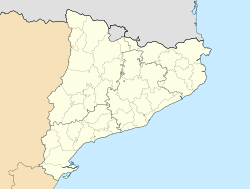
- Corbera d'Ebre
-
Corbera d'Ebre — Municipality — 
Coat of armsLocation in Catalonia Coordinates: 41°40′43″N 0°28′36″E / 41.67861°N 0.47667°ECoordinates: 41°40′43″N 0°28′36″E / 41.67861°N 0.47667°E Country  Spain
SpainCommunity  Catalonia
Province Tarragona Comarca Terra Alta Area - Total 53.1 km2 (20.5 sq mi) Elevation 337 m (1,106 ft) Population (2007) - Total 1,174 - Density 22.1/km2 (57.3/sq mi) Time zone CET (UTC+1) - Summer (DST) CEST (UTC+2) Corbera d'Ebre is a municipality in the comarca of la Terra Alta in Catalonia, Spain.
This town was thoroughly destroyed during the Battle of the Ebro in the Spanish Civil War (1936 - 39).
The lower part of the town has been rebuilt but the higher part, including the old church on the hill, has been kept as a reminder, with marked paths in a circuit known as Centre d'interpretació de la batalla de l'Ebre.[1] There is also a museum with Civil War artifacts and memorabilia in Corbera.[2]
References
- Panareda Clopés, Josep Maria; Rios Calvet, Jaume; Rabella Vives, Josep Maria (1989). Guia de Catalunya, Barcelona:Caixa de Catalunya. ISBN 84-87135-01-3 (Spanish). ISBN 84-87135-02-1 (Catalan).
External links
- Pàgina web de l'Ajuntament
- Informació de la Generalitat de Catalunya
- Informació de l'Institut d'Estadística de Catalunya
- The Battle of the Ebro in one day
Municipalities of Terra Alta Arnes · Batea · Bot · Caseres · Corbera d'Ebre · La Fatarella · Gandesa · Horta de Sant Joan · El Pinell de Brai · La Pobla de Massaluca · Prat de Comte · Vilalba dels Arcs Categories:
- Municipalities in Catalonia
- Terra Alta
- Catalonia geography stubs
Wikimedia Foundation. 2010.


