- Community Displacement in Philadelphia
-
Contents
Neighborhoods
Mantua
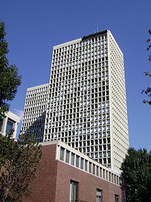
 Main Campus building Ross Commons
Mantua is a neighborhood located in West Philadelphia. It lies north of Hamilton Street and south of Mantua Avenue, bounded to the west by 40th Street and to the east by 31st Street. Mantua was originally an independent town, outside of Philadelphia city limits. The land was inherited by Judge William Peters, who planned it as a small development and marketed it as a settlement in 1809. In the late 1800s, Mantua became a predominantly white, working class neighborhood. In the 1940s, however, “white flight” occurred due to many factors including redlining, deindustrialization, and suburbanization. As in many other areas of Philadelphia, "white flight" resulted in Mantua becoming a primarily African American neighborhood.
Drexel University, which constructed its main building on 32nd and Chestnut Streets in 1889, has been the major institutional influence in Mantua for over a century. From 1910 to 1990, Drexel added many new buildings inside of Mantua. Many of these buildings were constructed on newly redeveloped lots, previously owned by residents of Mantua. When Drexel University released its 1970 Development Plan, residents of Powelton Village, a neighboring community, objected to the expansion, but to no avail. The purpose of the 1970 Development Plan was to "designate the additional amount of land" needed by Drexel University to support the expanding University's population and facility needs. Since the University of Pennsylvania owned most of the land to the west and the south, Drexel had to expand north into Mantua. The expansion of both Drexel and the University of Pennsylvania has made the relatively inexpensive land inside of Mantua's boundaries very desirable. Today, much of the land continues to be redeveloped to accommodate the Drexel's needs, and recently many students have begun living in Mantua.
Currently, Mantua consists of low income residents (44% below poverty line), and 94% of the population is African American. Impoving Mantua has become a priority for city leaders, as the neighborhood has been plagued with violence and many blighted properties. In 2008, the Mantua Tower, a public housing project, was demolished. The Tower will be replaced with low density public housing. City officials view blight removal, beautification, and economic advancement as essential to future of Mantua
Chinatown
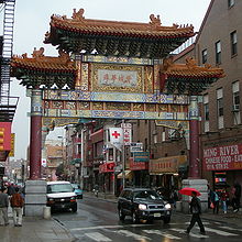 The Chinatown Friendship Gate
The Chinatown neighborhood extends from 9th to 12th Streets and stretches south from Vine to Arch Streets in Center City. Philadelphia's Chinatown began in 1846 when a Chinese-owned laundry business was opened at 913 Race Street; a Chinese restaurant opened the same year. The area soon became home to many Asian immigrants. In the 1920s, the population was about 1,600, but as the 1960s and 70’s approached, Chinatown lost about 26% of its housing and the population went down to around 400 people. From the 1960s through the 1980s, parts of Chinatown were destroyed for Independence Mall, the Vine Street Expressway and the Pennsylvania Convention Center. The Friendship Gate, completed in the winter of 1984, was the first authentic Chinese gate created by artists from China. Today, Chinatown does not only house Chinese, but also Filipinos, Japanese, Asian Indians, Koreans, Vietnamese, Cambodians, Hmong, Laotians, Thais and people of other races.
Chinatown has encountered many brushes with community displacement and has fought it off many times with mixed results. In 1992, there was a proposal for a federal prison to be built at 8th and Callowhill Streets in Chinatown. After two years of the Chinatown community fighting it, the plan was thrown out. In the mid- 1960s, the Pennsylvania Department of Transportation (PennDOT) announced plans to build the Vine Street Expressway. In 1973 PennDOT included the demolition of a building on 10th and Vine Streets and Holy Redeemer Catholic Church. When the demolition crew arrived, they found Chinese youth protesting on the demolition machines. They managed to slow the construction of the Vine Street Expressway, but in the end it was still built. The Gallery shopping mall and the Pennsylvania Convention Center are other completed projects that limit the expansion of Chinatown and which proceeded in spite of community objection. In 2000, there was a proposal to build a baseball stadium in Chinatown. Many of the people in Chinatown felt that the construction of the stadium would negatively impact the community by adding congestion and obnoxious fans, and they felt it would not bring anything positive to the community. Chinatown organizations united to stop the construction of the stadium. There were also plans to open a casino at the Gallery on 8th and Market Streets. Many Philadelphians thought that it would help the city, but the Chinatown community successfully opposed it; the casino will instead be built on the Delaware River waterfront.
East Falls
East Falls is a neighborhood bounded by Roxborough, Manayunk, Germantown, and Fairmount Park. It was previously a mill town but is now a mix of working and middle-class families. It has academic history as well and is home to the William Penn Charter School, Philadelphia University (founded in 1884 as Philadelphia Textile School and later known as Philadelphia College of Textiles and Science) and the former site of the Medical College of Pennsylvania.
Despite its static nature, there are instances of community transformation in East Falls. Median house prices are rising, going from $70,000 in 1995 to $202,000 in 2002. East Falls has been viewed as undergoing gentrification, as it’s increasingly inhabited by young professionals. Upscale stores such as a glass blowing shop and The Doggy Boutique, have only added to fears that East Falls will soon cater only to the rich. Change has also come about as a result of the razing of Schuylkill Falls, a high rise public housing facility in an area roughly bounded by the R6 tracks, School House Lane, and Ridge Avenue. The new Hilltop at Falls Ridge public housing contains 304 mixed-income housing units, and is part of a growing development on Ridge Avenue.
A planned community transformation was thwarted, however, when developers proposed locating a casino in the former Budd and Tastykake factory area (2). This plan fell through because of community protests. Proponents of the proposed casino claimed that it would bring more business to East Falls, while the East Falls Community Council argued that crime would increase. In the end, the community won the battle, a testament to the strong character of the neighborhood.
Additionally, Philadelphia University has tried to expand into the East Falls region. The East Falls Community Council worked with the president of the university to find a way to have the expansion benefit both the college and the community which resulted in several compromises. According to Jennifer Greenfield, the first vice president of the East Falls Community Council, “The university wanted to expand outwards, but now we convinced them to expand upward.” Efforts such as this to maintain the integrity of the neighborhood are evidence that despite evident gentrification and other changes, East Falls will remain the working and middle-class neighborhood that it is today.
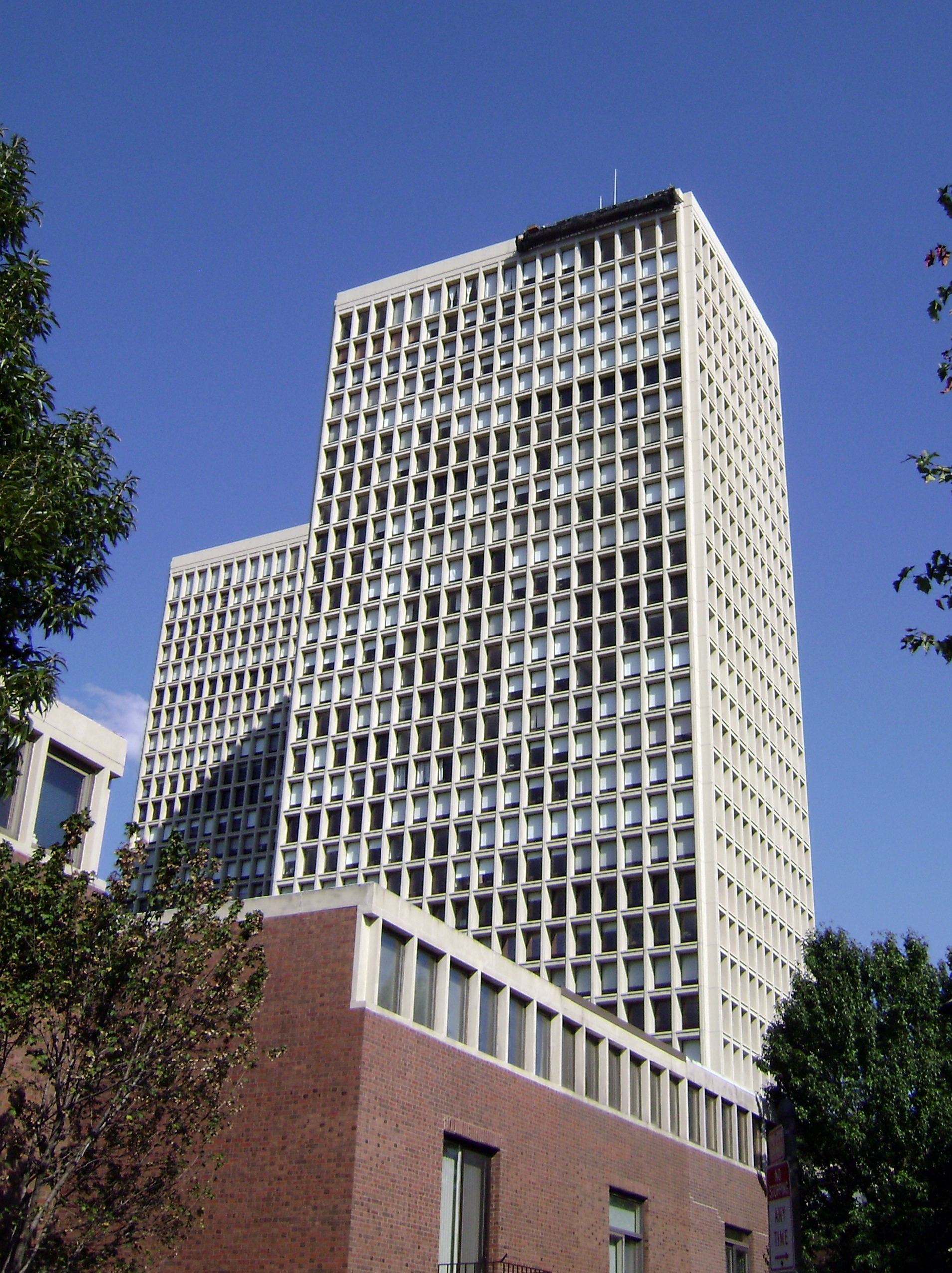
Society Hill
 Society Hill Towers, 210 Locust St
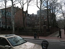 National Historic Landmarks are near Society Hill, Philadelphia
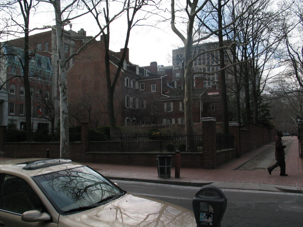
Society Hill began as an affluent neighborhood in Southeast Philadelphia close to the Delaware River and civic buildings like Independence Hall. The name originates from The Free Society of Traders, a London based development company that was granted land from William Penn. It is bordered by Front, Lombard, 8th and Walnut Streets. In the 19th century, the area lost appeal as the city's main commercial district moved west and the affluent residents moved closer to Center City or to areas like Chestnut Hill and the Main Line. The neighborhood then became an African American community centered around the Mother Bethel Church at 6th and Lombard. W.E.B. Du Bois studied the neighborhood in the late 19th and early 20th centuries as an employee of the University of Pennsylvania. In his groundbreaking work of urban sociology, The Philadelphia Negro, DuBois documented the awful conditions of the neighborhood: "We lived there for a year, in the midst of an atmosphere of dirt, drunkenness, poverty, and crime. Murder sat at our doorsteps, police were our government..." W.E.B. DuBois studied the 7th Ward, which only includes roughly two blocks of what is today known as Society Hill.[1] Also, US Census data shows that Society Hill in 1940 (census tract 10) was a racially mixed area and quite consistent with the rest of Philadelphia. The houses deteriorated until the 1950s.
In 1948, Edmund Bacon, head of the Philadelphia City Planning Commission, created plans to “redevelop” Society Hill. In 1956, the Old Philadelphia Development Corporation joined the Philadelphia Redevelopment Authority (RDA) in the effort. In the 1950s, the RDA acquired 31 acres (130,000 m2) of land in the Dock Street area by declaring it "blighted". They designed standards of restoration for historic property. In 1960, owners were forced to renovate their houses or their property would be declared blighted and the RDA would use eminent domain to obtain the property. Residents of these “blighted” homes were often forced out, for a variety of reasons. Some residents could not pay for the renovation of their houses, others were renters, and their landlords would not pay. In either case, the RDA, through blight declaration, bought out many African American residents and sold the houses to people who agreed to restore the exteriors, virtually all of whom were white.
High-rise towers designed by I.M. Pei were built in 1962 on the periphery of the neighborhood. The purpose of the Society Hill Towers was to attract a substantial number of affluent residents to the area and to encourage others to move into Society Hill to renovate old houses or construct new ones. As redevelopment continued, the neighborhood became more desirable and demand for real estate ballooned. The increase in demand led the RDA to acquire 58 more acres of land for revitalization.
Currently, the area known as Society Hill is home to a plurality of young, white, affluent singles. Those living in the area take pride in the colonial heritage of the neighborhood which has been meticulously documented. The 19th and early to mid-20th century history of the neighborhood has largely been forgotten. It is an attractive neighborhood for its historic housing stock as well as its proximity to the Center City commercial district and to Old City shops and restaurants.
Riverfront
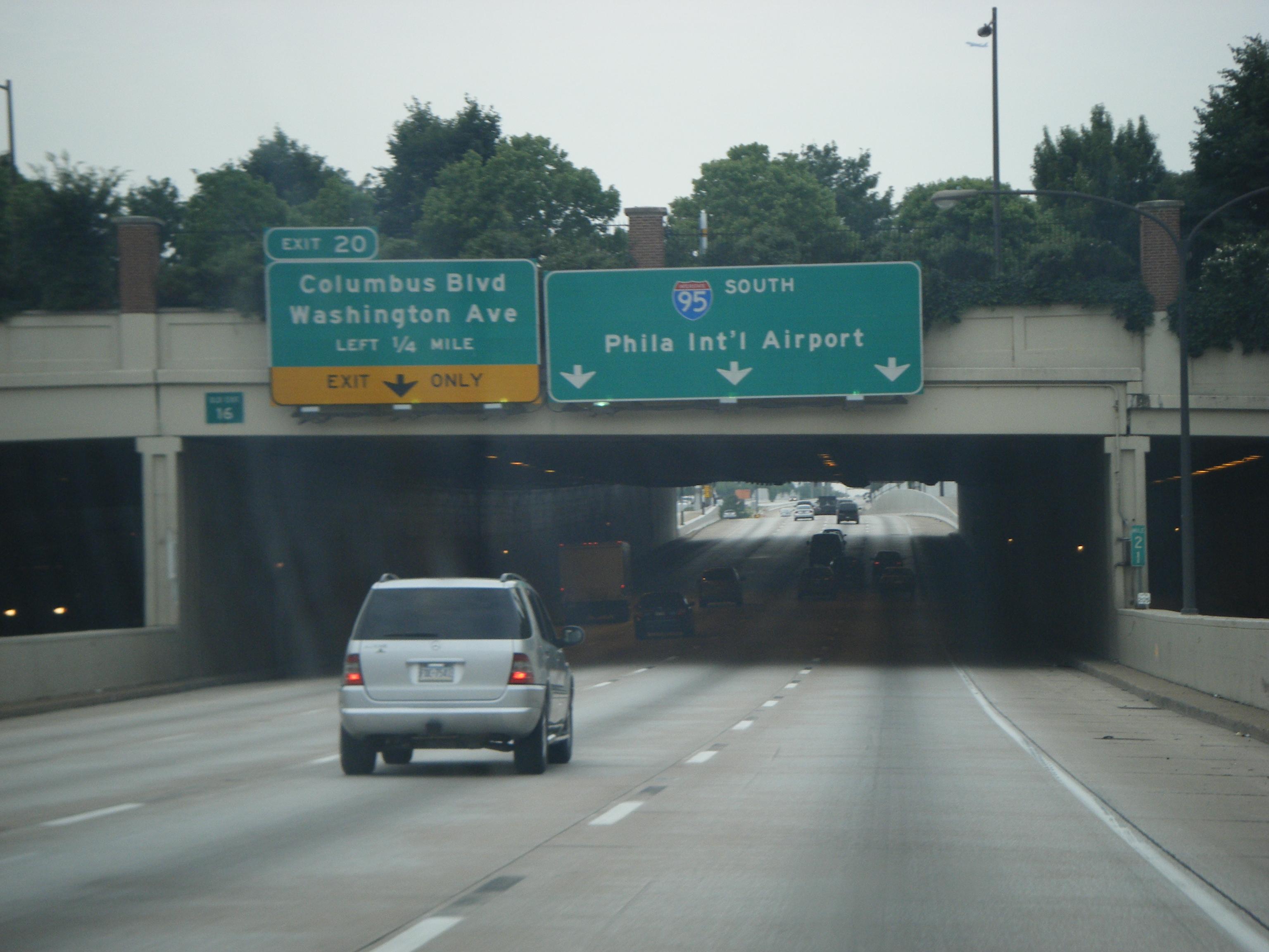
 A view of I-95 south of Walnut Street, looking towards one of the cover decks with a small park on top.
In the 1960s, Interstate 95 was being constructed in various sections of Pennsylvania. The first part to open in Philadelphia was in Northeast Philadelphia. Work continued, moving southward from the Northeast. There was much controversy, however, over the central portion of the highway, through Center City and its adjacent riverfront neighborhoods. A 1959 plan called for an eight-lane elevated highway along the Delaware River waterfront, with the demolition of blighted buildings in the name of "urban renewal" an intentional part of the plan. Numerous citizens, city officials, and architects raised objections to the plan. The design was changed to put the highway below ground level, open to the air above. One proposal involved covering the highway from Pine Street to Arch Street, but this was later reduced in the final design to two smaller cover decks, with the rest still open to the air above. The downtown portion of the highway was constructed, and eventually opened in 1979.
In the neighborhood of Queen Village, the construction of the highway involved the destruction of hundreds of homes and businesses, including over 300 houses built in the 18th century, and the displacement of their respective residents and owners. It also created a major barrier between residential neighborhoods and the Delaware River.
Queen Village resident Marty Labb described the destruction in a publication by the Queen Village Neighborhood Association: “I-95 almost destroyed the neighborhood because it took an awful lot of homes away. There were a lot of homes on the east side of Front Street, between Washington Avenue and Christian and Queen Street, and they went down because of the highway. ... Someone called me up. They said, 'They’re taking your house. They’re gonna rip it down because they’re putting a highway in there.' That went by the wayside, but that was one of the original plans...."
In the neighborhood of Fishtown, too, the construction of I-95 involved the bulldozing of many blocks of homes near the waterfront.
In the present day, many of the neighborhoods along the waterfront are stable and successful. Despite this, though, the homes that were destroyed were lost forever. Also, the highway continues to separate the city from the waterfront, and is a blighting influence on the streets directly beneath or adjacent to it.
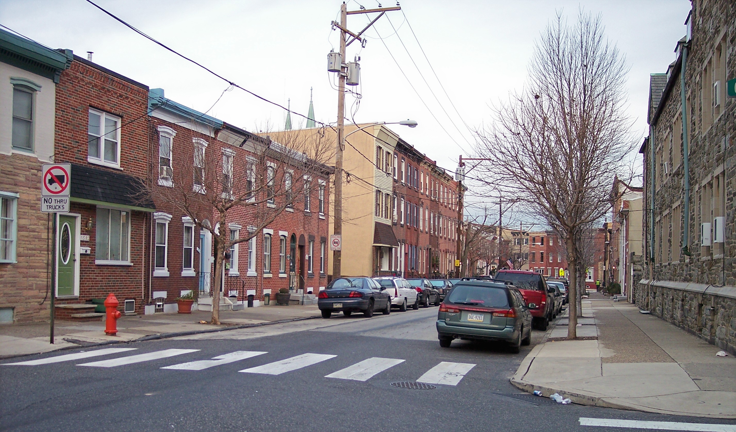
Fishtown
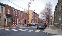 Berks Street in Fishtown
Fishtown, also known as Lower Kensington, is part of Philadelphia’s Kensington section. Local folklore says that Charles Dickens gave Fishtown its name, but this has been dispelled as a myth because there is no record of Charles Dickens ever visiting the area. The name comes from the large amount of sea-faring businesses that were present in the area during the 18th and 19th centuries: shipbuilding factories, fisheries, and ice houses.
Fishtown is located on the Delaware River. To the southwest of Fishtown are Old City, Center City, and Northern Liberties; to the west, there is Poplar and Yorktown, and to the North is Kensington. In the past, the neighborhood was made up mainly of working class families—traditionally German, Polish, and Irish. Since the neighborhood is in such close proximity to other high income gentrified neighborhoods of the city – Northern Liberties and Old City – the hipster culture has recently spread into the surrounding area of Fishtown. Artists, musicians, and young professionals have been drawn to the area, and they are rapidly buying up properties. Due to the large population of older people, many homes that had been passed down from generation to generation are being sold by the children as the parents die off. The nightlife and art scene, resulting from the growing population of "hipsters", creates a new and young atmosphere in the neighborhood. This change in the make-up and character of the neighborhood attracts more people of the same relatively young and affluent demographic, thus reinforcing the process of gentrification.
Due to the widespread availability of housing and the high rate of home ownership, there have not been many people displaced by the gentrification of Fishtown. In the past eight years, however, the housing values have more than doubled. There have been some tensions and conflicts between the locals and the new, young residents, but many long-time inhabitants seem to welcome influx of high-income people who bring better resources and culture. As one Fishtown resident said: “If I had to choose between folks who frequent a crack house and those who can afford a Starbucks on a regular basis, I'm not sure who I'd pick”4 . The Rocket Cat Café, on the corner of Frankford Ave and Norris St, is one example of the new “hipster” vibe present in the neighborhood.
Fairmount
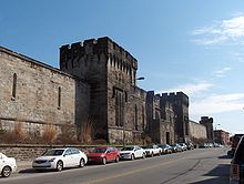 The Eastern State Penitentiary
Fairmount is a neighborhood in Philadelphia located north of Center City and south of Girard Avenue. The neighborhood extends from the Schuylkill River to 20th Street. The area was first settled in the 17th and 18th centuries by farmers from varied parts of Europe. It was a popular a spot for prominent families to put their summer homes and is also the location of several significant sites. In 1829, the Eastern State Penitentiary was opened. It was the first prison that focused on reform rather than punishment. In 1831 Girard College was built. It was founded by Stephen Girard, the wealthiest man in America at the time, for white, orphaned boys. In 1839 St. Francis Church was built, but during the anti-Catholic/Irish riots of 1844 the church was closed. Then, in 1852 the Fairmount Dam and Waterworks was built. During the 19th century, Irish and German immigrants made up most of the neighborhood's population. In the early 20th century Polish and Ukrainian immigrants also began coming to Fairmount.
The Fairmount neighborhood changed dramatically after the 1940s and 1950s. The Girard Avenue shopping area was destroyed by riots in the early 1960s, and it’s never been built up again. Also, the residents of Fairmount experienced the hardships of deindustrialization; factories closed and poverty and crime increased. The demographics of the area changed as many white residents moved to suburban areas, and parts of the neighborhood became predominantly African-American or Hispanic. The addition of upscale town homes in the 1980s and 1990s caused displacement of longtime residents as people, in particular the younger generations, moved away from Fairmount when they could no longer afford to live there. The real estate boom began to draw many affluent white people back from the suburbs to neighborhoods like Fairmount. Members of the community have worked diligently to preserve and improve their surroundings. The neighborhood remains largely white, but it continues to become gentrified. Younger professional families, students, and singles are moving in. The attraction for most is its proximity to Center City, Fairmount Park, and the Philadelphia Museum of Art.
South Street West
South Street West, located in the southwest corner of Center City and also known as the Graduate Hospital area, was planned by William Penn to be the southernmost border of Philadelphia. From the time that settlement in the area began around 1600, it was primarily an immigrant neighborhood and eventually became a thriving African American commercial and entertainment district. In 1947, the Philadelphia City Planning Commission proposed the Crosstown Expressway, a multi-lane highway across the city along the blocks between South Street and Lombard Street. This project would have effectively separated the different “land usages” to the north and south, which would have been, in essence, separating racial groups. The project would have also uprooted several thousands of people from homes they had owned for years, if not generations.
Fearing that their homes would be confiscated through use of eminent domain, many residents sold their homes and left the area, while others stayed to fight back. The Citizens’ Committee to Preserve and Develop the Crosstown Community (CCPDCC), was formed in opposition to the expressway and was composed mostly of white residents from the Society Hill and Rittenhouse Square areas, as well as the black residents along the path of the planned expressway. As a result of this opposition, the plans for the expressway ultimately fell through, leaving the area full of abandoned property.
With the neighborhood weakened and vulnerable, Graduate Hospital, an established hospital on the edge of the neighborhood, took advantage of the cheap, abandoned property and expanded through a process of buying properties and letting them deteriorate to bring other property values down. As people moved out of the declining neighborhood, Graduate Hospital bought more of the abandoned property until it could build a new hospital building. The hospital provided necessary services, however, they did not confine their expansion to sections of the neighborhood approved during negotiations with the community. Several community organizations banded together and, though there was some displacement, residents and local merchants were able to maintain their neighborhood. Recently, due to the spread of the upscale businesses and residences of Center City toward western South Street, property values have risen, and there has been further displacement of lower income, mostly minority, inhabitants. The former Graduate Hospital is now Penn Medicine at Rittenhouse[disambiguation needed
 ], a rehabilitation and acute-care facility owned owned by University of Pennsylvania Health System.
University City
Displacement in University City has mainly been caused by the expansion of local institutions, most prominently the University of Pennsylvania. After moving to West Philadelphia 1872, Penn was faced with a massive influx of students after World War II as a result of the GI Bill. The university's first significant expansion into the community was done with the aid of the federal slum clearance program. Areas around the university were designated as blighted, and the use of eminent domain cleared the way for developing the land.
Around this time, the Housing Act of 1949 allowed Penn to rebuild West Philadelphia, with the help of federal aid. Families were forced to leave their homes, in the name of urban renewal. An exact number of the people displaced isn't known, but figures range from 5,000 – 10,000. Soon after that, the West Philadelphia Corporation, consisting of Penn, Drexel University, Philadelphia College of Pharmacy and Science, Presbyterian Hospital, and the College of Osteopathy worked together to build the University City Science Center. An earlier Housing Act would give the institutions generous grants to building academic centers, and soon enough, West Philadelphia became Urban Renewal Areas 3, 4, and 5. Area 3 consisted mainly of the Black Bottom neighborhood, and while described by newspapers as "20 devastated acres of rundown bars and garages and warehouses," it was still home to hundreds of families who soon found themselves without a home.
In more recent years, Penn has attempted to bring their professors closer to the university, and back into the city. As part of Penn's effort to have the university integrated into West Philadelphia, Penn has sponsored a program to make their professors residents of nearby neighborhoods. The university has instituted the Home Ownership Incentive Program that provides $3,000 per year for seven years or $15,000 up front for housing expenses to employees who purchase homes in University City. The only restriction is that the employees must live in the house for seven years. The employees who already own a home in the designated area get up to $7,500 in matching funds toward exterior home improvements. This has been in effect since 1965, when it created the Guaranteed Mortgage Program, which offers an option to finance 120 percent of the cost for a property needing rehabilitation.
As another incentive, the university helped to build Penn Alexander Elementary School, a state-of-the-art K-8 school designed to make the neighborhood even more attractive to professors and other affluent residents. However, the school only accepts students who live within a certain radius, and alienates many of the poorer residents in University City. However, this wasn't the only school Penn had a hand in building. In 1963, University City High School was planned as a magnet feeder school for the universities in the area. Residents in the community fought against it, not believing that their children would be allowed in. After countless battles, the school was built, and is now predominantly African American and is afflicted with the problems typical of an inner-city high school.
The University of Pennsylvania, with the help of the government, has been able to exert its power under the pretense of eminent domain and urban renewal. The stated intentions of their programs are to collaborate with the community of West Philadelphia, and work towards the common goal of an attractive and safe neighborhood. The effect has yet to be seen, and many residents in the area dislike the "Penn Bubble" that continues to expand. The University of Pennsylvania has grown multiple times since their move to West Philadelphia, and many residents have been displaced as a result.
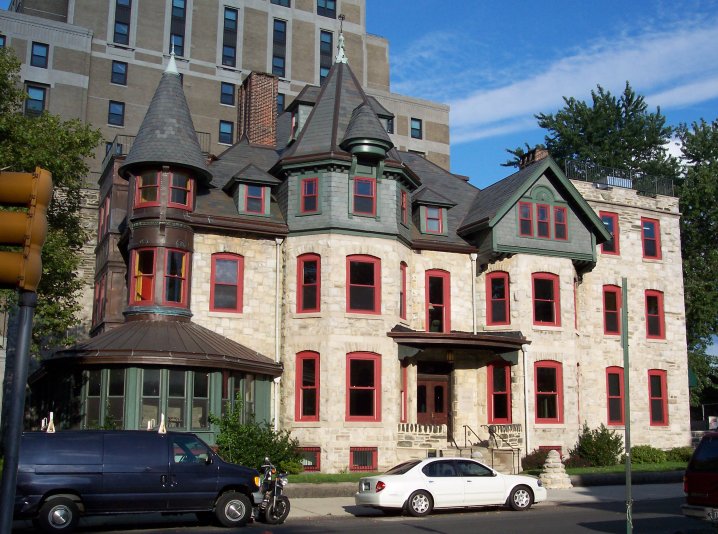
Hawthorne
 High School For The Creative & Performing Arts
Hawthorne is a neighborhood located between South Street and Washington Avenue and between Broad and 11th Streets in Philadelphia, PA. The area is home to the former Ridgeway Library, which is now CAPA (Philadelphia High School for Creative and Performing Arts).
One of the neighborhood’s most notable landmarks was the Martin Luther King Plaza, which included a complex of four low-income housing high-rise towers constructed in 1960. The MLK towers were located in the 700 block of South 13th Street and quickly became riddled with crime, physical deterioration, fragmented services, and increasing levels of poverty.
On October 17, 1999, the building was demolished and was replaced by a residential development with mixed income housing funded through HOPE VI, an initiative of the Department of Housing and Urban Development (HUD). The construction of the new homes was completed in the end of 2004. This new housing became an integral part of the neighborhood; it wasn't a separate entity as the MLK towers had been. The development is equipped with a park and recreation center, as well as support services to help residents get and keep jobs. The neighborhood also has mixed raced committees organized to keep the area clean and make it more welcoming and beneficial to the community’s users.
Despite the positive results of the initiative’s efforts, it ultimately led to significant community displacement. The former residents of the MLK towers were dispersed during the construction. In addition, the amount of residential space was reduced after the redevelopment, and the vast majority of former residents could not afford to move into and sustain a living in the new MLK complex. This has ultimately changed the demographic of the neighborhood; prior to the government intervention and development provided by Hope VI, the neighborhood was predominantly African American, however, since federal intervention the community is 67% White, 12% Black, 15% Asian, and 6% Latino.
9th and Ellsworth
9th and Ellsworth was universally considered a blighted area in 2000 and was officially declared as such in a survey by the City Planning Commission. Recently, however, Mexican and Chinese immigrants have been moving in, opening businesses, and renovating the housing stock (126 percent increase in Asians from 1990 to 2000) . Following this revival of the area, the only part of the neighborhood still in a state of deterioration was the Ice House, a building abandoned by owner Jerald Goldfine who paid taxes to resist condemnation. The Ice House was a paradox: it increased in value as the area improved, but it was also the only structure keeping the area from reaching its true potential. In response, in 2007 Councilman Frank DiCicco proposed a redevelopment bill. However, the surrounding areas were included in the redevelopment bill as well, meaning that the immigrant businesses responsible for the upswing could potentially be seized by eminent domain at any time. There was huge public outcry, but the bill was passed anyway, even without the community’s support. So far only the Ice House has been seized, and there are plans to build a two 31 story building in its place. At this point, no residents have been displaced.
See also
Notes
References
- "Delaware Expressway Historic Overview". http://www.phillyroads.com/roads/delaware/. Retrieved December 29, 2009.
- "Community Displacement". http://blackbottom.org/communities/south-street-west/community-displacement/. Retrieved December 17, 2009.
- "Philadelphia Area Roads, Crossings and Exits". http://www.phillyroads.com/roads/crosstown/. Retrieved December 17, 2009.
- "Mapping the DuBois Philadelphia Negro". http://www.haverford.edu/HHC/files/internships/PennDesign_2009.pdf. Retrieved December 18, 2009.
- "Fishtown/Lower Kensington." The Hammersmith Group. Web. Dec. 14, 2009.
- Stover, Chris. "MURL: A look at Fishtown gentrification." Web. Dec. 14, 2009.
- "A Guide to Fishtown". http://www.acontinuouslean.com/2009/02/18/a-guide-to-fishtown-philadelphia-usa/. Retrieved December 14, 2009.
- "Gentrification". http://fishtown.us/node/438. Retrieved December 14, 2009.
- "Philadelphia Neighborhood Base". http://cml.upenn.edu/nbase. Retrieved December 18, 2009.
- "Casino-Free Philadelphia". http://www.casinofreephila.org/. Retrieved December 18, 2009.
- "The Philadelphia Inquirer". http://inquirer.philly.com/graphics/slots_nov14.html. Retrieved December 18, 2009.
- "School for at-risk students has East Falls grumbling". http://www.philly.com/dailynews/local/20090714_School_for_at-risk_students_has_East_Falls_grumbling.html. Retrieved December 18, 2009.[dead link]
- "The Slots Hearings". http://changingskyline.blogspot.com/2006/04/slots-hearings.html. Retrieved December 18, 2009.
- "Philadelphia Housing Authority Pressrooms". http://www.pha.phila.gov/press/index.asp?id=48. Retrieved January 8, 2010.
- "Chinatown". http://www.ushistory.org/tour/tour_china.htm. Retrieved December 20, 2009.
- "Blackbottom". http://www.blackbottom.org. Retrieved December 20, 2009.
- "Chinatown Philadelphia". http://www.wikipedia.org/Chinatown_Philadelphia. Retrieved December 20, 2009.[dead link]
- "Chinatown". http://philadlephia.about.com/od/neighborhood/p/chinatown.htm. Retrieved December 20, 2009.
- "Walk the Town". http://Walkthetown.com/page27/page32/page32.html. Retrieved December 20, 2009.
- "Society Hill History". http://www.societyhillcivic.com/aboutSH/history.asp. Retrieved December 21, 2009.
- "Society Hill Community Displacement". http://blackbottom.org/communities/society-hill/community-displacement. Retrieved 2009=12–19.
- "MLK Towers". http://www.implosionworld.com/MLK.htm. Retrieved January 8, 2010.
- "MLKPLaza". http://www.mlkplaza.org. Retrieved January 8, 2010.
- "Mantua Data". http://www.city-data.com/neighborhood/Mantua-Philadelphia-PA.html. Retrieved 200-12-20.
- "Mantua Information". http://westphillydata.library.upenn.edu/infoR_Neigh_Mantua.htm. Retrieved December 20, 2009.
- "Mantua Community Displacement". http://blackbottom.org/communities/mantua/community-displacement/. Retrieved December 20, 2009.
- "Mantua Archives". http://blackbottom.org/communities/mantua/archives/. Retrieved December 20, 2009.
- "Mantua". http://uchs.net/Rosenthal/mantua.html. Retrieved December 20, 2009.
- "Penn Offers Cash Incentive to Increase Home ownership in University City". http://www.upenn.edu/pennnews/article.php?id=520. Retrieved December 17, 2009.
- Pothier. The Philadelphia Inquirer. 1978. Jan 16, 2010
Categories:- Geography of Philadelphia, Pennsylvania


Wikimedia Foundation. 2010.