Comb Wash

Comb Wash

Coordinates: 37°19′55″N 109°39′47″W / 37.332°N 109.663°W / 37.332; -109.663

Location of Comb Wash within Utah

Comb Wash is a valley in southeastern Utah, in San Juan County. It runs from Elk Ridge in the north approximately 35 miles (56 km) to the south, where it merges with the San Juan River at an elevation of about 4200 feet (1280 m). The eastern edge of the wash forms steep cliffs of Navajo Sandstone, rising in places to 1000 feet (300 m) above the valley floor.

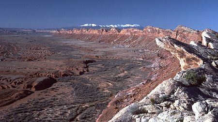
Comb Wash, looking north

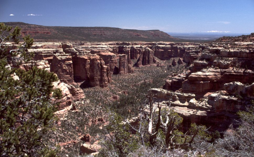
On the western edge of Comb Wash is a series of canyons draining Cedar Mesa. To the north is Arch Canyon, which has Texas Canyon as an upper tributary. In the central section are Mule Canyon, Dry Wash, and the combined outlet of Fish and Owl Canyons. To the south are McCloyd's Canyon (containing the Moon House ruin) and Road Canyon. Scattered throughout these canyons are cliff dwellings of the Ancestral Puebloans.

State Route 95 crosses the northern part of Comb Wash, while U.S. Route 163 crosses further south. Running along the wash is a primitive road, often impassable after floods. Nearby are the Natural Bridges National Monument, the Grand Gulch Primitive Area, the Valley of the Gods scenic area, and Goosenecks State Park.

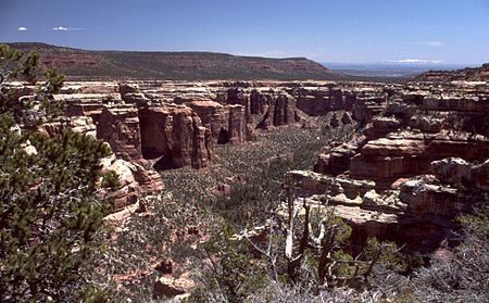
Texas Canyon, looking southeast
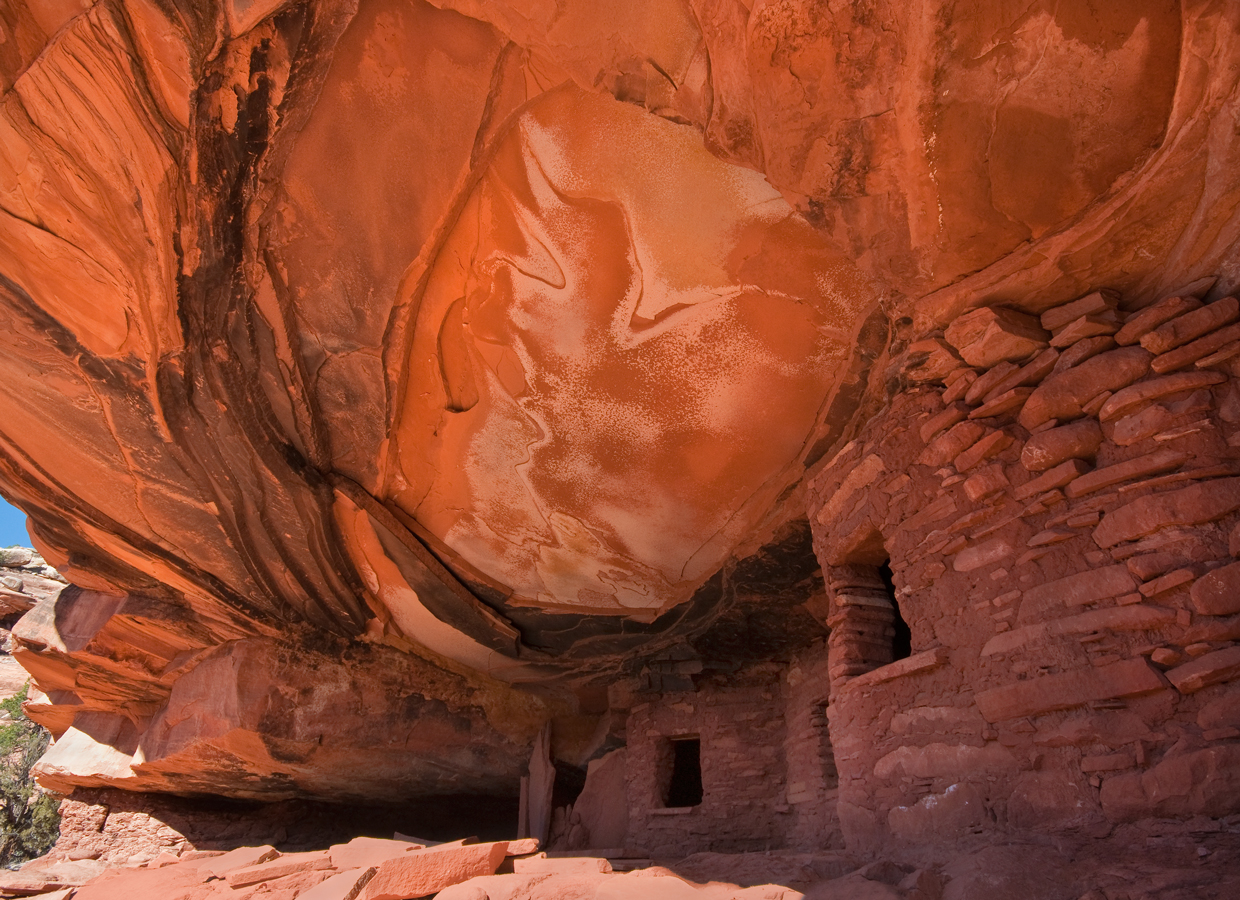
Fallen Roof Ruin in Road Canyon

See Also

  • Posey War

External links


Wikimedia Foundation. 2010.

Игры ⚽ Нужна курсовая?

Look at other dictionaries:

  • Comb Wash, Utah — Comb Wash is a valley in southeastern Utah, in San Juan County. It runs from Elk Ridge in the north approximately 35 miles (56 km) to the south, where it merges with the San Juan River at an elevation of about 4200 feet (1280 m). The eastern edge …   Wikipedia

  • Comb Ridge — from the air, above Bluff Utah and the San Juan River. Photo by Doc Searls. Comb Ridge is a linear north to south trending monocline nearly 120 miles long in southeast Utah and Arizona. Composed of Jurassic age Navajo Sandstone, it displays… …   Wikipedia

  • Cedar Mesa, Utah — Cedar Mesa is a plateau in San Juan County in the southeastern portion of the U.S. state of Utah. It extends from Elk Ridge in the north, Comb Wash to the east, the gorge of the San Juan River to the south, and Grand Gulch to the west, an area of …   Wikipedia

  • Hole-in-the-Rock-Trail — Der Hole in the Rock Trail ist eine rund 320 Kilometer lange historische Überlandverbindung im Süden Utahs. Inhaltsverzeichnis 1 Geschichte 2 Hole in the Rock Road 3 Referenzen 4 Weblinks …   Deutsch Wikipedia

  • Jesse Ray Ward — United States Marshals Service …   Wikipedia

  • San Juan County, Utah — Infobox U.S. County county = San Juan County state = Utah seal seallink map size = 150 founded year = 1880 seat wl = Monticello largest city wl = Blanding area total sq mi = 7933 area total km2 = 20547 area land sq mi = 7820 area land km2 = 20254 …   Wikipedia

  • San Juan Expedition — The San Juan Expedition (also known as the San Juan Mission or the Hole In The Rock Expedition) was a group of Mormon settlers intent on establishing a colony in what is now southeastern Utah, in the western United States. Their difficult passage …   Wikipedia

  • Eriogonum clavellatum Small — Symbol ERCL2 Common Name Comb Wash buckwheat Botanical Family Polygonaceae …   Scientific plant list

  • Eriogonum clavellatum — ID 32078 Symbol Key ERCL2 Common Name Comb Wash buckwheat Family Polygonaceae Category Dicot Division Magnoliophyta US Nativity Native to U.S. US/NA Plant Yes State Distribution CO, NM, UT Growth Habit Subshrub, Shrub, Forb/herb …   USDA Plant Characteristics

  • do — 1. verb 1) she does most of the manual work Syn: carry out, undertake, discharge, execute, perform, accomplish, achieve; bring about/off, engineer; informal pull off; formal effectuate 2) they can do as they please Syn: act …   Thesaurus of popular words

Share the article and excerpts

Direct link
Do a right-click on the link above
and select “Copy Link”