- St Olave's Church, Southwark
-
St Olave's Church, Southwark was a church in Southwark, England which is believed to be mentioned in the Domesday Book. It became redundant in 1926 and was demolished. It is now the location of St Olaf House, which houses part of the London Bridge Hospital.
Contents
Patron Saint
Olav Haraldsson, an early King of Norway, attempted to convert his people to Christianity and was martyred for his trouble in 1030. Before this, in 1014, he was a prince and an ‘ally’ (ie mercenary) of King Æthelræd II ‘the Unready’ fighting the Danes. They were occupying London Bridge. He is said to have tied his long-boats to the bridge supports and rowing away pulled it down.[1]
Domesday Book
Whatever the veracity of these exploits he became a popular saint in England. Five other churches in the City of London were dedicated to him. It is likely that it is St Olave’s which is the ‘church’ / ecclesiam mentioned in the Southwark Domesday entry and that it seemed to have royal patronage before the Conquest. The church’s probable beginning is as a Godwin private chapel. Godwin was ‘Earl of Wessex’ from at least 1018 and his Southwark interest was probably contemporary to this. He may well have known Olav personally from this period, so the dedication was quite apposite.
The Domesday entry for Southwark has the following three statements relating to Bishop Odo’s interests:
- Qui ecclesiam habebat de rege tenebat. ‘[He] who had the church held [it] from the king’. This statement is suspiciously vague as to who ‘had’ the church and just which ‘king’ is being referred to. The royal connection was probably that of Godwin’s eldest son who succeeded to his Earldom, Harold II, the last Anglo-Saxon king of England.
- Episcopus autem dedit aecclesiam & fluctum primum Adeloldo deinde Radulfo pro excambio unius domus. ‘The bishop gave the church & the tidal-stream at first to Adelold, then to Ralph in exchange for a house’. The ‘tidal stream’ is likely to have been the later ‘Watergate’ the small dock next to St Olave’s which was probably its endowment; this dock was progressively filled in from south-end to shore, effectively disappearing by 1747, although a ‘stairs’/ landing place survived well into the next century. However, there is no confirmation in Domesday that Odo had any legal interest in the church at all, for neither of the terms for ownership i.e. ‘has’/ habet or ‘holds’/ tenet are used.
- This gives special weight to the third statement: Vicecomes quoque negat se preceptum uel sigillum regis de hac re unquam percepisse. ‘The sheriff also denies that he had ever received the king’s precept or seal concerning this matter’. This confirms the ‘king’s’ interest in the church and calls into question Odo’s action.[2]
Bishop Odo, William the Conqueror’s half-brother who seems to have succeeded to the Godwin interest, had attempted to let out the church but he should have sought the king’s authority to do so. The earliest priests of the church were named Adelold (Athelwold) and then Ralph before 1086. The church is first mentioned by name in 1096 in relation to its priest ‘Peter de St Olavo’ being party to a land transaction involving Bermondsey Priory.[3]
Early Medieval Period
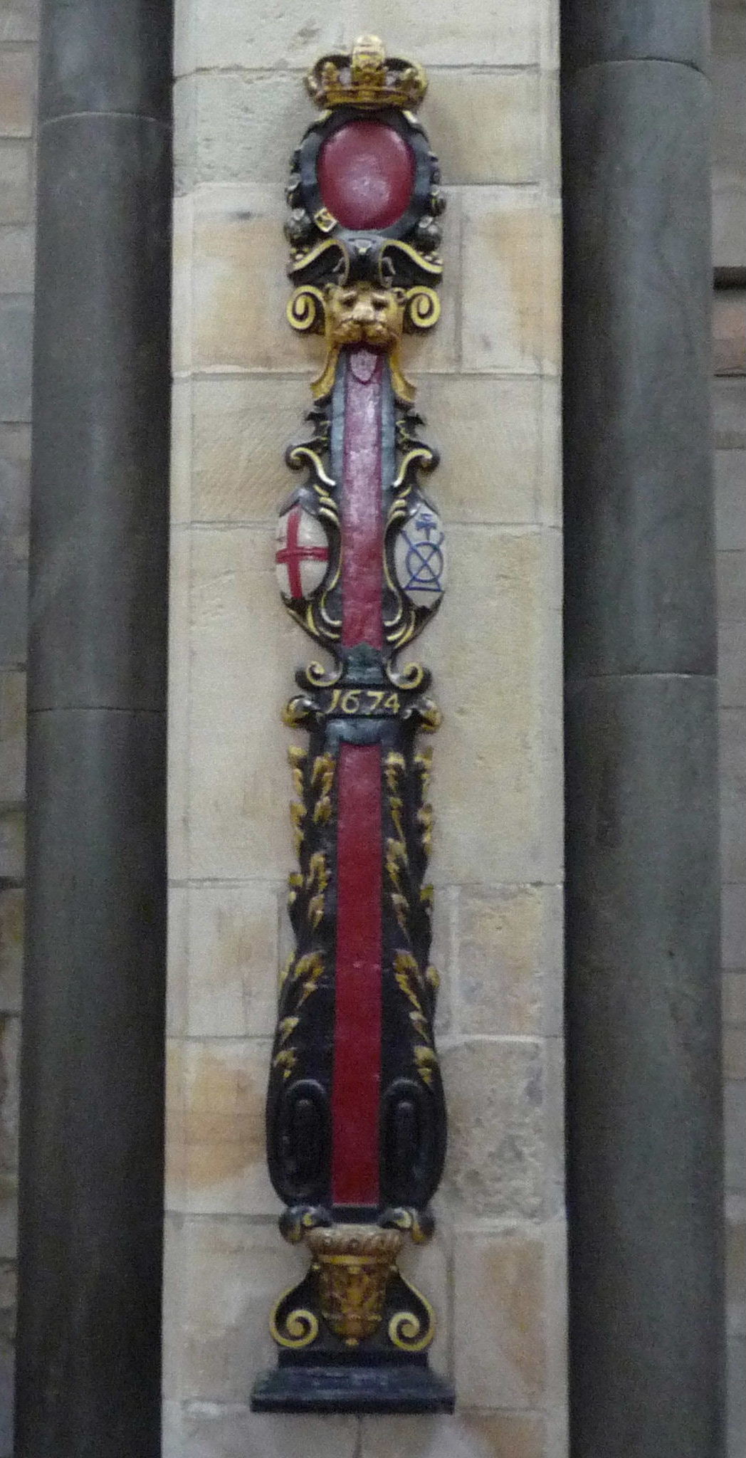
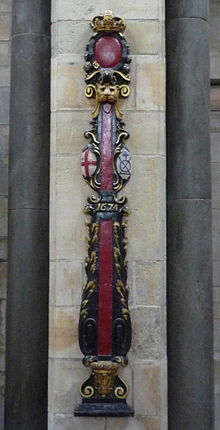 This sword rest formerly stood in the church. It bears the Bridge Mark (blue logo on right-hand side) of the Bridge House which was nearby
Sometime between 1090 and 1121 the Warennes (successors to Odo) had given the church and neighbouring property to Lewes Priory. Although situated next to the old London Bridge, its parish took in the north-east end of the High Street and stretched out along to the east and to the south was limited by Bermondsey parish.[4]
The Norman stone church, replacing the Saxon structure which may only have been of timber, was so close to the river, that when a terrible flood affected the Thames in 1327, it was reported that the tides had damaged the church walls and had washed away bodies from the churchyard.[5]
Stuart and Georgian Era
The Norman building partially collapsed through a combination of age, neglect and river subsidence in 1736. This was replaced, by 1740, with a structure designed by Henry Flitcroft which in turn was severely damaged in the major 1843 Tooley Street fire.[6]
Henry Gauntlett was the organist from 1827 - 1846.
Depopulation of Parish, Redundancy and Demolition of the Church
The church was restored. It was, therefore, very much a docklands church but as the industrial expansion of the area led to population decline so too did the parish. In 1926 the church was declared redundant and the nave was demolished, leaving a forlorn tower, removed in 1928.
The site became the head office of the Hay’s Wharf company. This Art Deco building still stands, called ‘St Olaf’s House’, on lower Tooley Street; it has an attractive and informative decoration on its façade about the church and its patron.
Legacy
The parish church was the originator of St Olave's Grammar School for boys (renamed St Olave's and St Saviour's Grammar School in 1896), and from 1902 its foundation fund also applied to St Saviour's and St Olave's Church of England School for girls. A separate St Olave's Foundation Fund still supports local youth's educational and vocational aspirations through grants.
The St Olave's United Charities parochial foundation, based in nearby Druid Street, is one of the best endowed of the Southwark parish charities providing for local poor and elderly. The endowment was supplemented until the mid-1990s by a 'parish rate' over the area.[7]
References
- ^ Snorri Sturlusson 'Heimskringla Saga'
- ^ Southwark in Domesday: a Reconstruction Tony Sharp, Guildable Manor 2003
- ^ Mediaeval Southwark pp20 - 25 Martha Carlin, Hambledon Press 1998
- ^ Carlin op cit
- ^ Annales Bermundsei
- ^ St Olave's, Southwark, LCC Church History Series
- ^ St Olave's United Charities Reports to the Charity Commissioners
Categories:- Churches in Southwark
Wikimedia Foundation. 2010.