- Church of St Mary, Nempnett Thrubwell
-
Church of St Mary 
Location: Nempnett Thrubwell, Somerset, England Coordinates: 51°20′27″N 2°40′20″W / 51.34083°N 2.67222°WCoordinates: 51°20′27″N 2°40′20″W / 51.34083°N 2.67222°W Listed Building – Grade II* Designated: 21 September 1960[1] Reference #: 32985 
 Location of Church of St Mary in Somerset
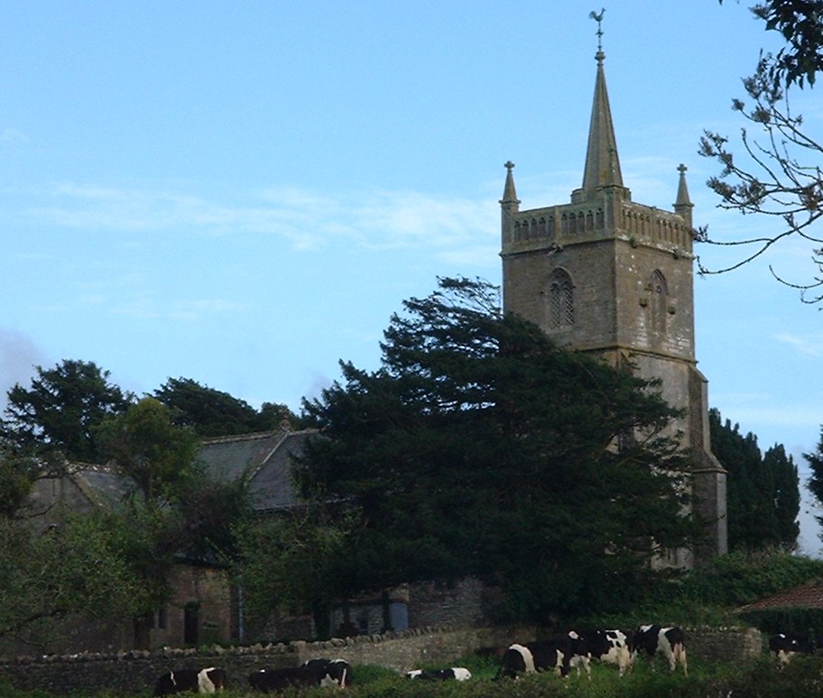
The Anglican Church of St Mary stands on Knap Hill in Nempnett Thrubwell, Somerset, England dates from the 15th century, but was built on the site of an earlier Norman church.[2] It is a Grade II* listed building,[1]
Before the dissolution of the monasteries the parish belonged to Flaxley Abbey in Gloucestershire. In 1537 the land and manor were granted to Sir William Kingston.[2] The parish register lists christenings, marriages and burials from 1568.
The three stage tower, which contains five bells, has set back buttresses and two arch bell openings with tracery. The tower is crowned by a parapet with blank arcading, and square pinnacles, it also has a slightly higher stair turret. The nave was restored at a cost of £700 in 1864.[2] The late Victorian chancel of 1897 is in the decorated style. Inside the church is a screen attributed to Pugin, although Nikolaus Pevsner is of the opinion the architect is probably Pugin the younger.[3]
The base of a 15th century cross in the churchyard is listed Grade II.[4]
Wade and Wade in their 1929 book "Somerset" described it as "a small building with a Perp. W. tower, from the W. face of which project two curious and uncanny carved heads of a man and beast. The walls of the nave still bear the original 13th cent. consecration crosses. The chancel is modern, and contains a rich modern screen and a good E. window of Munich glass. Note (1) rude Norm. S. doorway filled with Perp. tracery; (2) Norm. font carved with a curious device by some later craftsman. Near the porch in the churchyard is (1) base of ancient cross; (2) tomb of first rector — Robert — bearing an incised cross".[5]
References
- ^ a b "Church of St. Mary". Listed Buildings Online. http://www.heritagegateway.org.uk/Gateway/Results_Single.aspx?uid=32985&resourceID=5. Retrieved 4 December 2010.
- ^ a b c Robinson, W.J. (1915). West Country Churches. Bristol: Bristol Times and Mirror Ltd. pp. 77–81.
- ^ Pevsner, Nikolaus (1958). The Buildings of England : North Somerset and Bristol. Penguin Books. ISBN 0-14-071013-2.
- ^ "Base Of Cross In The Churchyard About 4 Metres South Of Porch Of St Mary". Listed Buildings Online. http://www.heritagegateway.org.uk/Gateway/Results_Single.aspx?uid=32986&resourceID=5. Retrieved 4 December 2010.
- ^
Categories:- Church of England churches in Somerset
- 15th-century architecture
- Grade II* listed churches
- Grade II* listed buildings in Somerset

Wikimedia Foundation. 2010.