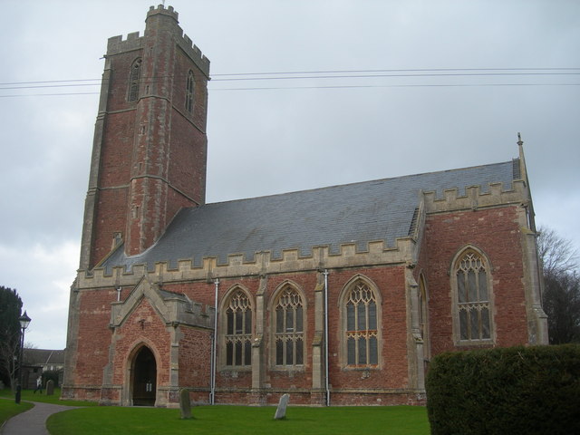
- Church of St Mary, Cannington
-
Church of St Mary 
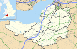
 Location within Somerset
General information Town or city Cannington Country England Coordinates 51°09′01″N 3°03′45″W / 51.1502°N 3.0624°W Completed 15th century The Church of St Mary in Cannington, Somerset, England has a tower which dates from the 14th century, the remainder was rebuilt in the early 15th century and restored in 1840 by Richard Carver.[1] It has been designated as a Grade I listed building.[2]
The nave was built between 1375 and 1400, however the tower remains from the previous church. The pulpit is from the 15th century. Buriels and memorials in the church are to the family of John Pym.[3]
It was previously connected to Cannington Court and is postulated as the former church of a house of Benedictine Nuns.[2] The nuns arrived in Cannington after fleeing from the French Revolution.[3]
The parish is part of the benefice of Cannington, Otterhampton, Combwich and Stockland within the Quantock deanery.[4]
See also
- List of Grade I listed buildings in Sedgemoor
- List of towers in Somerset
References
- ^ Dunning, RW, ed (1992). A History of the County of Somerset: Volume 6. pp. 87–89. ISBN 978-0197227800. http://www.british-history.ac.uk/report.aspx?compid=18559.
- ^ a b "Church of St Mary". Images of England. http://www.imagesofengland.org.uk/details/default.aspx?id=268856. Retrieved 13 January 2008.
- ^ a b "Church of St Mary and churchyard, Cannington". Somerset Historic Environment Record. Somerset County Council. http://webapp1.somerset.gov.uk/her/details.asp?prn=10307. Retrieved 18 September 2011.
- ^ "The Blessed Virgin Mary, Cannington". Church of England. http://acny.co.uk/11322/. Retrieved 18 September 2011.
Categories:- Church of England churches in Somerset
- 15th-century architecture
- Grade I listed churches
- Grade I listed buildings in Somerset
- Sedgemoor

Wikimedia Foundation. 2010.