- Church of St John the Baptist, Axbridge
-
Church of St John the Baptist 
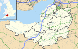
 Location within Somerset
General information Town or city Axbridge Country England Coordinates 51°17′16″N 2°49′00″W / 51.2877°N 2.8166°W Completed 13th century The Church of St John the Baptist in Axbridge, Somerset, England was built in the 13th century and has been designated as a grade I listed building.[1]
Work on the current building began in the early 15th century, and grew from an earlier building dating back to about 1230. The church is built of limestone and decorated with Doulting stone, while the steps are an interesting example of Dolomitic Conglomerate (pudding stone).[2]
The crossing tower, which was built around 1400,[3] is over 100 feet (30 m) high, and holds six bells, one of which dating from 1723 was made by Edward Bilbie of the Bilbie family.[4] The statue on the east side is that of St John the Baptist. On the west side is a king - perhaps Henry VII, which would place it after 1485. The North aisle ceiling retains some mediaeval painted panels, and amongst the carved bosses is the head of a Green Man, with leaves sprouting around his face.[5] The nave roof is Jacobean and dates from 1636.[2]
See also
- List of Grade I listed buildings in Sedgemoor
- List of towers in Somerset
References
- ^ "Church of St John The Baptist". Images of England. http://www.imagesofengland.org.uk/details/default.aspx?id=268697. Retrieved 2006-05-09.
- ^ a b Reid, Robert Douglas (1979). Some buildings of Mendip. The Mendip Society. ISBN 0905459164.
- ^ Poyntz Wright, Peter (1981). The Parish Church Towers of Somerset, Their construction, craftsmanship and chronology 1350 - 1550. Avebury Publishing Company. ISBN 0861275020.
- ^ Moore, James; Roy Rice & Ernest Hucker (1995). Bilbie and the Chew Valley clock makers. The authors. ISBN 0952670208.
- ^ "Church of St John The Baptist". http://www.stjohnthebaptistaxbridge.org.uk/. Retrieved 2006-08-25.
Categories:- Church of England churches in Somerset
- 13th-century architecture
- Grade I listed churches
- Grade I listed buildings in Somerset
- Sedgemoor


Wikimedia Foundation. 2010.