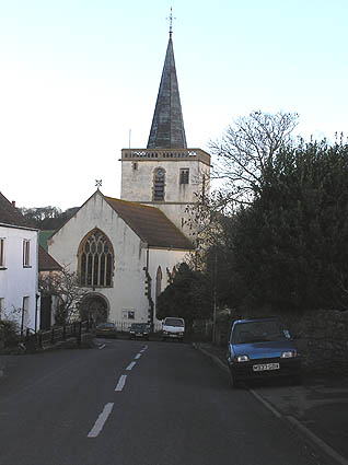
- Church of St Andrew, Stogursey
-
Church of St Andrew 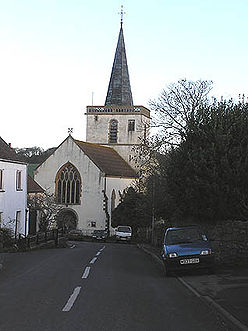
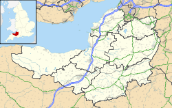
 Location within Somerset
General information Town or city Stogursey Country England Coordinates 51°10′46″N 3°08′20″W / 51.1795°N 3.1389°W Completed 12th century The Church of St Andrew in Stogursey, Somerset, England which dates from the early 12th century and has been designated as a Grade I listed building.[1]
The church of St Andrew, was built by William de Falaise, as a Benedictine priory church, around 1117 though it is believed to incorporate earlier features.[2] It was given to Abbey at Lonlay near to Falaise.[3][4] A small community of monks then settled in Stogursey forming the Priory of St. Andrews of the Ards, which the church served.[5]
The church was enlarged around 1180 when the apses were demolished and the chancel extended. The priory was dissolved around 1440, and it became a parish church. It was further altered in the 15th century, the nave was extensively restored 1824 by Richard Carver and the chancel rebuilt between 1863 and 1865 by John Norton.[1] The interior contains two Norman fonts.[3]
The tower holds six bells the oldest of which dates from 1611.[4]
The parish is part of the Quantock Coast benefice within the Quantock deanery.[6]
See also
- List of Grade I listed buildings in West Somerset
References
- ^ a b "Church of St Andrew". Images of England. http://www.imagesofengland.org.uk/Details/Default.aspx?id=265206. Retrieved 11 March 2008.
- ^ Gathercole, Clare. "An archeological assessment of Stogursey". English Heritage Extensive Urban Survey. Somerset County Council. http://www1.somerset.gov.uk/archives/hes/downloads/EUS_StogurseyText.pdf. Retrieved 6 November 2011.
- ^ a b "Stogursey". Great English Churches. http://greatenglishchurches.co.uk/html/stogursey.html. Retrieved 6 November 2011.
- ^ a b R W Dunning, C R Elrington (Editors), A P Baggs, M C Siraut (1992). "Stogursey: Churches". A History of the County of Somerset: Volume 6: Andersfield, Cannington, and North Petherton Hundreds (Bridgwater and neighbouring parishes). Institute of Historical Research. http://www.british-history.ac.uk/report.aspx?compid=18611. Retrieved 6 November 2011.
- ^ "The church of St Andrew Stogursey.". Stogursey village. http://www.meb39.freeuk.com/church.htm. Retrieved 6 November 2011.
- ^ "St Andrew, Stogursey". Church of England. http://www.achurchnearyou.com/stogursey-st-andrew/. Retrieved 6 November 2011.
Categories:- Church of England churches in Somerset
- Grade I listed churches
- Grade I listed buildings in Somerset
- West Somerset
- 12th-century church buildings

Wikimedia Foundation. 2010.