- Church of St Andrew, Brympton
-
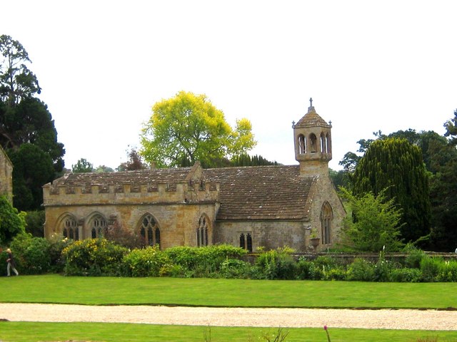
Church of St Andrew 
Location: Brympton, Somerset, England Coordinates: 50°56′06″N 2°41′02″W / 50.935°N 2.68389°WCoordinates: 50°56′06″N 2°41′02″W / 50.935°N 2.68389°W Built: 13th century Listed Building – Grade I Designated: 19 April 1961[1] Reference #: 263467 
 Location of Church of St Andrew in Somerset
The Church of St Andrew in Brympton, Somerset, England dates from the 13th century and has been designated as a Grade I listed building.[1]
It is closely associated with the manor house of Brympton d'Evercy. The d'Evercy family were responsible for building the church. Thomas d'Evercy purchased the estate in 1220. Sir Peter founded a chantry at Brympton d'Evercy in 1306, endowing a priest with a messuage and 40 acres (160,000 m2) in the parish. It has been suggested that this is the building today known as the priest house, but no structural evidence exists to support this claim. The church contains monuments to Sir John Sydenham (died 1626) and his family who were lords of the manor.[2]
Some of the effiges within the church were originally in the churchyard but were moved into the church in the 19th century and restored by John Edward Carew.[3]
The parish is within the benefice of Odcombe with Brympton, Lufton and Montacute, which is within the deanery of Yeovil.[4]
See also
- Brympton d'Evercy
- List of Grade I listed buildings in South Somerset
- List of towers in Somerset
References
- ^ a b "Church of St. Andrew". Images of England. English Heritage. http://www.imagesofengland.org.uk/Details/Default.aspx?id=263467. Retrieved 13 June 2009.
- ^ "Brimpton". GENUKI. http://www.genuki.org.uk/big/eng/SOM/Brimpton/index.html. Retrieved 18 September 2011.
- ^ "Brympton d'Evercy St Andrew". The Church Monuments Society. http://www.churchmonumentssociety.org/Somerset.html#Brympton_dEvercy_St_Andrew. Retrieved 18 September 2011.
- ^ "St Andrew, Brympton". Church of England. http://www.achurchnearyou.com/brympton-st-andrew/. Retrieved 18 September 2011.
Categories:- Church of England churches in Somerset
- 13th-century architecture
- Grade I listed churches
- Grade I listed buildings in Somerset
- South Somerset

Wikimedia Foundation. 2010.