- Hougham Without
-
Coordinates: 51°07′30″N 1°13′48″E / 51.125°N 1.23°E
Hougham 
 Hougham
Hougham shown within KentDistrict Dover Shire county Kent Region South East Country England Sovereign state United Kingdom Police Kent Fire Kent Ambulance South East Coast EU Parliament South East England List of places: UK • England • Kent For the village of Hougham, Lincolnshire see Hougham, Lincolnshire
Hougham Without is a civil parish between Dover and Folkestone in southeast England. The main settlements are the villages of Church Hougham and West Hougham, collectively known simply as "Hougham". Great Hougham Court Farm is located to the south of the two villages, near the Dover transmitting station. The Channel Tunnel runs underground just south of West Hougham and directly under both Church Hougham and the Farm.
See also
- Hougham Battery
- Lydden Spout Battery
- St. Radegund's Abbey
- Samphire Hoe
- Alkham Valley
External links
Settlements in the Dover district of Kent 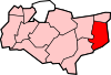
Towns Villages and hamlets Alkham · Ash · Ashley · Aycliff · Aylesham · Barfrestone · Barnsole · Betteshanger · Buckland · Buttsole · Capel-le-Ferne · Chillenden · Church Whitfield · Coldred · Coombe · Denton · Drellingore · East Langdon · Eastry · East Studdal · Elmstone · Elvington · Ewell Minnis · Eythorne · Farthingloe · Finglesham · Frogham · Goodnestone · Great Mongeham · Little Mongeham · Guston · Hacklinge · Ham · Hoaden · Hougham · Kearsney · Kingsdown · Knowlton · Langdon · Lydden · Marley · Marshborough · Martin · Martin Mill · Maxton · Nonington · Northbourne · Preston-next-Wingham · Richborough · Ringwould · Ripple · River · Shepherdswell · Sholden · Sibertswold · Snowdown · St Margaret-at-Cliffe · Staple · Stourmouth · Sutton · Swingate · Temple Ewell · Tilmanstone · Waldershare · Ware · West Langdon · West Studdal · Westcliffe · Westmarsh · Whitfield · Wingham · Woodnesborough · Wootton · WorthCivil parishes Categories:- Villages in Kent
- Dover (district)
- Kent geography stubs


Wikimedia Foundation. 2010.