- Drellingore
-
Coordinates: 51°07′26″N 1°12′00″E / 51.124°N 1.2°E
Drellingore 
 Drellingore
Drellingore shown within KentOS grid reference TR239410 District Dover Shire county Kent Region South East Country England Sovereign state United Kingdom Post town Dover Postcode district CT18 Dialling code 01304 Police Kent Fire Kent Ambulance South East Coast EU Parliament South East England UK Parliament Dover List of places: UK • England • Kent Drellingore is a village in South East Kent, England. It lies in the Alkham Valley an area of outstanding natural beauty between Folkestone and Dover. Although the Alkham Valley is a dry valley most of the surrounding land forms a water catchment area. Water is extracted from the chalk aquifer for use in the Dover/Folkestone area of Kent.
Settlements in the Dover district of Kent 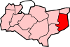
Towns Villages and hamlets Alkham · Ash · Ashley · Aycliff · Aylesham · Barfrestone · Barnsole · Betteshanger · Buckland · Buttsole · Capel-le-Ferne · Chillenden · Church Whitfield · Coldred · Coombe · Denton · Drellingore · East Langdon · Eastry · East Studdal · Elmstone · Elvington · Ewell Minnis · Eythorne · Farthingloe · Finglesham · Frogham · Goodnestone · Great Mongeham · Little Mongeham · Guston · Hacklinge · Ham · Hoaden · Hougham · Kearsney · Kingsdown · Knowlton · Langdon · Lydden · Marley · Marshborough · Martin · Martin Mill · Maxton · Nonington · Northbourne · Preston-next-Wingham · Richborough · Ringwould · Ripple · River · Shepherdswell · Sholden · Sibertswold · Snowdown · St Margaret-at-Cliffe · Staple · Stourmouth · Sutton · Swingate · Temple Ewell · Tilmanstone · Waldershare · Ware · West Langdon · West Studdal · Westcliffe · Westmarsh · Whitfield · Wingham · Woodnesborough · Wootton · WorthCivil parishes Categories:- Kent geography stubs
- Villages in Kent


Wikimedia Foundation. 2010.