- Sugarloaf (Christchurch)
-
Sugarloaf communications tower 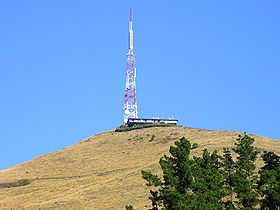
The Sugarloaf communications tower viewed from Bowenvale ValleyElevation 493.78 m (1,620 ft) Location Location of Sugarloaf in Christchurch, New Zealand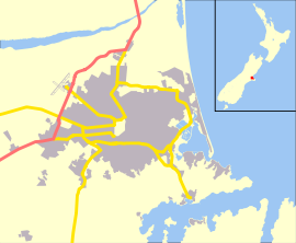
 Sugarloaf
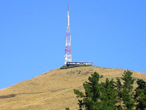
Location Christchurch, New Zealand Coordinates 43°36′12″S 172°38′58″E / 43.603244°S 172.649534°ECoordinates: 43°36′12″S 172°38′58″E / 43.603244°S 172.649534°E Geology Type Basalt Volcanic Rock The Sugarloaf in Christchurch's Port Hills is a landmark to the south of the city. The Sugarloaf communications tower is an iconic transmission mast located on top of the hill.
Contents
Geography
The tower is situated at an elevation of 493.78 m on the top of the Port Hills, near Dyers Pass. This area is officially known as Sugarloaf Scenic Reserve. This reserve land occasionally doubles as a sheep farm and includes a car park lookout point for general public use.
Communications tower
With a height of 121 m, the lattice steel structured tower is founded on a 5 metre deep concrete pad underlain by basalt volcanic rock. It is situated approximately 50 m behind the main transmission building, which combined with the tower is visible from most parts of Christchurch city.
 The Sugarloaf communications tower stands 121 m high.
Visual Appearance
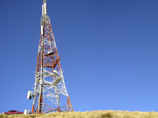
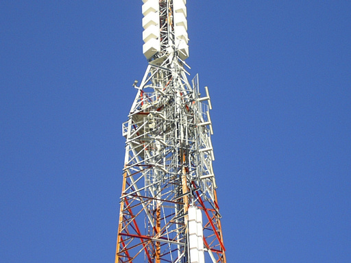
At a closer glance, the red and white tower includes an array of antennas including parabolic dishes, dipoles and microwave links. The tower has three main service decks for authorised technicians only with access ladders that run vertically along the eastern side. At night the tower is illuminated with three red beacons which span across the mast from top to bottom. On a clear night and viewed from the city you can often see the beacons and some fluorescent lighting coming from a room inside transmission house.
Transmission House
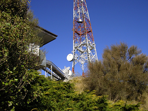
The tower is located 50 m behind a single storey transmission building which houses multiple transmission gear. The main equipment room is fully air conditioned and known to local technicians as the great transmitter hall. The building is approximately 40 m in width and 20 m in depth. On the roof of this building there are several satellites, small antennae and multiple parabolic dishes for private WiFi networks. There are two main shielded cable runs that go between the transmission house and back to the tower. This building has been unmanned for several years.
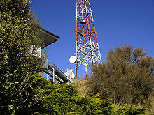 Sugarloaf Communications Tower showing cable runs from back of building to base of tower.
Site Access
The entire transmission site is surrounded by a mesh security fence and a continuous hedge mixed with foliage. Access to the tower is highly restricted to authorised personnel only and climbing the tower is strictly prohibited. Vehicle access to the actual site itself is restricted via a locked gate, however there is a car park lookout point located 200m in front of the tower with panoramic views of Canterbury. Access to this reserve is permitted to the general public until approximately 6:00PM. After this time the gate between Summit Road and Service Lane is locked until the following morning.
Technical Aspects
There are six main antennas that transmit TV and FM signals in the 45 MHz to 800 MHz range. The composite total power fed to all of the transmitting antennas is approximately 64 kW while the antenna gain values range from 7.8 to 16.5 dBd. Multiple services operate off the tower including television, radio, emergency response, aviation, cellular and other data signals.
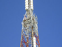 Close up view of the top half of the Sugarloaf Communications Tower.
Transmission Frequencies
The following table contains television and radio frequencies currently operating at Sugarloaf:
TV Channel Transmit Channel Transmit Frequency Band Radio Station Transmit Frequency TV One 3 62.25 MHz VHF The Edge 95.30 MHz TV Two 6 189.25 MHz VHF Concert FM 89.70 MHz TV Three 8 203.25 MHz VHF Tahu FM 90.50 MHz FOUR 11 224.25 MHz VHF ZM 91.30 MHz More FM 92.10 MHz Solid Gold 92.90 MHz CTV 44 655.25 MHz UHF The Rock 93.70 MHz Digital Multiplex A (TVNZ) 47 UHF The Breeze 94.50 MHz Digital Multiplex 2 (MediaWorks) 49 UHF Plains FM 96.90 MHz Digital Multiplex 3 (Kordia) 50 UHF Radio Live 99.30 MHz Prime TV 62 799.25 MHz UHF Nui FM 104.10 MHz The above television frequencies however are subject to 'Analogue Switch Off' otherwise known as 'Digital Switch Over' (DSO), which is planned for the Sugarloaf and the rest of the South Island in April 2013.
Case Studies
An RF emissions report conducted on 9 February 1998 by the National Radiation Laboratory found that maximum exposure levels of 8 μW/cm2 were detected in the car park area, immediately below the Sugar Loaf antenna. This is 4% of the maximum of 200 μW/cm2 specified for public exposure levels in NZS 6609.1:1990. As the distance from the antenna increased, the exposure levels decreased markedly and, in general, were below 2 μW/cm2. The report concluded that the site is operating in accordance with NZS 6609.1:1990.
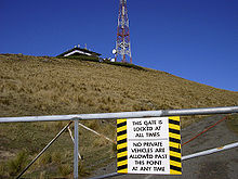 A barrier gate prevents access to the transmitter site for private vehicles.
Management
The tower and building are currently owned and maintained by Kordia, previously known as Broadcast Communications Limited (BCL NZ).
External links
- Sugarloaf Communications Tower as seen in Google Maps
- Panorama View from Sugarloaf Scenic Reserve
- Kordia Limited
- Christchurch City Council Reserve Information
- Port Hills Visitor Information
- Digital Switch Over Information for New Zealand
- 1998 RF Emissions Report for The Sugarloaf Communications Tower (Adobe PDF Format)
- 2005 Tower Upgrade Contract (Adobe PDF Format)
- Sugarloaf Scenic Reserve Dog Control Map (Adobe PDF Format)
Categories:- Buildings and structures in Christchurch
- Hills of New Zealand


Wikimedia Foundation. 2010.