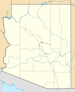
Childs Valley

Childs Valley
Childs Valley
Valley
Country United States
State Arizona
Region ((north-central)-Sonoran Desert)
Districts Maricopa County AZ, Pima County AZ
Borders on Sentinel Plain-NE
San Cristobal & Growler Valleys-W & NW
City Ajo, AZ
Rivers Childs Wash, Tenmile Wash
Coordinates 32°25′50″N 112°56′40″W / 32.430611°N 112.944333°W / 32.430611; -112.944333
Length 50 mi (80 km), NW-SE
Width 12 mi (19 km)
Childs Valley
in Arizona

The Childs Valley is a valley in the Sonoran Desert of south-central Arizona west of Ajo. Upstream sections are located in far western Pima County; downstream it merges into the Gila River Valley in southwestern Maricopa County. Upstream, the valley is east and parallel to the Growler Valley and Growler Mountains which lie directly west.

Childs Valley description

Childs Valley is north trending as is Growler Valley. The west part of the valley contains Daniels Wash which flows north, then west at the north end of the Growler Mountains to meet Growler Wash, the upstream, southern region of the San Cristobal Valley Watershed.[1] The eastern part of the upper Childs Valley contains Childs Wash, the western tributary to the Tenmile Wash Watershed.[2] The Childs Wash drains the northwest of the Little Ajo Mountains, where Ajo, Arizona is on its east. The east of the Little Ajo's are drained by Tenmile Wash.

Childs Valley & Wash are north-trending at the south, but turn northwest x southeast to meet the region in the northwest at the Gila River Valley and Park Valley. The extensive Sentinel Plain is northeast, Park Valley is northwest at the Gila River, and the Crater Range in the center of the Childs Valley, borders its northeast, and is also the northeast border of Tenmile Wash.

The small, low elevation Aguila Mountains border the northwest, a water divide from the San Cristobal Valley.

The upper Childs Valley & Childs Mountain are located at 32°25′50″N 112°56′40″W / 32.430611°N 112.944333°W / 32.430611; -112.944333 (Childs Mountain).[3]

References

  1. ^ San Cristobal Valley Watershed
  2. ^ Tenmile Wash Watershed
  3. ^ Childs Mountain, Registered Land Mobile Towers in Ajo, city-data.com.

External links


Watersheds


Wikimedia Foundation. 2010.

Игры ⚽ Поможем написать реферат

Look at other dictionaries:

  • Childs, Arizona —   Unincorporated settlement   …   Wikipedia

  • Childs Glacier — (83°24′S 58°40′W / 83.4°S 58.667°W / 83.4; 58.667) is a glacier in the Neptune Range of the Pensacola Mountains, draining westward from Roderick Val …   Wikipedia

  • Growler Valley — The Growler Valley is a valley of south central Arizona west of Ajo, Arizona.Growler Valley is 65 mile (21 km) convert|65|mi|km|0 long valley paralleling the Growler Mountains on the east (attached to the Little Ajo Mountains), and the Granite… …   Wikipedia

  • Thomas Childs — was a U.S. soldier who served with distinction during the Mexican American War.Childs was born on March 16, 1796, in Pittsfield, Massachusetts, the son and grandson of Revolutionary War veterans. He graduated from West Point in 1814 and fought in …   Wikipedia

  • H6 Childs Way — Coordinates: 52°00′15″N 0°48′17″W / 52.0043°N 0.8048°W / 52.0043; 0.8048 …   Wikipedia

  • Oro Valley, Arizona — Town of Oro Valley, Arizona   Town   View of Pusch Ridge in the Santa Catalina Mountains from Oro Valley. September 2004 …   Wikipedia

  • Golden Valley High School (Merced) — Infobox School name = Golden Valley High School imagesize = logo = caption = location = 2121 E. Childs Ave Merced, California 95341 district = Merced Union High School District country = coordinates = coord|37|17|18.8|N|120|27|2.2|W|type:edu… …   Wikipedia

  • Ouse Valley Way — Swans nesting beside the Great Ouse near St Neots The Ouse Valley Way is a 150 mile footpath in England, following the River Great Ouse from its source near Brackley in Northamptonshire to its mouth in The Wash near King s Lynn. The path begins… …   Wikipedia

  • Three Valley Museum — The Three Valley Museum is a non profit museum in Durant, Oklahoma. It houses a massive collection of artifacts regarding the history of Bryan County. It opened in 1976. It is named after the book Queen of the Three Valleys by Henry McCreary. The …   Wikipedia

  • Little Ajo Mountains — Geobox|Range name=Little Ajo Mountains image size= image caption= country= United States state= Arizona geology=|orogeny= highest=Ajo Peak highest elevation imperial=3220 map caption= The Little Ajo Mountains is a mountain range in southern… …   Wikipedia

Share the article and excerpts

Direct link
Do a right-click on the link above
and select “Copy Link”