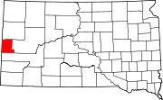
Cheyenne Crossing, South Dakota
Look at other dictionaries:
Maverick Junction, South Dakota — Maverick Junction, South Dakota, is a small, unincorporated community located in Fall River County, South Dakota at the intersection of South Dakota State Highway 79 and US Highways 18 and 385, approximately 5 miles southeast of Hot Springs. Like … Wikipedia
Cheyenne, Wyoming — City of Cheyenne City Capitol Ave. in Downtown Cheyenne … Wikipedia
Mule Creek Junction, Wyoming — Mule Creek Junction is an unpopulated locale in Niobrara County, Wyoming at the junction of US 18 and US 85. Direction via Destination Distance from Mule Creek Junction North US 85 Newcastle, Wyoming 33 miles East US 18 Edgemont, South Dakota 22… … Wikipedia
Scenic roads in the Black Hills — The Black Hills of South Dakota and Wyoming feature many scenic highways, constructed from the 1920s on to provide routes of interest for tourists. Among these are:* Spearfish Canyon (US 14A) between Cheyenne Crossing, South Dakota and Spearfish … Wikipedia
Keystone Wye — An interchange of US 16 and US 16A located in the Black Hills, featuring two unique glulam (Glue laminated) timber bridges. The Keystone Wye is a trumpet style three way interchange for the two divided highways, constructed in 1966 67 as part of… … Wikipedia
Mobridge — ▪ South Dakota, United States city, Walworth county, north central South Dakota, U.S. It lies along the Missouri River (there broadened to form Lake Oahe), about 110 miles (175 km) north of Pierre. Arikara and, later, Sioux Indians were… … Universalium
Sioux Indians — • Provides information about their history, language, population, culture and religion Catholic Encyclopedia. Kevin Knight. 2006. Sioux Indians Sioux Indians … Catholic encyclopedia
American Old West — Wild West redirects here. For other uses, see Wild West (disambiguation). For cultural influences and their development, see Western (genre). American Old West The … Wikipedia
U.S. Route 85 — CanAm Highway Route information … Wikipedia
Missouri River — Coordinates: 38°48′49″N 90°07′11″W / 38.81361°N 90.11972°W / 38.81361; 90.11972 … Wikipedia

