- Chestnuthill Township, Monroe County, Pennsylvania
-
Chestnuthill Township Settlement 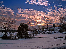 A farm in Chesnuthill Township
Country United States State Pennsylvania County Monroe Elevation 696 ft (212.1 m) Coordinates 40°56′00″N 75°21′59″W / 40.9333333°N 75.36639°W Area 37.6 sq mi (97.4 km2) - land 37.5 sq mi (97 km2) - water 0.1 sq mi (0 km2), 0.27% Population 14,418 (2000) Density 384.9 / sq mi (148.6 / km2) Founded 1763 Timezone EST (UTC-5) - summer (DST) EDT (UTC-4) Area code 570 
 Location of Chestnuthill Township in Pennsylvania
 Location of Pennsylvania in the United States
Website: http://www.chestnuthilltwp-pa.gov Chestnuthill Township is a township in Monroe County, Pennsylvania, United States. The population was 14,418 at the 2000 census. Chestnuthill Township is served by the Pleasant Valley School District.
Contents
Geography
According to the United States Census Bureau, the township has a total area of 37.6 square miles (97 km2).37.5 square miles (97.0 km²) of it is land and 0.1 square miles (0.26 km2) of it (0.35%) is water.
Demographics
As of the census[1] of 2000, there were 14,418 people, 4,906 households, and 3,905 families residing in the township. The population density was 384.9 people per square mile (148.6/km²). There were 5,593 housing units at an average density of 149.3/sq mi (57.7/km²). The racial makeup of the township was 92.34% White, 4.06% African American, 0.13% Native American, 1.00% Asian, 0.02% Pacific Islander, 1.03% from other races, and 1.41% from two or more races. Hispanic or Latino of any race were 4.88% of the population.
There were 4,906 households out of which 42.4% had children under the age of 18 living with them, 67.9% were married couples living together, 7.5% had a female householder with no husband present, and 20.4% were non-families. 16.1% of all households were made up of individuals and 6.7% had someone living alone who was 65 years of age or older. The average household size was 2.91 and the average family size was 3.26.
In the township the population was spread out with 29.8% under the age of 18, 6.6% from 18 to 24, 29.7% from 25 to 44, 22.7% from 45 to 64, and 11.3% who were 65 years of age or older. The median age was 37 years. For every 100 females there were 99.8 males. For every 100 females age 18 and over, there were 96.6 males.
The median income for a household in the township was $50,210, and the median income for a family was $55,058. Males had a median income of $41,988 versus $25,363 for females. The per capita income for the township was $20,017. About 5.9% of families and 7.9% of the population were below the poverty line, including 9.2% of those under age 18 and 6.6% of those age 65 or over.
References
- ^ "American FactFinder". United States Census Bureau. http://factfinder.census.gov. Retrieved 2008-01-31.
External links
Municipalities and communities of Monroe County, Pennsylvania Boroughs 
Townships Barrett | Chestnuthill | Coolbaugh | Eldred | Hamilton | Jackson | Middle Smithfield | Paradise | Pocono | Polk | Price | Ross | Smithfield | Stroud | Tobyhanna | Tunkhannock
CDPs Unincorporated
communitiesBartonsville | Canadensis | Cresco | Effort | Gilbert | Jonas | Long Pond | Marshalls Creek | Pocono Manor | Pocono Summit | Skytop | Swiftwater | Tannersville | Tobyhanna
Categories:- Populated places established in 1763
- Townships in Monroe County, Pennsylvania


Wikimedia Foundation. 2010.