Chester Grant, Nova Scotia
- Chester Grant, Nova Scotia
-
Categories:
- Communities in Lunenburg County, Nova Scotia
- Lunenburg County, Nova Scotia geography stubs
Wikimedia Foundation.
2010.
Look at other dictionaries:
Chester, Nova Scotia — Map of all coordinates from Google Map of all coordinates from Bing Export all coordinates as KML … Wikipedia
Nova Scotia Trunk 12 — Trunk 12 in the community of Chester Basin, Nova Scotia. Trunk 12 is part of the Canadian province of Nova Scotia s system of Trunk Highways. The route runs from Chester Basin to Kentville, a distance of 67 kilometres. The road s routing is… … Wikipedia
Chester Municipal District, Nova Scotia — This article is about the municipal district. For the village, see Chester, Nova Scotia (community). Chester Municipal district … Wikipedia
Nova Scotia general election, 2009 — 2009 Nova Scotia general election 2006 ← members June 9, 2009 members → 39th … Wikipedia
List of communities in Nova Scotia — This is a list of communities in the Canadian province of Nova Scotia, as designated by the Union of Nova Scotia Municipalities. Incorporated municipalities in Nova Scotia are either counties, towns or regional municipalities. There are no… … Wikipedia
Middleton, Nova Scotia — Middleton Town … Wikipedia
Clark's Harbour, Nova Scotia — Clark s Harbour Town … Wikipedia
Chéticamp, Nova Scotia — Coordinates: 46°38′16.39″N 61°0′32.90″W / 46.6378861°N 61.009139°W / 46.6378861; 61.009139 … Wikipedia
Argyle, Nova Scotia — Argyle Municipal district Fl … Wikipedia
Liste der Vizegouverneure von Nova Scotia — Amtsflagge des Vizegouverneurs von Nova Scotia Diese Liste führt die Vizegouverneure (engl. lieutenant governor) der kanadischen Provinz Nova Scotia seit dem Beitritt zur Kanadischen Konföderation im Jahr 1867 auf. Ebenfalls enthalten sind die… … Deutsch Wikipedia
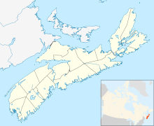
 Chester Grant in Nova Scotia