Chedabucto Bay

Chedabucto Bay
Chedabucto Bay is located in Nova Scotia
{{{alt}}}
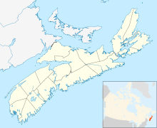
Chedabucto Bay in Nova Scotia

Chedabucto Bay is a large bay on the eastern coast of mainland Nova Scotia between the Atlantic Ocean and the Strait of Canso next to Guysborough County. At the entrance to Chedabucto Bay is the town of Canso at the head is the community of Guysborough and on the other end is the town of Mulgrave.

History

Chedabucto Bay was formed by the drowning of part of an ancient river system and owes its origin and shape to position of the Chedabucto Fault, which runs across central Nova Scotia from the Bay of Fundy to the Canso peninsula.[1]

Raid on Chedabucto (1690)

La Rochelle merchants enjoyed a fishing monopoly in Acadia. Fort St. Louis was established by the Company of Acadia.[2] The principal ports were at Chedabucto, which accounted for fifty fishers in 1686. In 1690, Captain Cyprian Southack proceeded to Chedabucto to take Fort St. Louis at village of Guysborough which, unlike Port Royal, Nova Scotia, put up a fight before surrendering.[3]

The company encountered a variety of difficulties on the way to its final disappearance in 1702.[4]

On Wednesday, February 4, 1970 the Liberian-registered tanker Arrow ran aground on Cerberus Rock with a cargo of 108,000 barrels (17,200 m3) barrels of Bunker C fuel. The oil spilled into the bay. Out of the 375 statute miles (604 km) of shoreline, 190 miles (310 km) were contaminated with oil.[5]

References

  1. ^ Chedabucto Bay Geology
  2. ^ Brenda Dunn, p. 29
  3. ^ Brenda Dunn, p. 39
  4. ^ Daigle, Jean. 1650-1686: 'Un pays qui ne'est pas fait'. in Buckner, P. and Reid J. (eds). The Atlantic Region to Confederation: A History. Toronto University Press. 1994. p. 74.
  5. ^ Environment Canada, Liberian Tanker Arrow

Coordinates: 45°23′33.59″N 61°18′13.36″W / 45.3926639°N 61.3037111°W / 45.3926639; -61.3037111 (Chedabucto Bay)


Wikimedia Foundation. 2010.

Игры ⚽ Поможем решить контрольную работу

Look at other dictionaries:

  • Chedabucto Bay — Sp Šedabãkto įlanka Ap Chedabucto Bay L ŠV Atlante, Kanada (N. Škotija) …   Pasaulio vietovardžiai. Internetinė duomenų bazė

  • Chedabucto Fault — The Chedabucto Fault is a fault that divides Mainland Nova Scotia from the Minas Basin in the west to Chedabucto Bay in the east into the Avalon zone in the north and the Meguma Zone in the south .The Avalon and Meguma Zones are different because …   Wikipedia

  • Nova Scotia peninsula — Map of Nova Scotia highlighting the Nova Scotia peninsula The Nova Scotia peninsula is a peninsula on the Atlantic coast of North America. Contents …   Wikipedia

  • Canso Canal — The Canso Canal is a short canal located in Nova Scotia, Canada.Canal locationThe Canso Canal is located in the Strait of Canso, on the eastern side of the Canso Causeway, a rock fill causeway which opened in 1955 to carry a 2 lane highway and… …   Wikipedia

  • Canso, Nova Scotia — Infobox Settlement official name = Canso other name = native name = nickname = settlement type = Town motto = imagesize = image caption = flag size = image seal size = image shield = shield size = city logo = citylogo size = mapsize = map caption …   Wikipedia

  • Canso, Strait of — or Canso Gut Channel, Nova Scotia, Canada. Separating mainland Nova Scotia and Cape Breton Island, it is 4.5 mi (23 km) long and 1 mi (2 km) wide, with depths of 200 ft (60 m). Since 1955 the 7,000 ft (2,100 m) Canso Causeway has linked Cape… …   Universalium

  • 1970 in Canada — See also: 1969 in Canada, other events of 1970, 1971 in Canada and the list of years in Canada . Incumbents*Monarch Queen Elizabeth II *Governor General Roland Michener *Prime Minister Pierre Trudeau *Premier of Alberta Harry Strom *Premier of… …   Wikipedia

  • Arichat, Nova Scotia — The village of Arichat is one of the oldest communities in Nova Scotia, dating back to the 1700s, when tall ships ruled the seas. It is the county seat of Richmond County.Arichat was first settled in the early 1700s. In 1713, a permanent… …   Wikipedia

  • Guysborough, Nova Scotia — Guysborough   Municipal district   …   Wikipedia

  • Meguma terrane — Map of Nova Scotia, showing how the Meguma terrane forms the southern portion. The Meguma terrane is a terrane exposed in southern Nova Scotia, that became joined to the present North American landmass as part of the Appalachian orogeny. Composed …   Wikipedia

Share the article and excerpts

Direct link
Do a right-click on the link above
and select “Copy Link”