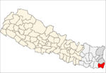
- Charpani
-
Charpane(चारपाने) — Village development committee — Country  Nepal
NepalZone Mechi Zone District Jhapa District Population (1991) - Total 7,766 Time zone Nepal Time (UTC+5:45) Charpane (चारपाने) is a village development committee in Jhapa District in the Mechi Zone of south-eastern Nepal. At the time of the 1991 Nepal census it had a population of 7766 people living in 1472 individual households. Ramchowk is a Chautari popular for local meeting and discussion platfirm for the people living in this area. There is a small jungle of SAAL from which the jungle is given a name of SAALGHARI. There is a local public school named Mohanmaya School. Bal Kalyan Boarding School is besides (south corner)of Charpane Chowk(चारपाने चोक). Ram Sitoula is the Principal of this School.[1]
References
- ^ "Nepal Census 2001". Nepal's Village Development Committees. Digital Himalaya. http://www.digitalhimalaya.com/collections/nepalcensus/form.php?selection=1. Retrieved 24 November 2008.
Anarmani · Arjundhara · Bahundangi · Baigundhara · Balubari · Baniyani · Bhadrapur · Budhabare · Chakchaki · Charpani · Damak · Dangibari · Dhaijan · Dharmpur · Dhulabari · Duhagadhi · Garamani · Gauradaha · Gauriganj · Ghailadubba · Gherabari · Golchhap · Haldibari · Jalthal · Juropani · Jyamirgadhi · Kankarbhitta · Kechana · Khajurgachhi · Khudnabari · Kohabara · Korabari · Kumarkhod · Lakhanpur · Mahabhara · Maharanijhoda · Maheshpur · Mechinagar · Panchganchi · Pathabhari · Pathariya · Prithivinagar · Rajghadh · Sanischare · Satasidham · Shantinagar · Sharanamati · Shivaganj · Surunga · Taganduba · Topgachchi
 Categories:
- Populated places in Jhapa District
- Mechi Zone geography stubs
Wikimedia Foundation. 2010.
