- Černá Voda
-
Černá Voda — Municipality — 
Flag
Coat of arms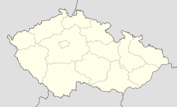
 Černá Voda
Coordinates: 50°18′30″N 17°9′21″E / 50.30833°N 17.15583°ECoordinates: 50°18′30″N 17°9′21″E / 50.30833°N 17.15583°E Country  Czech Republic
Region Olomouc District Jeseník Area – Total 9.96 km2 (3.8 sq mi) Elevation 340 m (1,115 ft) Population (2006) – Total 629 – Density 63.2/km2 (163.6/sq mi) Postal code 790 54 Website http://cernavoda.rychleby.cz Černá Voda (German Schwarzwasser, both meaning "black water") is a village and municipality (obec) in Jeseník District in the Olomouc Region of the Czech Republic.
The municipality covers an area of 9.96 square kilometres (3.85 sq mi), and has a population of 629 (as at 3 July 2006).
Černá Voda lies approximately 9 kilometres (6 mi) north of Jeseník, 80 km (50 mi) north of Olomouc, and 197 km (122 mi) east of Prague.
References
Towns and villages of Jeseník District Bělá pod Pradědem · Bernartice · Bílá Voda · Bílý Potok · Černá Voda · Česká Ves · Hradec-Nová Ves · Javorník · Jeseník · Kobylá nad Vidnavkou · Lipová-lázně · Mikulovice · Ostružná (Jeseník District) · Písečná · Skorošice · Stará Červená Voda · Supíkovice · Uhelná · Vápenná · Velká Kraš · Velké Kunětice · Vidnava · Vlčice · Zlaté Hory · Žulová
This Olomouc Region location article is a stub. You can help Wikipedia by expanding it.


