- Asaga village
-
Asaga — Village — 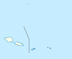
 Asaga
AsagaCoordinates: 13°35′56″S 172°12′17″W / 13.59889°S 172.20472°WCoordinates: 13°35′56″S 172°12′17″W / 13.59889°S 172.20472°W Country  Samoa
SamoaDistrict Fa'asaleleaga Elevation 3 m (10 ft) Population (2006) - Total 288 Time zone -11 Asaga is a village on the north east coast of Savai'i island in Samoa[1], situated between the villages of Lano to the south and Pu'apu'a to the north.
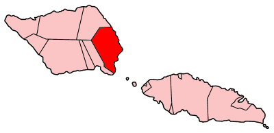
The village is part of the electoral constituency (Faipule District) Fa'asaleleaga IV which is within the larger political district (Itumalo) of Fa'asaleleaga.
The population is 288.[2]
References
- ^ "Samoa Territorial Constituencies Act 1963". Pacific Islands Legal Information Institute. http://www.paclii.org/ws/legis/consol_act/tca1963317/. Retrieved 19 December, 2009.
- ^ "Population and Housing Census Report 2006". Samoa Bureau of Statistics. July 2008. http://www.sbs.gov.ws/Portals/138/PDF/census%20survey/Table%202.%20Population%20byregion,%20faipule%20district%202006.pdf. Retrieved 19 December, 2009.
 Fa'asaleleaga District: Itūmālō
Traditional center: Safotulafai Township: Salelologa Villages · Falefia · Fogapoa · Lalomalava · Lano · Asaga · Pu'apu'a · Sa'asa'ai · Saipipi · Salelavalu Tai · Salelavalu Uta · Sapapali'i · Sapulu · Tino i Iva · Tuasivi · Vaiafai · Vaimaga ·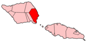
Airport & Ferry Terminal Education & Schools · Savai'i Public Library · List of schools in Savai'i ·Notable people · Lauaki Namulauulu Mamoe · Malietoa ·Politicians Conservation & Evironment · Central Savai'i Rainforest · Samoan plant names · Birds of Samoa · Mammals of Samoa · Protected areas of Samoa ·Electoral constituencies: Faipule Districts · Fa'asaleleaga No. 1 (2 seats) · Fa'asaleleaga No. 2 · Fa'asaleleaga No. 3 · Fa'asaleleaga No. 4 ·Categories:- Populated places in Samoa
- Samoa geography stubs

Wikimedia Foundation. 2010.