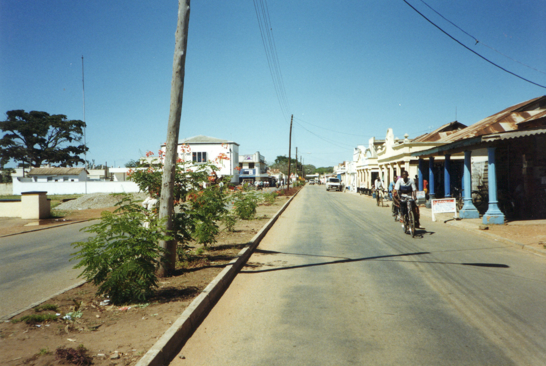
- Soroti
Infobox Settlement
official_name = Soroti
other_name =
native_name =
nickname =
settlement_type =
motto =
imagesize = 300px
image_caption = Soroti main street
flag_size =
image_
seal_size =
image_shield =
shield_size =
image_blank_emblem =
blank_emblem_type =
blank_emblem_size =
mapsize =
map_caption =
mapsize1 =
map_caption1 =
image_dot_
dot_mapsize =
dot_map_caption =
dot_x = |dot_y =
pushpin_
pushpin_label_position =bottom
pushpin_map_caption =Location in Uganda
subdivision_type = Country
subdivision_name =
subdivision_type1 = Admin. division
subdivision_name1 =Soroti District
subdivision_type2 =
subdivision_name2 =
subdivision_type3 =
subdivision_name3 =
subdivision_type4 =
subdivision_name4 =
government_footnotes =
government_type =
leader_title =Mayor
leader_name =
leader_title1 =
leader_name1 =
leader_title2 =
leader_name2 =
leader_title3 =
leader_name3 =
leader_title4 =
leader_name4 =
established_title =
established_date =
established_title2 =
established_date2 =
established_title3 =
established_date3 =
area_magnitude =
unit_pref =Imperial
area_footnotes =
area_total_km2 =
area_land_km2 =
area_water_km2 =
area_total_sq_mi =
area_land_sq_mi =
area_water_sq_mi =
area_water_percent =
area_urban_km2 =
area_urban_sq_mi =
area_metro_km2 =
area_metro_sq_mi =
area_blank1_title =
area_blank1_km2 =
area_blank1_sq_mi =
population_as_of =2005
population_footnotes =
population_note =
population_total =
population_density_km2 =
population_density_sq_mi =
population_metro =
population_density_metro_km2 =
population_density_metro_sq_mi =
population_urban =
population_density_urban_km2 =
population_density_urban_sq_mi =
population_blank1_title =Ethnicities
population_blank1 =
population_blank2_title =Religions
population_blank2 =
population_density_blank1_km2 =
population_density_blank1_sq_mi =
timezone =
utc_offset =
timezone_DST =
utc_offset_DST =
latd=1 |latm=41|lats= |latNS=N
longd=33 |longm=37 |longs= |longEW=E
elevation_footnotes =
elevation_m =
elevation_ft =
postal_code_type =
postal_code =
area_code =
blank_name =
blank_info =
blank1_name =
blank1_info =
website =
footnotes =Soroti is the main commercial and administrative centre of
Soroti District inUganda , lying nearLake Kyoga . It is known for the rock formation near the town as well as a variety of Muslim mosques, Hindu temples, Sikh gurdwaras as well as several churches that meet in various buildings in the town varying from the drab AnglicanCathedral to small Pentecostal congregations in school classrooms.The town of Soroti still has many buildings reflecting the tastes of the large Indian population that once traded in the town. These ornate buildings fell into disrepair following
Idi Amin ’s expulsion of the Asians in the 1970s. In recent years, with the return of stability to the area, the town is beginning to thrive again with many new businesses opening up. This has also increased the sprawl of the town into the surrounding farmland. Soroti market suffered a fire in the late 1990s mainly due to its ramshackle set-up. The market that replaced is much more ordered, but still has stalls of fresh fruit and vegetables, dry goods and the local fish.It is possible to climb the rock beside the town, with permission from the Town Clerk, and this gives an excellent panorama of the town and the surrounding areas. Views from the rock on a clear day extend as far as
Mount Elgon andLake Kyoga . The rock itself is avolcanic plug , which are common in the region.At the back of the rock you can still find the graves from Uganda's colonial period. The age at which the residents of these plots died is an indication of the dangers that the area of Soroti once posed. Many of the graves are in disrepair and overgrown. On the otherside of the airport is a much larger municipal
cemetery where there are many graves withArabic inscriptions. Located there is a bath house specifically for the washing of bodies, an important ritual in both local and Islamic burials.Soroti Airport has the second longest tarmac runway in Uganda, at 6100 feet, the longest being found at Entebbe. This runway is capable of handling jets the size ofBoeing 737 s. Soroti Airport was originally built as a training school for theBritish Overseas Airways Corporation to train their pilots in tropical flying techniques. It was later used by the East African Flying Academy to train pilots from theEast African Community (Uganda ,Kenya andTanzania ). Today, the airport is home Soroti Flying School, which has various aircraft, including aCessna 310 .In the summer of 2003 Soroti was attacked by soldiers from the
Lord's Resistance Army . Previous attacks in Uganda had been centred on districts in Northern Uganda. The attack on Soroti was seen by the Ugandan government as an escalation in the threat posed by the LRA because of Soroti airport's strategic military importance. Fierce gun battles between the LRA and government troops forced the LRA back into the surrounding countryside. The threat of abduction posed by LRA soldiers then began a nightly exodus of people from the rural areas into the town seeking protection from the government troops stationed there.The satellite imagery of Soroti is unusually detailed for a small African town.
For more information visit the government website: http://www.soroti.go.ug/index.htm
Wikimedia Foundation. 2010.

