- Mount Sizer
-
Mount Sizer 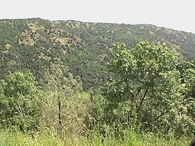
Mount Sizer, highest point in photo as seen from Hobbs Road just above Deer Horn Spring.Elevation 3,216 ft (980 m) [1] Location Location Santa Clara County, California, USA Range Diablo Range Coordinates 37°12′50″N 121°30′49″W / 37.2138298°N 121.5135515°WCoordinates: 37°12′50″N 121°30′49″W / 37.2138298°N 121.5135515°W[2] Topo map USGS Mount Sizer Climbing Easiest route Hike Mount Sizer is a prominent peak located on Blue Ridge in Henry W. Coe State Park, just east of Morgan Hill, California. Because Mount Sizer is the highest point on Blue Ridge and under 10 miles (16 km) miles from the park's headquarters, it makes it an ideal destination for day hikers. There are two ways to reach the summit. One by trails and one by a combination of trail and fire road. The fire road route leads you almost directly up Blue Ridge to Mount Sizer and is affectionately nicknamed "The Shortcut". This road rises roughly 1,500 feet (457 m) in 1.3 miles (2.1 km) giving it an average grade of 22%. Paved roads in California seldom exceed an 8% grade.
References
- ^ "Mount Sizer, California". Peakbagger.com. http://www.peakbagger.com/peak.aspx?pid=23506. Retrieved 2008-11-29.
- ^ "Mount Sizer". Geographic Names Information System, U.S. Geological Survey. http://geonames.usgs.gov/pls/gnispublic/f?p=gnispq:3:::NO::P3_FID:233189. Retrieved 2008-11-29.
External links
- "Mt. Sizer & Black Oak Spring". Photo Tour: Henry W. Coe State Park. Mindbird Maps & Books. http://www.coestatepark.com/sizer.htm. Retrieved 2008-11-29.
- "The Short Cut". Photo Tour: Henry W. Coe State Park. Mindbird Maps & Books. http://www.coestatepark.com/shortcut.htm. Retrieved 2008-11-29.
Categories:- Mountains of Santa Clara County, California
- Mountains of the San Francisco Bay Area
- Santa Clara County, California geography stubs

Wikimedia Foundation. 2010.