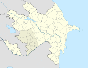
- Novxanı
-
Novxanı — Municipality — Coordinates: 40°31′47″N 49°46′46″E / 40.52972°N 49.77944°ECoordinates: 40°31′47″N 49°46′46″E / 40.52972°N 49.77944°E Country  Azerbaijan
Rayon Absheron Population[citation needed] – Total 4,468 Time zone AZT (UTC+4) – Summer (DST) AZT (UTC+5) Novxanı (also, Nobkhana, Novkhana, Novxana, and Novkhany) is a village and municipality in the Absheron Rayon of Azerbaijan. It has a population of 4,468. The name means new house in the Tat language.There is a water park in Novxani, the largest in The Caucasus[citation needed]
Notable natives
- Azim Azimzade — painter and graphic artist, founder of Azerbaijani satirical graphics, People's Artist of Azerbaijan SSR (1927).
- Lotfi Asker Zadeh — American mathematician, electrical engineer, computer scientist, founder of the theory of fuzzy sets and fuzzy logic.
- Mammed Amin Rasulzade — statesman, scholar, public figure and one of the founders of Azerbaijan Democratic Republic, the chairman of the Azerbaijani National Council (1918).
- Mehdi Huseynzade — legendary guerrilla fighter in Yugoslavia and Italy during World War II, Hero of the Soviet Union.
- Suleyman Rustam — pet, the People's Poet of Azerbaijan SSR (1960 ).
References
External links
Absheron Rayon Capital: XırdalanAşağı Güzdək, Babadzhan, Ceyranbatan, Çuxanlı, Digah, Fatmayı, Gasan, Hacıvəli, Hökməli, Kayaldzha, Keytikh, Klych, Kum, Masazır, Mehdiabad, Məmmədli, Miadzhik, Nağdalı, Nakhar, Novxanı, Pirəkəşkül, Pirəkəşkül-Qobustan, Qobu, Qobustan, Ramazan, Saray, Shoki, Suleyman, Sündü, Utalgi, Uzun-Dere, Veylyar, YuzufCategories:- Populated places in Absheron Rayon
- Absheron villages
- Absheron Economic Region geography stubs
Wikimedia Foundation. 2010.


